Photos from Steamboat Springs
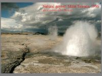
I was doing some research to see if a book listed on eBay was worth a bid (it wasn't), when I came across some interesting photos of Steamboat Springs, Nev. The first three were taken by Don Hudson in 1986, a year before testing began on the powerplants that eventually destroyed the geysers there. I met him on the terrace one day during the the activity of 1986-1987, maybe even the day these photos were made. Note also that I might have some of the feature number wrong, as it has been a couple of decades since I last saw these geysers. I did check my maps, so I got at least the names of what I think they are correct.
In the foreground is #41, while in the background the center of steaming is most likely #39. Both were quite active during that time. As you can see, much of the runoff of #41 went down into a nearby fissure. Many of these fissures were filled with rubble and debris, but when cleared, they were several meters deep. The previous year the Strassers and I visited the terraces around the end of June when #41 was dormant. Because of the high angle of the sun, one could catch a glimpse of a reflection of water about 3 meters down in the vent.
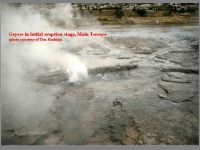
I believe this is a close-up of #102 in eruption. Its vent was not marked on the 1950s Don White maps we used, so I gave it a new, three digit number. It was the only geyser along the top of the terrace which had any sort of pool. The other geysers were often just wide spots in a fissure, or a void in rubble filled fissure. Like nearby #39, which was a a long fissure, this feature appeared to erupt continuously during the several hours of several different visit.s But since the activity here only lasted about a month, I believe it qualifies as a geyser, just one with a very long duration.
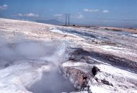
Here we have minor activity from the fissure vents of Geyser #42. Over to the left, and not visible, is the vent of #42w, the tallest geyser we observed in all our visits. The main vent of #42 is in the large, wide southern end. Both #42 and #42w could be induced to erupt, both together and separately. On most visits, the first activity we'd get would be a simultaneous eruption of #42, with solo eruptions of #42w afterwards. But on at lest one occasion we did get a series of eruptions of #42, but nothing from #42w. Even during a major eruption, the little sputs you see here didn't get much taller, although they did turn into little columns of suds about a foot high.
In the background you can see the white fresh sinter and dark runoff that surrounded a string of geysers and springs, #12, #13, and the various vents of #14, #15 and #16. Back in the 1950 White reported geyser activity from the first two, while we observed sputtering from a number of vents from #15 and #16.
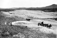
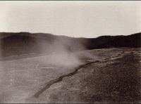
Finally, here are a couple of 1867 photos which show how little the look of the surface features had changed over a century. That road now appears to be bordered to the left by Steamboat Ditch, a channel that diverts water from the Truckee River to Steamboat Creek, with the features of the first two photographs located in the vicinity of the middle of the leftmost fissure.
