
Posted on
Posted on
Posted on
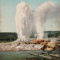
Grand Geyser Starts, 2026 (Pt.2)
Posted on
Grand Geyser Starts, 2026 (Pt.1)
Posted on
Guy Sir speaks
So today I'm working on an update to my GeyserLog app, fixing some stupid bugs, and getting ready to do another release. Also working on a newer app that will get field testing in August if everything works out.
The webcam is being displayed on another screen, and working on the app gets me to see changes in the database almost in real time. A lot of postings do seem to disappear after a while. It's also amusing to watch the Turban Delay number get bigger as I'm working…
I see this comment on Grand, from something calling itself "guysirgooner (Guy Sir)", which registered less than an hour before making the posting.
"Pool is full. Waiting on turban to bust. Need waves and bubbles. Surely 17:15."
There was a second, similar comment to this a few minutes prior that disappeared before I had a chance to also note it.
Shortly after that, Graham posts a Turban eruption time with the comment, "D0. Late fill at 20m mark."
To which this same person comments: "D0? But yea this one went off for sure. I just saw it a couple minutes ago."
I flag the Grand post: "Do not report Turban Delays with Grand notes. (And geysers don't "bust")".
(Attempting to add the flag from my app actually revealed another bug in need of fixing, as I wasn't logged in, but the app acted like the flag went through, instead of correctly displaying an error. So I did it from the website instead.)
I fix that posting bug (easy fix, but it appeared in multiple locations), and then after a while I get an email message from GeyserTImes saying a positing I flagged has been changed. It appears that a long diatribe was appended to the Grand comment. Quoted here in full for your edification and amusement.
My response to the flag is as follows: Calling Turban a “flag” for delay is rookie-tier Grand analysis. Turban behavior absolutely correlates with delayed Grand intervals in many cycles because it reflects continued energy/water redistribution in the vent complex instead of a fully stabilized recharge state. That’s not controversial if you actually watch the basin instead of parroting simplified interval charts.
Notes 44931 and 44495 both discuss/mention Turban-related behavior associated with delayed Grand eruptions. The entire point is that Grand is not an isolated vent — it is dynamically linked with Turban and Vent. Persistent or unusually active Turban behavior can indicate heat/water being bled off or system instability before Grand commits to eruption.
People love pretending Grand is a perfect timer. It isn’t. The “average interval” crowd gets humbled constantly because Grand responds to:
- number/strength of prior bursts
- recharge efficiency
- Turban/Vent activity
- minor seismic/water level fluctuations
- overflow characteristics
- basin-wide thermal interactions
If Turban is highly active late in the interval, especially with strong sustained boiling or atypical surging, experienced watchers absolutely factor that into eruption expectations. Nobody who seriously studies Grand dismisses Turban observations outright.
The funniest part is acting like observational heuristics are invalid unless they’re a binary deterministic predictor. Geyser forecasting is probabilistic hydrodynamics, not a microwave timer.
I’d trust basin-side pattern recognition over internet armchair “flags” every time.
I amended my flag:
The added comments do not address the problem-- This comment is still inappropriate and added to the wrong feature.
The long, arrogant lecture on Grand's behavior, ending with "I’d trust basin-side pattern recognition over internet armchair “flags” every time." is especially amusing, considering to whom it is being addressed.
After I amended the flag, I decided to do this posting to capture this exchange. Because, as expected, shortly after the One Burst Grand eruption (on the third Turban eruption after the Delay), the flagged note, along with the long comment, disappeared. I decided that all the work and wisdom that that person put into the reply should not be lost forever.
Now back to application development, as I eagerly await more "basin-side" observations and insights from "Guy Sir".
Update 19:15:
A post-Grand comment from "Guy Sir":
Crazy how people were “waiting for more signs” while I literally called the exact eruption time and then the post gets deleted after being right. Some of y’all watch Grand like it’s astrology instead of actually understanding interval behavior, Turban pacing, and vent dynamics. The geyser does not care about your vibes-based predictions.
Posted on
GeyserLog 4.1.2
GeyserLog 4.1.2 is available on the iOS AppStore.
Fixed SMS note support and fixed bugs found during field testing.
- Fixed toolbar compatibility with iOS 26 ("liquid glass").
- Added a GrandWait widget and lockscreen item.
- Add optional Stopwatch actions as observations/events.
- Fixed some AppleWatch issues
- Fixed login settings not in sync with Settings App values.
Once again, geyser gazers are welcome to contact me to get a Promo Code which will allow downloading of the app for free. I'm also open to suggestions for features users would like to see added, or finding out about bugs that need to be fixed.
Posted on
Yellowstone Radio — 2026 Part 1
Radio calls
It appears that this year either people are less stupid, or the NPS is being more circumspect on the radio, or they are just using alternate forms of communication. Sometimes most of the day went by with even minimal traffic stops ("verbal warning for speeding") being called.
21 May
- Couple on foot behind the Lodge feeding ravens. Later report they were walking toward OF followed by several ravens.
22 May
- Group of 4 at Ojo Caliente in the bear closure area. Just a warning.
23 May
- Thermal trespass by four at Fountain Paint Pots. Court dates requested for two.
- Ravens attacking trash in the back of red pickup parked in handicap spot next to the VC.
- At sunset, two women from California off trail north of Fountain Paint Pots. Only warnings.
- Report of bear spray deployment along road north of Midway. Attempt to find failed, then report of victim already at clinic.
24 May
- Need to stop traffic near Gibbon Picnic in order to euthanize an injured deer hit by car.
30 May
- Bear reported near the Old Faithful employee pub. UTL: "Unable To Locate"
02 June
- "East lot, outbound on the inbound lane" Warning.
- F150 pickup from Sask. "back is completely full of food.". "Does YPSS have ability to store vehicle inside?" "In the bus barn." Third raven pickup attack in two days.
03 June
- Need maint at OFVC due to several spots of vomit in lobby.
- Dog off leash in Madison Campground
06 June
- Calif Jeep passing line waiting to enter Fairy Falls parking, then using handicap spot w/o proper permit.
07 June
- At Madison Campground, RV dumped graywater tank in campsite, then left.
- Coyote jam at Mallard Lake Trailhead.
- Two cars "parked out in the field" at Fairy Falls trailhead. Citations issued.
Posted on
Observations for 2026 June 07
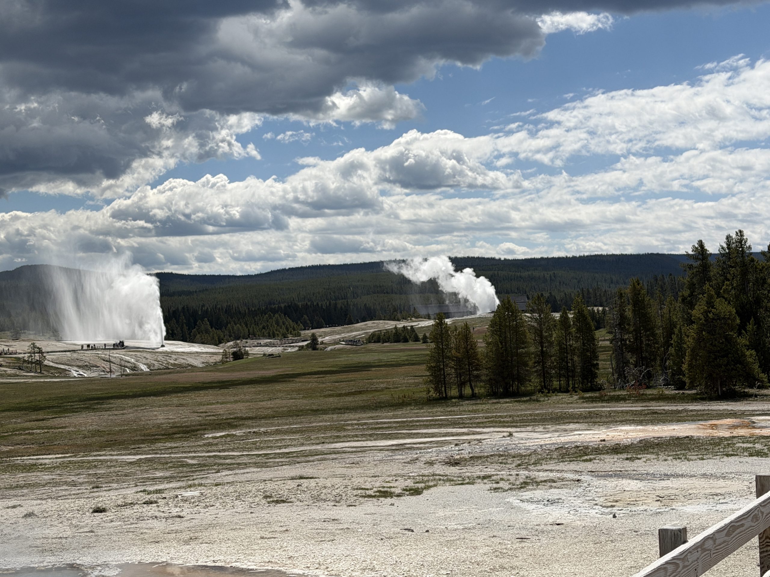
Got a late start because Grand had a short interval overnight. Woke up to showers that were clearing at the time to head out approached. The wind also started to pick up around then, and it was strong for the rest of the day.
At Grand, first I got a Turban Delay Interval, then West Triplet started to erupt. Two Turban eruption intervals later, we got a second Delay Interval. With that, it looked to be a long wait.
Two hours and six Turban eruption intervals later, Grand finally erupted. Grand's pool filled early and then stayed high as waves started around the 16 minute mark. Vent overflowed well before Grand started to boil and boop. An 8-1/2 minute interval was a good indication that we were going to get a second burst, and we did. Despite the total duration being less than ten minutes, Vent & Turban quit.
2026-Jun-07 : 12:30:26 D2/D6/G2Q

 12:30:14	Vent Ovfl	-0m12s
 12:30:23	Boop	-0m03s
 12:30:26	B1	--- d=08m25s
 12:30:31	Turban	0m05s
 12:33:35	Vent	3m09s
 12:38:51	P1	8m25s d=37s
 12:39:28	B2	9m02s d=52s
 12:40:20	P2	9m54s
 12:41:22	V&T Quit	10m56s

				     ΣB=09m17s	ΣD=09m54s
	* * * * *
 09:53:01			d=05m01s  D0
 09:53:41	West Triplet d=33m17s
 10:12:02	Int: 19m01s	d=03m28s  D1
 10:38:17	Int: 26m15s	d=04m01s  D2/D0
 10:56:22	Int: 18m05s	d=03m35s  D2/D1
 11:16:15	Int: 19m53s	d=03m26s  D2/D2
 11:34:24	Int: 18m09s	d=03m12s  D2/D3
 11:53:31	Int: 19m07s	d=03m45s  D2/D4
 12:11:37	Int: 18m06s	 	  D2/D5
 12:46:58	West Triplet
		      Grand: 18m49s
It never got warm during the day, and the wind never died down. A good day to stay inside and let others brave the wind, except that Beehive had a mid-afternoon no-Indicator eruption.
Conditions were unchanged when it was time to head out to Grand. After an hour wait, we got a Turban Delay interval, and then had to wait another five more Turban intervals before Grand showed signs of wanting to erupt. It was still light, and the wind pushed the steam from the runoff away, making Grand easily visible. West Triplet had no water visible during the wait, but rose and erupted during Grand's One Burst Eruption. The only thing of note with the eruption was that despite the longer duration (about 10-1/2 minutes), Vent & Turban died down briefly, but then did not quit. Did not see any afterplay from Grand in the few minutes before we all headed in to warm up.
2026-Jun-07 : 21:03:31 D5/G1C

 21:03:30	Boop	-0m01s
 21:03:31	B1	--- d=10m28s
 21:04:12	Turban	0m41s
 21:07:15	Vent	3m44s
 21:13:59	P1	10m28s
Vent & Turban continue

				     	ΣD=10m28s
	* * * * *
 18:16:08			d=02m34s
 18:34:30	Int: 18m22s	d=03m21s
 18:53:27	Int: 18m57s	d=03m24s
 19:27:23	Int: 33m56s	d=04m47s  D0
 19:46:07	Int: 18m44s	d=03m33s  D1
 20:03:40	Int: 17m33s	d=03m12s  D2
 20:24:39	Int: 20m59s	d=03m49s  D3
 20:42:42	Int: 18m03s	d=03m19s  D4
 21:10:51	West Triplet
		      Grand: 20m49s
Posted on
Observations for 2026 June 06
Not as cold as expected, as clouds moved in during the night, and it was overcast at dawn when I went back out to Grand. Arrived to find West Triplet in eruption. Spent the next 2-1/2 hours waiting for the next West Triplet eruption as Turban had a series of varying strength eruption.
West Triplet started again just before the Grand One Burst Eruption. It was calm, so there was a nice base surge rolling across the runoff channels at the start. The eruption was followed by an eruption of Rift.
2026-Jun-06 : 07:57:01 T1C

 07:56:23	Vent Ovfl	-0m38s
 07:56:24	Turban	-0m37s
 07:56:56	Boop	-0m05s
 07:57:01	B1	--- d=09m13s
 07:59:22	Vent	2m21s
 08:06:14	P1	9m13s
Vent & Turban continue

				     	ΣD=09m13s
	* * * * *
 05:22:28			d=02m00s
 05:22:39ie	West Triplet d=18m55s
 05:36:49	Int: 14m21s	d=03m18s
 05:54:51	Int: 18m02s	d=03m38s
 06:14:30	Int: 19m39s	d=03m37s
 06:33:33	Int: 19m03s	d=03m32s
 06:51:31	Int: 17m58s	d=03m13s
 07:07:06	Int: 15m35s	d=03m08s
 07:25:00	Int: 17m54s	d=03m29s
 07:40:47	Int: 15m47s	d=03m23s
 07:51:41	West Triplet
 08:27:07	Rift
		     Turban: 15m37s
Then it was off to Geyser Hill as Beehive had not yet erupted. Got over there and after killing some time, thought about waiting over at Aurum in case it erupted. Instead at that point water appeared in the Indicator, and shortly afterward, like yesterday, Aurum erupted while Beehive's Indicator was erupting. So if I had gone over to Aurum, I probably would have missed the eruption while en route past Lion.
With the wind, the best view of Beehive was from near Plume. Not the full arc like yesterday, but still strong and double.
The wind blew the spray from Beehive all over the area around Scissors. When I went past shortly after Beehive's eruption ended, Scissor was completely quiet. I wasn't able to get a photo at that time (too many people milling about), and when I tried again a few minutes later, Scissors was back to normal.
Went up to look at the various holes and features around to the left of Sponge. I noticed that Sponge itself was having periodic overflow eruptions, but never dropped out of sight. Dropping out of sight is what I remember from a few years ago. Then waited around and eventually saw an eruption of Slot Geyser.
That's when the fun began. Old Faithful started to erupt, after a nearly two hour long interval. Then we noticed a bison passing by Doublet headed our way. We quickly cleared out as the bison crossed the boardwalk by Pump, then broke through the crust. It continued on, again crossing the boardwalk to the left of Sponge. Out in the flat it broke through again, but continued to plod along. We started moving in order to beat it to the junction by Sulphide. Fortunately, it found some tasty grass below Giantess. By that time we were ahead of it, but the crowd from Old Faithful was starting to appear. None of us wanted to hang around considering that bison/touron interactions were bound to occur soon. Fortunately, on the other side of the bridge a person in NPS uniform was headed toward Geyser Hill, and I warned her of the bison.
In the mid afternoon I walked up on a gently steaming Uncertain, having missed it by about ten minutes. The wait for Grand was short and uneventful, less than an hour long. Once again we got a One Burst Eruption, but no activity from West Triplet either before or after.
2026-Jun-06 : 14:38:00 T1Q

 14:37:30	Vent Ovfl	-0m30s
 14:37:34	Turban	-0m26s
 14:37:53	Boop	-0m07s
 14:38:00	B1	--- d=10m45s
 14:40:58	Vent	2m58s
 14:48:45	P1	10m45s
 14:49:36	V&T Quit	11m36s

				     	ΣD=10m45s
	* * * * *
 13:57:19			d=04m01s
 14:17:02	Int: 19m43s	d=03m51s
		     Turban: 20m32s
Despite it being a bit breezy, it was warm and sunny and too nice to go inside, so went down basin to kill some time. Arrived at Riverside just before the eruption started. I don't remember Riverside starting this way, but it's been a few years since I've actually waited in the loop there. The back vent surge thickly several meters high, repeatedly for about twenty seconds before the eruption started throwing water onto the river.
Down at Fan & Mortar, bicycled up on High vent erupting to at least four meters, with Gold going strong next to it, and nothing else active. That activity continued intermittently for a number of minutes, until Angle started to join in. That's when the other two vents died down quite a bit, and shortly after, were left to themselves.
After intermittent evening showers, went out to Grand before sunset. About 18 minutes after a Turban eruption, West Triplet began to erupt. At that point, Grand didn't look good. But over the next twelve minutes, it came up and started to pour off water. Around the 32 minute mark, the overflow seemed to subside a bit, and at over 35 minutes, Turban began to erupt.
About 30 seconds in, Turban seemed to pick up in intensity, and in the dim light, it looked like Grand had risen back up and was having good waves. So no surprise when about 1-1/2 minutes after Turban started, Grand began another One Burst Eruption. It was another eruption that was long enough for there to be no doubt about there not being a second burst. Vent & Turban quickly restarted, and West Triplet was still in eruption as we left. From the bike rack I didn't see any activity from Rift.
2026-Jun-06 : 21:12:45 D0/T1Q

 21:11:17	Turban	-1m28s
 21:12:42	Boop	-0m03s
 21:12:45	B1	--- d=10m58s
 21:15:05	Vent	2m20s
 21:23:43	P1	10m58s
 21:24:46	V&T Quit	12m01s
 21:32:36	V&T Restart	19m51s

				     	ΣD=10m58s
	* * * * *
 20:35:57			d=03m54s
 20:53:45	West Triplet
		     Turban: 35m20s
Posted on
Observations for 2026 June 05
Turns out Grand erupted only an hour after we left, so needed to get back out a bit earlier than I'd expected. Still ended up waiting two hours of ordinary Turban eruption intervals. During that time Castle had a short, minor eruption, the Grand filled and erupted without a Turban Delay Interval. The One Burst Eruption lasted less than ten minutes, and showed no signs of trying for a second burst. West Triplet started in the middle of the Grand eruption, but I didn't stick around to get a duration.
2026-Jun-05 : 09:07:43 T1C

 09:06:58	Vent Ovfl	-0m45s
 09:06:59	Turban	-0m44s
 09:07:35	Boop	-0m08s
 09:07:43	B1	--- d=09m47s
 09:10:21	Vent	2m38s
 09:17:30	P1	9m47s
Vent & Turban continue

				     	ΣD=09m47s
	* * * * *
 06:55:08			d=04m46s
 07:13:02	Int: 17m54s	d=04m18s
 07:31:47	Int: 18m45s	d=03m52s
 07:52:05	Int: 20m18s	d=04m03s
 08:10:45	Int: 18m40s	d=03m56s
 08:30:50	Int: 20m05s	d=03m47s
 08:49:23	Int: 18m33s	d=02m54s
 09:14:43	West Triplet
		     Turban: 17m36s
In the afternoon, Uncertain was in eruption as I tied up my bike near Castle. West Triplet started to erupt before I saw the first Turban eruption for this wait, so I figured it might be a while before the Grand eruption. Turned out to be less than an hour and a half, and the end of that consisted of a Turban Delay Interval lasting over 30 minutes. This time the One Burst Eruption lasted well over eleven minutes, with the last four in Big Sawmill mode, acting like it was about to stop, but never quit succeeding.
2026-Jun-05 : 16:23:56 D0/T1Q

 16:23:26	Turban	-0m30s
 16:23:38	Vent Ovfl	-0m18s
 16:23:53	Boop	-0m03s
 16:23:56	B1	--- d=11m20s
 16:26:24	Vent	2m28s
 16:35:16	P1	11m20s
 16:35:59	V&T Quit	12m03s

				     	ΣD=11m20s
	* * * * *
 14:52:36			d=02m10s
 15:04:25	West Triplet d=37m23s
 15:11:49	Int: 19m13s	d=03m12s
 15:30:58	Int: 19m09s	d=04m16s
 15:51:03	Int: 20m05s	d=03m41s
		     Turban: 32m23s
Afterward I stopped in down basin to catch a windy and short Daisy eruption, then watch a lot of grumbling from Grotto, but no eruption.
After dinner, Beehive's Indicator was called on the radio. It being late evening, with the sun low and still windy, there was a full arc double rainbow visible from the western side. At one point I had to deploy the umbrella, and almost got a full circle rainbow.
According to the NPS radio traffic, around sunset there was a bear hanging around near Castle. A hazing round was deployed to move it back into the trees.
Got out to Grand early. After about five minutes, got a Turban eruption that lasted over five minutes. The next Turban eruption had no overflow preceding it, so I assumed that there had been a Turban Delay interval and I was in for a long wait.
Instead, Grand was heavily overflowing and there was indications that I was about to get another Delay Interval when Grand explosively started erupting. Turban took nearly a minute to start, and this was another case where Vent took nearly four minutes. The One Burst Eruption lasted just long enough to ensure there wasn't a second burst.
2026-Jun-05 : 22:54:22 G1C

 22:54:22	B1	--- d=09m15s
 22:55:18	Turban	0m56s
 22:58:14	Vent	3m52s
 23:03:37	P1	9m15s
Vent & Turban continue

				     	ΣD=09m15s
	* * * * *
 22:14:13			d=05m06s
 22:32:19	Int: 18m06s	d=04m29s
		      Grand: 22m03s
Posted on
Observations for 2026 June 04
With a short interval eruption in the middle of the night, didn't need to go back to Grand until mid-morning. Only waited about an hour before West Triplet started. That was quickly followed by the One Burst Eruption. The one notable thing about the eruption was that it took Vent over four minutes to get started.
2026-Jun-04 : 10:29:48 G1Q

 10:29:47	Boop	-0m01s
 10:29:48	B1	--- d=11m02s
 10:30:43	Turban	0m55s
 10:32:22	Vent Ovfl	2m34s
 10:33:56	Vent	4m08s
 10:40:50	P1	11m02s
 10:41:41	V&T Quit	11m53s
 11:01:45	V&T Restart	31m57s

				     	ΣD=11m02s
	* * * * *
 09:25:25			d=04m34s
 09:45:42	Int: 20m17s	d=04m17s
 10:06:22	Int: 20m40s	d=04m20s
 10:24:36	West Triplet
 11:07:31	Rift
		      Grand: 23m26s
After the eruption ended, I stuck around to see either West Triplet end, or Rift start. It was the latter, which started shortly before Beehive erupted. I caught that eruption from over by Castle.
Spent a couple of hours in the Bijou Cage. Bijou was pausing for about 75 seconds every 22 or so minutes, except at one point there was a 13 minute interval with a corresponding shorter pause. Then a 22 minute interval with a 2-1/2 minute pause. I didn't see anything from Mastiff during that time.
Emerald was rising and falling regularly, about ten minutes at the rim, bubbling slightly, then ten minutes out of sight. Giant had some nice cone filling vertical surges that got up as high as the top of the bite on the right side.
Late afternoon was partly cloudy and breezy at times. Without the sun out the wind made it almost uncomfortable, and the changes meant it went from underdressed to overdressed. Fortunately there was no rain and the wait was short.
I did see one complete Turban eruption interval before Grand filled nicely around 17 minutes, started having waves that built in intensity, then erupting at around the twenty minute mark. Once again, it took Vent nearly four minutes to start, which is much longer than I am used to seeing.
West Triplet started a few seconds before the first burst ended, then we a nice second burst that lasted over a minute. The West Triplet eruption was not followed by Rift, but Sput C1 was again active. At this point I think the sput will be a regular feature of those eruptions.
2026-Jun-04 : 17:03:15 G2Q

 17:03:15	B1	--- d=08m56s
 17:03:40	Vent Ovfl	0m25s
 17:04:01	Turban	0m46s
 17:07:13	Vent	3m58s
 17:12:11	P1	8m56s d=43s
 17:12:54	B2	9m39s d=01m02s
 17:13:56	P2	10m41s
 17:14:37	V&T Quit	11m22s
 17:36:39	V&T Restart	33m24s

				     ΣB=09m58s	ΣD=10m41s
	* * * * *
 16:24:46ns
 16:42:55	Int: 18m09s	d=03m44s
 17:12:02	West Triplet d=34m20s
		      Grand: 20m20s
Got back out to Grand about an hour before midnight. Within that hour we got a West Triplet eruption and a Turban Delay Interval. Most likely it would be several hours before Grand would finally erupt, so we headed back in just after midnight.
2026-Jun-04 : 23:02:14

 23:02:17			d=02m15s
 23:19:40	Int: 17m23s	d=04m32s
 23:28:32	West Triplet
 23:53:07	Int: 33m27s	d=04m36s  D0
Posted on
Observations for 2026 June 03
The day started with a radio call for Beehive's Indicator. Unlike yesterday, this was at the start, not when it had been erupting for ten minutes.
The sun was coming over the ridge, so the top of Beehive's water column was in the sun, while the bottom quarter was still in the shadow. This mean we got a strong double rainbow at the top of the water column, and the shadow of the water column being projected over the meadow across the river.
Overnight, Grand had a long interval, so there was plenty of time before heading out. This was a clear but windy day. About an hour after I got out there, Turban had its Delay Interval eruption. That was followed by seven more Turban intervals before we got what looked like it would be another Delay. Instead of sitting full for ten minutes, the waves on Grand built up and we got a long One Burst Eruption. At the end, despite the length, there was water sloshing about in Grand's vent for over a minute. then we finally got our West Triplet eruption.
2026-Jun-03 : 13:19:31 D7/G1Q

 13:19:28	Boop	-0m03s
 13:19:31	B1	--- d=10m30s
 13:19:34	Vent Ovfl	0m03s
 13:19:56	Turban	0m25s
 13:22:11	Vent	2m40s
 13:30:01	P1	10m30s
 13:31:11	Drain	11m40s
 13:31:26	V&T Quit	11m55s

				     	ΣD=10m30s
	* * * * *
 10:10:49			d=04m54s
 10:28:32	Int: 17m43s	d=03m45s
 11:03:46	Int: 35m14s	d=05m08s  D0
 11:21:26	Int: 17m40s	d=03m43s  D1
 11:40:55	Int: 19m29s	d=03m56s  D2
 11:59:32	Int: 18m37s	d=03m29s  D3
 12:19:17	Int: 19m45s	d=03m54s  D4
 12:38:32	Int: 19m15s	d=03m05s  D5
 12:56:26	Int: 17m54s	d=03m31s  D6
 13:38:18	West Triplet
		      Grand: 23m05s
Spent the afternoon bug fixing my GeyserLog app, and was surprised to see that I'd lost track of the time and it was already 5-1/2 hours since that Grand eruption. Expected that the eruption would be well after sunset, so dressed appropriately.
Got out in time to see the start of West Triplet. When Grand didn't follow up with an eruption on the next couple of Turban eruption opportunities, that insured a post-sunset eruption. Fortunately, Rift stayed quiet when West Triplet finally ended. It was such a nice night that I had to apply bug repellent as the mosquitoes were active.
While West Triplet was erupting, Sput C-1 was also active. It could be easily heard from the boardwalk as it splashed and pushed out a steady stream of water.
It was still light enough to see Grand's pool having a late fill, and to see the start of another One Burst Eruption. There wasn't any wind, so there was also a nice base surge rolling across the formations and putting up a wall of obscuring steam.
2026-Jun-03 : 21:24:04 T1Q

 21:23:59	Vent Ovfl	-0m05s
 21:24:00	Boop	-0m04s
 21:24:02	Turban	-0m02s
 21:24:04	B1	--- d=10m03s
 21:27:07	Vent	3m03s
 21:34:07	P1	10m03s
 21:36:10	V&T Quit	12m06s

				     	ΣD=10m03s
	* * * * *
 19:25:06	West Triplet d=41m28s
 19:31:47			d=05m41s
 19:49:52	Int: 18m05s	d=04m08s
 20:08:25	Int: 18m33s	d=03m17s
 20:29:17	Int: 20m52s	d=04m05s
 20:48:45	Int: 19m28s	d=03m46s
 21:05:54	Int: 17m09s	d=03m32s
		     Turban: 18m08s
Posted on
Observations for 2026 June 02
After not going out to last night's One Burst Grand Eruption, left at dawn for the next Grand opportunity. After a West Triplet eruption started, we got a Turban Delay Interval. That led to a short Turban eruption interval under 17 minutes, and then a Rift eruption that lasted about 13 minutes.
Grand tried again to have another Turban Delay Interval after four Turban eruption intervals, but that interval came up about a minute short. Then there was a short, almost 16 minute Turban interval, which finally led to the morning's One Burst Grand eruption.
2026-Jun-02 : 08:10:08 D6/G1Q

 08:09:57	Vent Ovfl	-0m11s
 08:10:06	Boop	-0m02s
 08:10:08	B1	--- d=11m48s
 08:10:15	Turban	0m07s
 08:13:04	Vent	2m56s
 08:21:56	P1	11m48s
 08:22:34	V&T Quit	12m26s

				     	ΣD=11m48s
	* * * * *
 05:45:15			d=03m18s
 05:59:44	West Triplet d=51m17s
 06:10:52	Int: 25m37s	d=04m12s  D0
 06:27:46	Int: 16m54s	d=03m42s  D1
 06:47:38	Int: 19m52s	d=03m29s  D2
 06:48:22	Rift
 07:08:39	Int: 21m01s	d=03m54s  D3
 07:32:47	Int: 24m08s	d=03m21s  D4
 07:48:46	Int: 15m59s	d=03m19s  D5
		      Grand: 21m22s
Later went to Fan & Mortar and spent over two hours watching nothing happen. For the first hour or so, there was a series of Fan vents splashing, sometimes fairly strong, alternating with nothing happening. Then Upper Mortar rumbled a couple of times, That's when Bottom Vent started to splash, and High and Gold became strong, tall and non-stop. When Fan's vents finally quit, that's when Main Vent started splashing. Most of the splashes were the small, just visible variety, but there were a few strong, noisy bursts that filled the crater. That activity lasted for well over an hour, and continued up to the time I left.
For the afternoon Grand, the wait was until West Triplet was ready. For almost the first two hours, nothing the Turban eruption intervals were a bit long, but otherwise uninteresting. Then there was a Delay Turban Interval lasting well over 30 minutes. Three Turban eruption intervals later, we got a second, even longer Turban interval that also ended in a Turban Delay interval.
Finally West Triplet started to erupt, and twenty minutes later Grand filled nicely and we got a long One Burst Eruption where Grand actually started on the early side of the Turban eruption interval.
2026-Jun-02 : 17:50:33 D3/D3/T1Q

 17:50:00	Vent Ovfl	-0m33s
 17:50:09	Turban	-0m24s
 17:50:28	Boop	-0m05s
 17:50:33	B1	--- d=11m10s
 17:53:03	Vent	2m30s
 18:01:43	P1	11m10s
 18:01:57	V&T Quit	11m24s

				     	ΣD=11m10s
	* * * * *
 13:59:52
 14:17:42	Int: 17m50s	d=03m39s
 14:38:39	Int: 20m57s	d=03m53s
 14:59:35	Int: 20m56s	d=03m18s
 15:20:10	Int: 20m35s	d=03m38s
 15:50:53	Int: 30m43s	d=04m11s  D0
 16:07:42	Int: 16m49s	d=02m32s  D1
 16:24:17	Int: 16m35s	d=02m46s  D2
 16:58:30	Int: 34m13s	d=04m11s  D3/D0
 17:15:06	Int: 16m36s	d=03m18s  D3/D1
 17:30:51	West Triplet
 17:32:32	Int: 17m26s	d=03m19s  D3/D2
		     Turban: 17m37s
While waiting, a black bear appeared out on the flat below the Rift runoff channel. It must have gone through the Sawmill Group or followed the river past Liberty Pool to get there. It continued onwards, crossing the river and was last seen headed for the bike trail.
Afterwards, based on a sunset eruption prediction for Great Fountain. Unfortunately, the sun disappeared behind a cloud bank even though it had about 15 minutes remaining before dropping below the horizon. But the Great Fountain eruption was strong, with a number of noisy, fairly tall looking jets. The first burst ended and we left before it got too dark.
Posted on
Observations for 2026 June 01
The boardwalks were especially slick in the morning, the whole way from Castle to Grand. Arrived at the end of a Turban eruption, and before the next one West Triplet began erupting. Forty-five minutes later, after about fifteen minute of heavy steaming, Rift too began erupting. The Rift eruption was short and the West Triplet was long, such that Rift ended only fifteen minutes after West Triplet ended.
The One Burst Grand eruption came on the next Turban start, which was also a Delay interval. It was backlit, but the wind was such that not much could be seen, other than it seemed tall.
2026-Jun-01 : 08:19:52 D0/T1C

 08:19:33	Turban	-0m19s
 08:19:52	B1	--- d=10m24s
 08:22:42	Vent	2m50s
 08:30:16	P1	10m24s
Vent & Turban continue

				     	ΣD=10m24s
	* * * * *
 06:35:55			d=28s
 06:46:59	West Triplet d=01h04m
 06:52:11	Int: 16m16s	d=04m18s
 07:12:24	Int: 20m13s	d=03m46s
 07:30:27	Rift d=35m07s
 07:32:01	Int: 19m37s	d=03m38s
 07:52:36	Int: 20m35s	d=03m27s
		     Turban: 26m57s
The other night, over in the Grand runoff channel between West Triplet and Rift, we heard some gurgling, and it looked like a small vent was active. This morning, before Rift began, I was able to confirm and photograph this feature. It appears to be what I called "Sput C-1" back in the early 1980s. To the left, the sput called "C-2" was also steaming heavily. I recall these only being active briefly, and I don't remember seeing them since the mid-1980s.
After than, it was a mostly sunny but cold, windy wait on Geyser Hill. It had been 26 hours since the previous eruption of Beehive, so it seemed likely to erupt soon. After about an hour, with little indication of an eminent eruption, Beehive suddenly had a large surge as if starting to erupt. That didn't happen, but after a pause of about five seconds, a second surge initiated an eruption. It was nice a tall despite the wind, and lasted almost 5-3/4 minutes.
In the afternoon it was sunny, but still windy and a bit cool. West Triplet erupted about an hour after arrival, and the duration was less than a half hour, so no Rift eruption. But that meant we would probably get to wait a couple of hours before Grand would attempt to erupt. And it did.
During that time there was also a short Castle minor eruption, and a Bulger major eruption with not even steam from Bulger's Hole.
The One Burst Grand Eruption came on a Turban eruption interval which was six seconds short of being a Delay Interval. Despite the wind, the eruption was nice and tall at first, but turned into Big Sawmill for the last few minutes. West Triplet never erupted, but did rise up in the vent to only drop below visibility, all within about a minute.
2026-Jun-01 : 16:22:43 G1Q

 16:22:43	B1	--- d=11m21s
 16:23:04	Vent Ovfl	0m21s
 16:23:34	Turban	0m51s
 16:25:34	Vent	2m51s
 16:34:04	P1	11m21s
 16:35:28	V&T Quit	12m45s

				     	ΣD=11m21s
	* * * * *
 14:00:59
 14:19:30	Int: 18m31s	d=03m51s
 14:27:53	West Triplet d=28m56s
 14:41:02	Int: 21m32s	d=04m23s
 15:00:26	Int: 19m24s	d=03m15s
 15:20:17	Int: 19m51s	d=03m47s
 15:39:18	Int: 19m01s	d=03m05s
 15:57:49	Int: 18m31s	d=03m35s
		      Grand: 24m54s
Posted on
Observations for 2026 May 31
Another cool and damp morning, but no wind. Got out to Grand in time to catch the Turban eruption prior to the Turban Delay Interval. Percolator was quiet, and I heard gurgling at depth in West Triplet, so I assumed that we were going to have to wait for West Triplet to recover from Rift erupting a few hours earlier. There was some rain, but nothing like yesterday.
That was the case, as it took Grand eight Turban intervals before I showed any inclination toward erupting. Percolator had been quiet for nearly three hours, but was active again just before the One Burst Grand eruption. West Triplet rose up and began to erupt shortly after Vent started. This eruption was short, at around 9-1/2 minutes, but too long for a second burst. There was some sloshing visible for about ten seconds, then a drained vent.
2026-May-31 : 09:16:24 D8/G1C

 09:16:19	Boop	-0m05s
 09:16:24	B1	--- d=09m33s
 09:17:00	Vent Ovfl	0m36s
 09:17:15	Turban	0m51s
 09:19:57	Vent	3m33s
 09:25:57	P1	9m33s
Vent & Turban continue

				     	ΣD=09m33s
	* * * * *
 06:18:36			d=04m09s
 06:50:02	Int: 31m26s	d=04m32s  D0
 07:06:53	Int: 16m51s	d=04m05s  D1
 07:26:27	Int: 19m34s	d=03m22s  D2
 07:46:42	Int: 20m15s	d=03m44s  D3
 08:06:07	Int: 19m25s	d=03m53s  D4
 08:22:43	Int: 16m36s	d=03m36s  D5
 08:41:33	Int: 18m50s	d=03m37s  D6
 08:58:38	Int: 17m05s	d=03m40s  D7
 09:21:46	West Triplet
		      Grand: 17m46s
Over the last few days, with all the rains, I've noticed that the Firehole River has finally covered the Sawmill runoff channel shelf below the bridge.
Leaving the cabin, I was wondering if I was overdressed. By the time I got to Sawmill Group, I was wondering if I should've added another layer in the pack, just in case.
As it turned out, it didn't really matter. I saw Turban in eruption from the Castle bike rack, so spent a little time by Uncertain watching it not do much. I arrived at Grand just in time to see West Triplet start. The next Turban eruption was short, and the pool seemed especially low afterwards, making me think I might have see a Turban Delay Interval eruption from the bike rack.
Instead there was a steady fill in Grand's pool, and even though it seemed like we were about to get a definite Turban Delay Interval, Grand boiled up well before the deadline.
The burst wasn't very big, but there was enough wind to push the wind and steam away. With the duration under nine minutes, it wasn't certain there would be a second burst, but it was quite likely.
The pause was one of the shorter one, only 20 seconds. The burst was short. I jokingly said it was 105 feet, while Ben Vander Lay measured it at 103 feet. With the long second burst, it's almost like the pause was an extended version of the false pauses we see so often.
2026-May-31 : 15:40:59 T2*Q

 15:40:36	Turban	-0m23s
 15:40:59	B1	--- d=08m29s
 15:44:21	Vent	3m22s
 15:49:28	P1	8m29s d=20s
 15:49:48	B2	8m49s d=01m42s
 15:51:30	P2	10m31s
 15:52:14	V&T Quit	11m15s

				     ΣB=10m11s	ΣD=10m31s
	* * * * *
 14:58:31
 15:16:43	West Triplet
 15:17:48	Int: 19m17s	d=02m58s
		     Turban: 22m48s
I waited around afterwards for the end of West Triplet, and a possible start of Rift. With the weather coming in, I left as soon as the first ended, and in because apparent that the steam wasn't getting stronger in the latter.
It really does seem that too often I am fine when Grand ends, and end up in the cabin drenched from the walk and bike ride back.
With the end of the rains, clearing skies and a full moon, had to at least try and see the next Grand eruption. West Triplet was in eruption when I arrived, and it seemed like Grand was pouring off a lot of water. Based on the Turban eruption duration and the next Turban interval, I would assume there was a Turban Delay interval.
Rift started shortly after, but it only erupted for about 45 minutes. Despite that, it took Grand three hours to finally have the One Burst Eruption. The start was nice and tall, and the eruption was well lit by the moon.
2026-Jun-01 : 00:42:45 T1C

 00:42:00	Turban	-0m45s
 00:42:45	B1	--- d=09m21s
 00:52:06	P1	9m21s
Vent & Turban continue

				     	ΣD=09m21s
	* * * * *
 21:40:23ie	West Triplet d=42m05s
 21:52:14			d=04m55s
 22:10:07	Int: 17m53s	d=04m08s
 22:21:47	Rift
 22:28:52	Int: 18m45s	d=03m57s
 22:49:01	Int: 20m09s	d=03m27s
 23:08:33	Int: 19m32s	d=03m31s
 23:29:23	Int: 20m50s	d=03m38s
 23:46:41	Int: 17m18s	d=03m47s
 00:05:56	Int: 19m15s	d=03m17s
 00:24:18	Int: 18m22s	d=03m29s
		     Turban: 17m42s
Posted on
Observations for 2026 May 30
I considered going for a moonlight Grand eruption, but at around midnight the moon was behind a cloudbank, and the weather radar map showed incoming showers in an hour or two, so I decided to stay indoors.
In the morning the rains had let up by the time to head out for the next Grand eruption, and again the radar map showed incoming showers. A steady rain started as I arrived. Fortunately I was able to set myself up and stayed dry the whole time.
West Triplet was also in eruption as I arrived, and the One Burst Grand Eruption started on the Turban eruption after the end of West Triplet. The eruption was just long enough to preclude a second burst.
2026-May-30 : 09:37:23 T1C

 09:37:10	Turban	-0m12s
 09:37:23	B1	--- d=09m40s
 09:47:03	P1	9m40s
Vent & Turban continue

				     	ΣD=09m40s
	* * * * *
 08:49:56ie	West Triplet d=31m27s
 08:56:11			d=05m11s
 09:15:09	Int: 18m58s	d=02m31s
		     Turban: 22m01s
The rains had stopped by the afternoon, but it was still cold, damp, and windy. Turban was in eruption as I arrived, and it didn't erupt again until over half an hour later. Fortunately, the wait was a reasonable four Turban eruption intervals. Grand even managed to start well before that interval would have become a Delay Interval. The pool was high with nice waves when everything happened in a matter of seconds. The duration of the burst was well over nine minutes, which is that intermediate range where the eruption could easily be one or two bursts. Fortunately, as the pause approached a minute, water could be seen through all the steam doming over the vent. Once again, it seemed like Turban quit at the same time as Grand. Also, West Triplet started near the end of the first burst.
2026-May-30 : 17:23:10 D4/T2Q

 17:23:03	Turban	-0m07s
 17:23:04	Boop	-0m06s
 17:23:07	Vent Ovfl	-0m03s
 17:23:10	B1	--- d=09m12s
 17:25:52	Vent	2m42s
 17:32:22	P1	9m12s d=01m00s
 17:33:22	B2	10m12s d=46s
 17:34:08	P2	10m58s
 17:34:47	V&T Quit	11m37s

				     ΣB=09m58s	ΣD=10m58s
	* * * * *
 15:32:34			d=01m36s
 16:04:09	Int: 31m35s	d=04m57s  D0
 16:21:39	Int: 17m30s	d=03m30s  D1
 16:40:54	Int: 19m15s	d=03m55s  D2
 16:58:50	Int: 17m56s	d=03m36s  D3
 17:29:17	West Triplet
		     Turban: 24m13s
Posted on
Observations for 2026 May 29
The first Turban eruption after I arrive at Grand in the morning is a Delay interval. Three eruptions later we get a second Delay Interval. It takes five more Turban intervals before West Triplet starts to erupt. Grand finally has the One Burst Eruption another Turban eruption interval later. Instead of triggering Rift, West Triplet ends early in Grand's eruption.
2026-May-29 : 10:06:39 D3/D6/T1C

 10:06:22	Vent Ovfl	-0m17s
 10:06:23	Turban	-0m16s
 10:06:33	Boop	-0m06s
 10:06:39	B1	--- d=09m44s
 10:09:09	Vent	2m30s
 10:16:23	P1	9m44s
Vent & Turban continue

				     	ΣD=09m44s
	* * * * *
 07:12:04			d=05m13s  D0
 07:30:14	Int: 18m10s	d=04m11s  D1
 07:49:44	Int: 19m30s	d=04m22s  D2
 08:22:03	Int: 32m19s	d=03m55s  D3/D0
 08:38:18	Int: 16m15s	d=04m12s  D3/D1
 08:55:59	Int: 17m41s	d=03m57s  D3/D2
 09:15:08	Int: 19m09s	d=03m39s  D3/D3
 09:32:53	Int: 17m45s	d=03m42s  D3/D4
 09:33:59	West Triplet
 09:50:14	Int: 17m21s	d=03m21s  D3/D5
		     Turban: 16m09s
After a period of housekeeping chores, I thought I might go down to the Bijou Monkey Cage and check out what's happening at Giant. Didn't spend much time there, as it looked like a rain-shower was coming in. I did see overflow from Emerald and a 1m46s Bijou pause. (The rain never materialized.)
It seems like Grand's series of short six to seven hour intervals has come to a close, but I still went out a bit early to make up for my coming in early. Got out in time to probably see the end of another Turban Delay interval. An hour later West Triplet began to erupt.
On the fourth Turban eruption after the Delay, there was a definite Turban Delay Interval. The interval looked normal, but Grand didn't start dropping around the time the Turban eruption would have been expected. Instead, the pool level continued to rise, with small ripples. Unlike so many recent Delay intervals, this one could be considered short at 26-1/2 minutes.
There was a dark cloud as a backdrop for the eruption, but the sun was out and a rainbow could be seen.
The burst looked like it tried to quit around the eight minute mark, then picked back up. Then 30 seconds later a second slowdown, this time resulting in a pause. That pause lasted almost a minute, and it wasn't until near the end that water could be sloshing in Grand's vent. Once again, it seemed like Turban had quit before Grand, but then the sloshing picked up again before it finally quit for real.
2026-May-29 : 17:46:11 D0/G2Q

 17:46:09	Boop	-0m02s
 17:46:11	B1	--- d=08m25s
 17:46:14	Turban	0m03s
 17:46:16	Vent Ovfl	0m05s
 17:49:24	Vent	3m13s
 17:54:36	P1	8m25s d=57s
 17:55:33	B2	9m22s d=01m00s
 17:56:33	P2	10m22s
 17:57:16	V&T Quit	11m05s

				     ΣB=09m25s	ΣD=10m22s
	* * * * *
 16:21:54			d=05m48s
 16:40:46	Int: 18m52s	d=04m18s
 17:00:13	Int: 19m27s	d=04m36s
 17:15:56	West Triplet
 17:19:32	Int: 19m19s	d=03m48s
 17:57:10       Rift
		      Grand: 26m39s
Rift started to erupt as Vent & Turban quit. West Triplet was still in eruption as we left. As so often happens it seems, the rain-showers started for real at that point, making for a wet exit from the basin.
When I head down to Fan & Mortar for the first time in a season, I go with the expectation of getting to see what is the current normal, typical activity. I expect that activity to be different from what I saw last year, or the year before. That feature changes every year. I'm not going to be The One who gets to see it come out of a dormancy, or do something unusual that no one else has seen. I figure others have probably seen before the activity that I see. What seems to be the current normal Fan & Mortar activity is different from previous years, and in previous years would have been considered noteworthy and signs of an imminent eruption.
It seems like every day this week a new gazer shows up and heads down to Fan & Mortar to take a look. They start posting and announcing over the radio a detailed play-by-play of events that have been repeatedly shown to be irrelevant a lead in to an eruption.
This year, it seems we need to get used to seeing Main Vent having periods of huge splashes that last a half-hour or more. These splashes can be as wide as the vent, and reach a height of two meters. We need to get used to the minor Fan vents going into the so-called "lock" state, where for five to ten minutes, they are flooding out water, erupting continuously, and High reaching a height of three to four meters. Angle may or may not join in with High and Gold during these times. We need to get used to Bottom Vent erupting without putting out enough water for the runoff to reach the river.