
Posted on
Category: Western US
Posted on
Posted on
Long Valley, Calif., 2021 April 17
Posted on
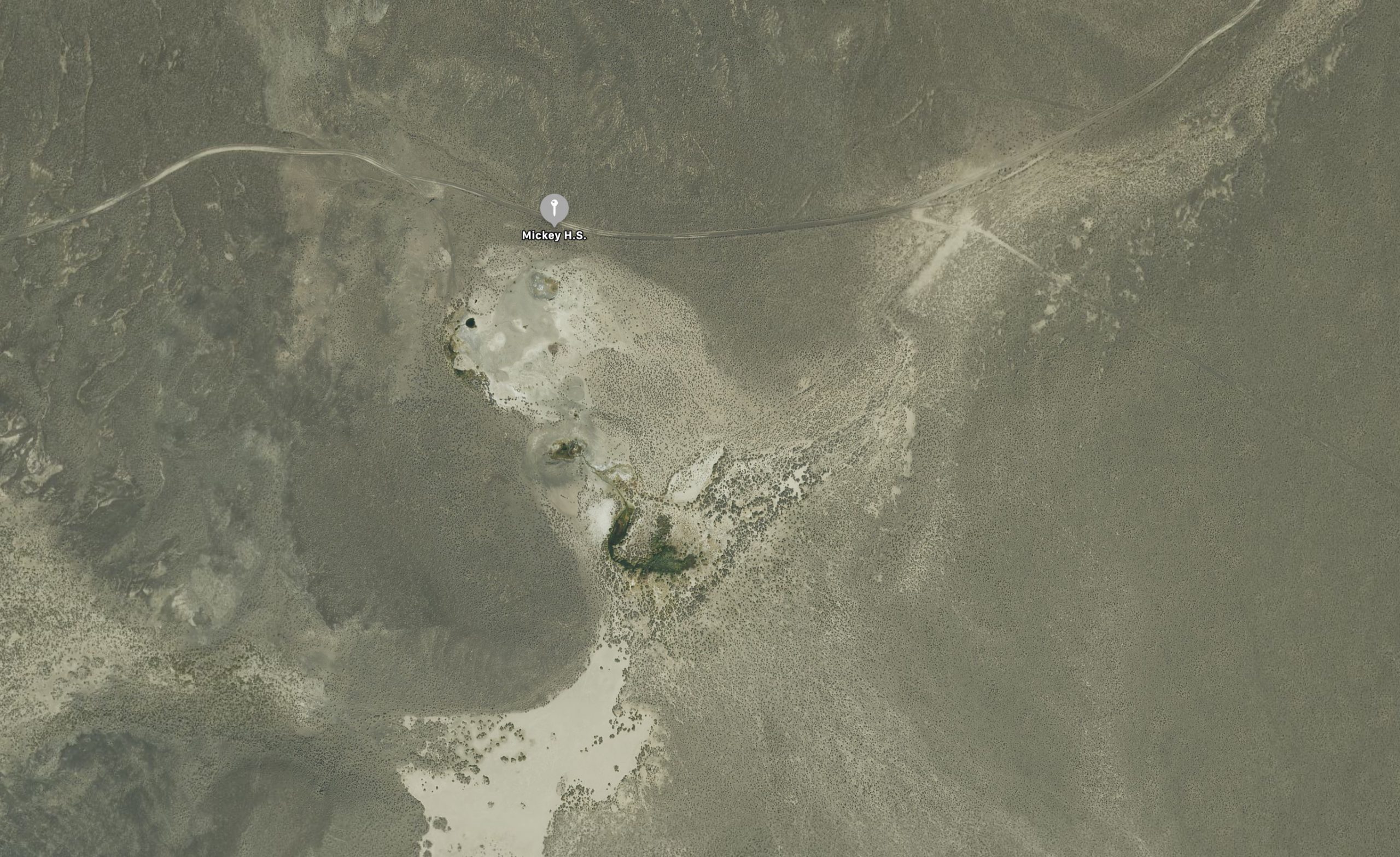
Mickey Hot Springs, Ore., 2021 April 21
Posted on
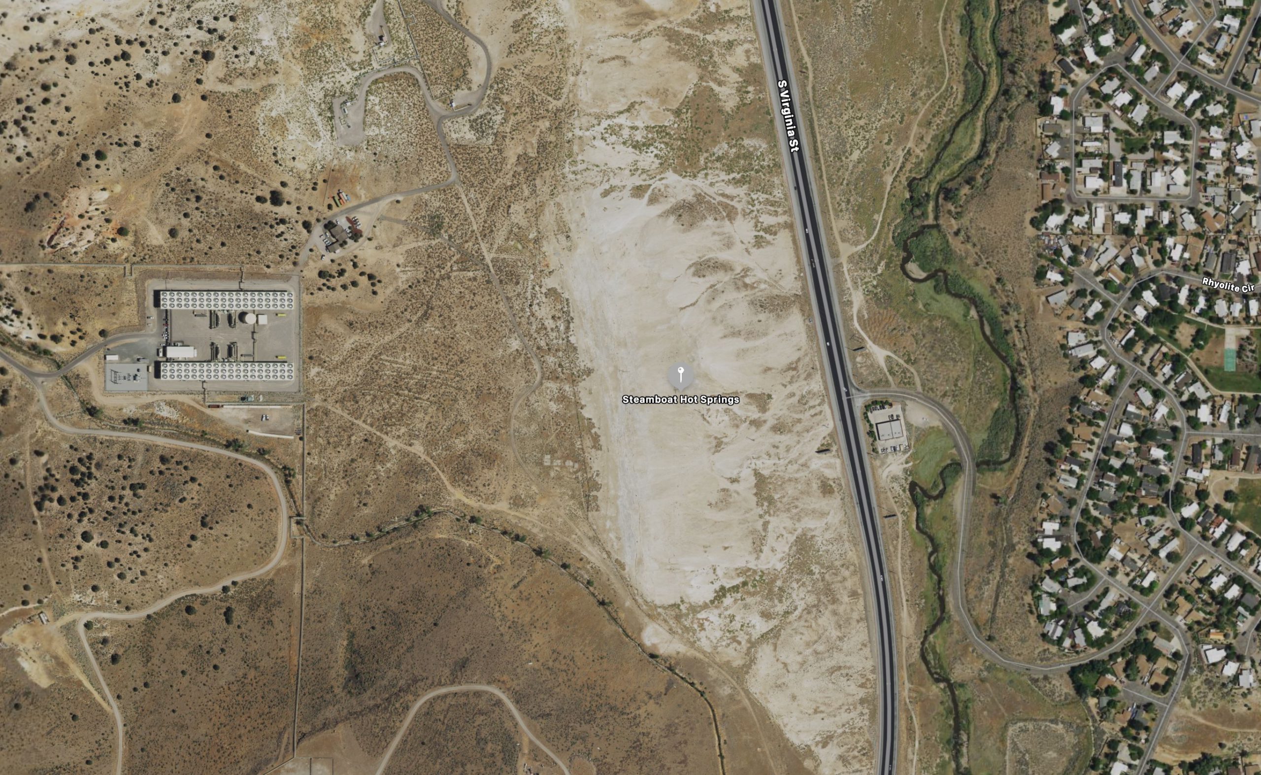
Steamboat Springs, Nev., 2021 April 18
Posted on
Soda Springs Observations for 2021 April 23
Found a feature that really does erupt "every hour on the hour."
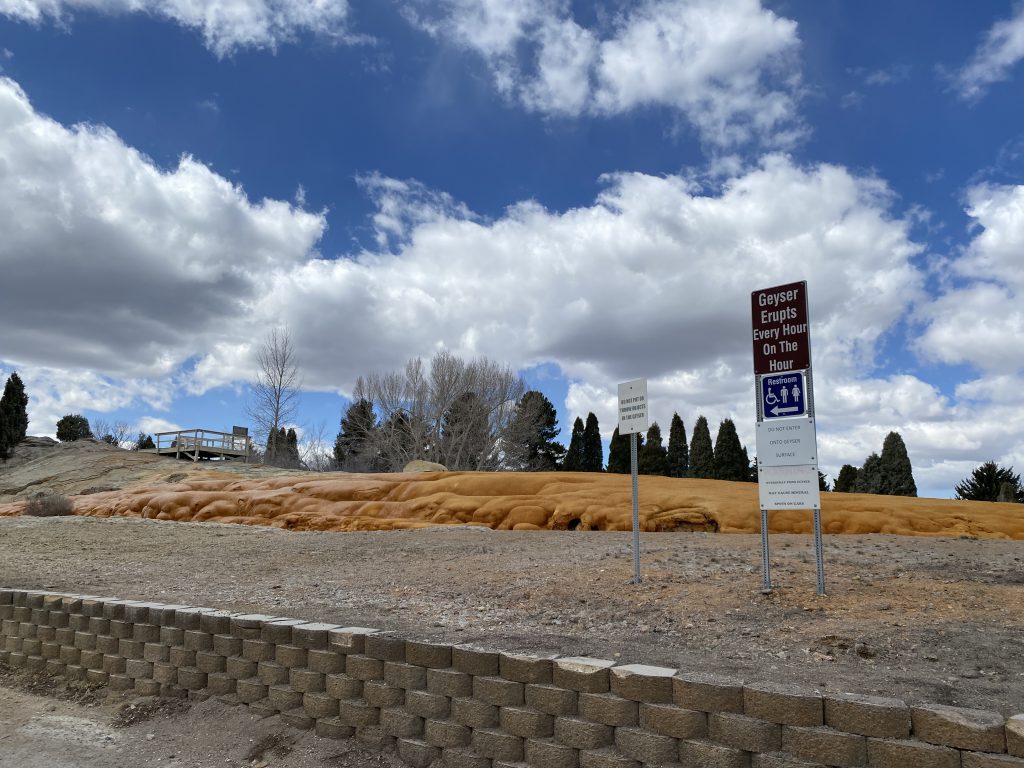
This is the CO2 geyser in Soda Springs, Idaho. It's located in a small city park off the main street, behind the businesses, and about the same distance from the Union Pacific Railroad tracks.
The eruption we saw started about 54 seconds after noon, and lasted almost exactly eight minutes. There appears to be a perpetual spouter erupting to about a meter when the upper vent is quiet. It wasn't as tall during the eruption, but after the eruption seemed to be perhaps twice as high.
The eruption comes from a nozzle above the spouter. I didn't try to measure a height, but estimated it to be around 15-20 meters. Both the start and the end of the eruption are abrupt. At the end the water was still falling well after the stop.
The travertine mound it has built up is an impressive, a dark orange lump that wouldn't look too out of place at Mammoth. It seems to grow pretty fast, as over on the side it's been removed because it was starting to encroach onto the nearby cemetery. The boardwalk near it is heavily encrusted with mineral deposits, and there was even a mineral encrusted snowbank off to one side.
Posted on
Mickey Hot Springs Observations for 2021 April 21
Mickey Hot Springs isn't on the edge of nowhere, it's right in the middle. It was about 150 miles from Winnemucca, and the last 30 miles or so was on gravel road.
It was windy the whole drive, but fortunately we arrived mid-day on a cloudless day, so it wasn't too bad. Had never been there before, so discovering new features was fun.
The "Morning Glory Pool" was overflowing slightly into the bathtub dug into the runoff channel. Below that, down slope we could hear the activity before we could see it. There are two noisy fumaroles at the north end of the active area. South of them were a number of erupting and overflowing features.
There were two small pools separated by a meter or two which were intermittently erupting to about a half meter. The one of the east (#28?) had a large splash zone, implying stronger activity, while the one on the wet was overflowing nicely, and probably the primary contributor of much of the runoff to the south along a well defined channel. In addition, above it was another smaller, unconnected pool which occasionally burst a few centimeters high. That, it appears, is the "Mickey Geyser", #23.
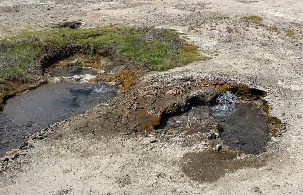
The other splashing vent appears to be the southern end of #26.
The fumaroles were #27 and #30, the latter appears to be larger and more active than what I saw in photos taken earlier.
We saw evidence of dead mudpots, but nothing recent. Large areas between the northern area and the active features were covered in a fine, white power which seemed like something produced by mudpots.
Perhaps it's due to the isolation, but the area was free of the usual trash and casual vandalism I've seen in most other thermal areas. There are some obviously engineered catch basins for bathing, but they are at least not modifications to existing features or runoff channels as far as I could tell.
Also, it's worth noting that we had excellent cell phone data connection (Verizon) in the area.
Posted on
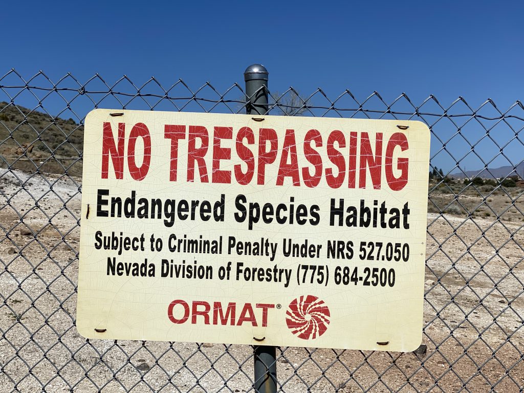
Steamboat Springs Observations for 2021 April 18
Steamboat Springs is long gone. There's now a fence right along the property line, restricting access to the BLM portion of the terrace. This means that only those features on private land are accessible without crossing the fence, which separates #10 from #42, for example.
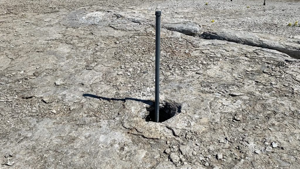
Not that it matters. All the vents are dry, and there's no evidence of any activity anywhere. A few of the cracks have plants growing in them. Perhaps on a cold day there might be whiffs of fog coming from hole.
The vents themselves are mostly recognizable, although I didn't do a full inventory. For some reason there is a long, capped pipe sticking out of #42w, perhaps there's a thermal probe of some kind down there.
Posted on
Long Valley Observations for 2021 April 17
Passing through Long Valley, Calif., so Suzanne and I had to visit Hot Creek. My last visit there was thirty-five years ago, so things have changed. We spent a bit more than an hour there.
The walkways and access is now completely different. Back then, there were trails down near the creek next to the erupting features, and a bridge across the creek. Swimming was also permitted back then. This time the area is fenced off, and signs on the road announced that the area was closed at night.
The previous visit, all the activity was on the south bank of the creek. One of the craters was erupting as much as seven or eight meters high, and there were several other hot pools near it. Those craters are now all dead, with the geyser showing greenish water well below the rim.
In line with those craters, on the north bank was where there was activity, There are three pools that were not there during the previous visit, two of them hot and blue. They appear to be on a linear trend line from the old activity. The water levels of the blue pools were different, with the higher pool, about a quarter to half meter higher. It was continuously pouring water into the lower pool, and all three were pouring that water into the creek. We saw no change in the flow during our visit, although one time, due to the way the runoff can be hidden by the surrounding ground, I thought it had quit because I couldn't hear the runoff.
There were also at least two areas that appeared to be convection in the creek itself. Again, didn't notice any change in the brief time of our visit.
On the way out, stopped at the Casa Diablo powerplant. It too is changed, not surprisingly. The old US-395 road is now blocked off, and where the old hot ground and steam vents were on the northeast side of the road is now occupied by a generator complex. There's no good views of the area. Within the fenced in area, near where the old Casa Diablo Geyser used to be was something steaming heavily. This activity seemed to vary, but again, fences prevented any good views. There is still one area of thermally altered ground open to the west of the complex.
Posted on
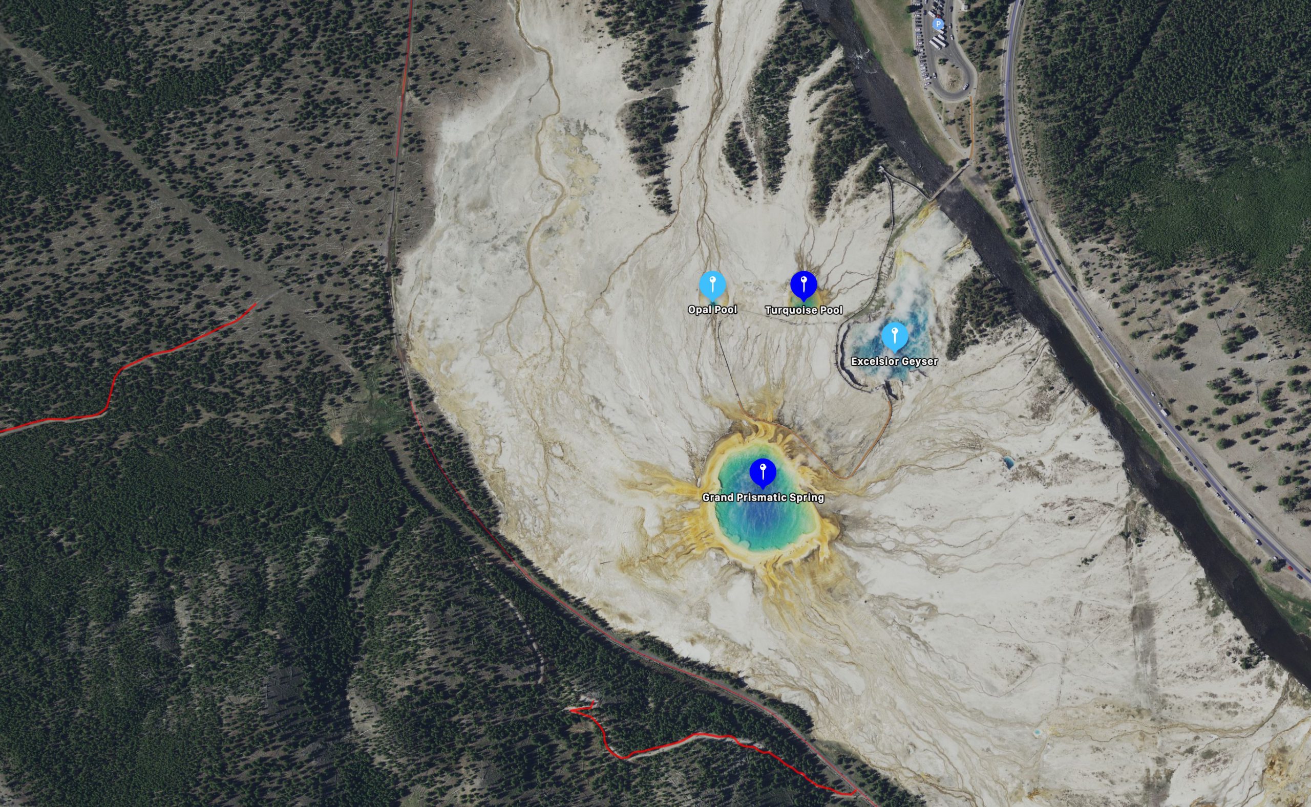
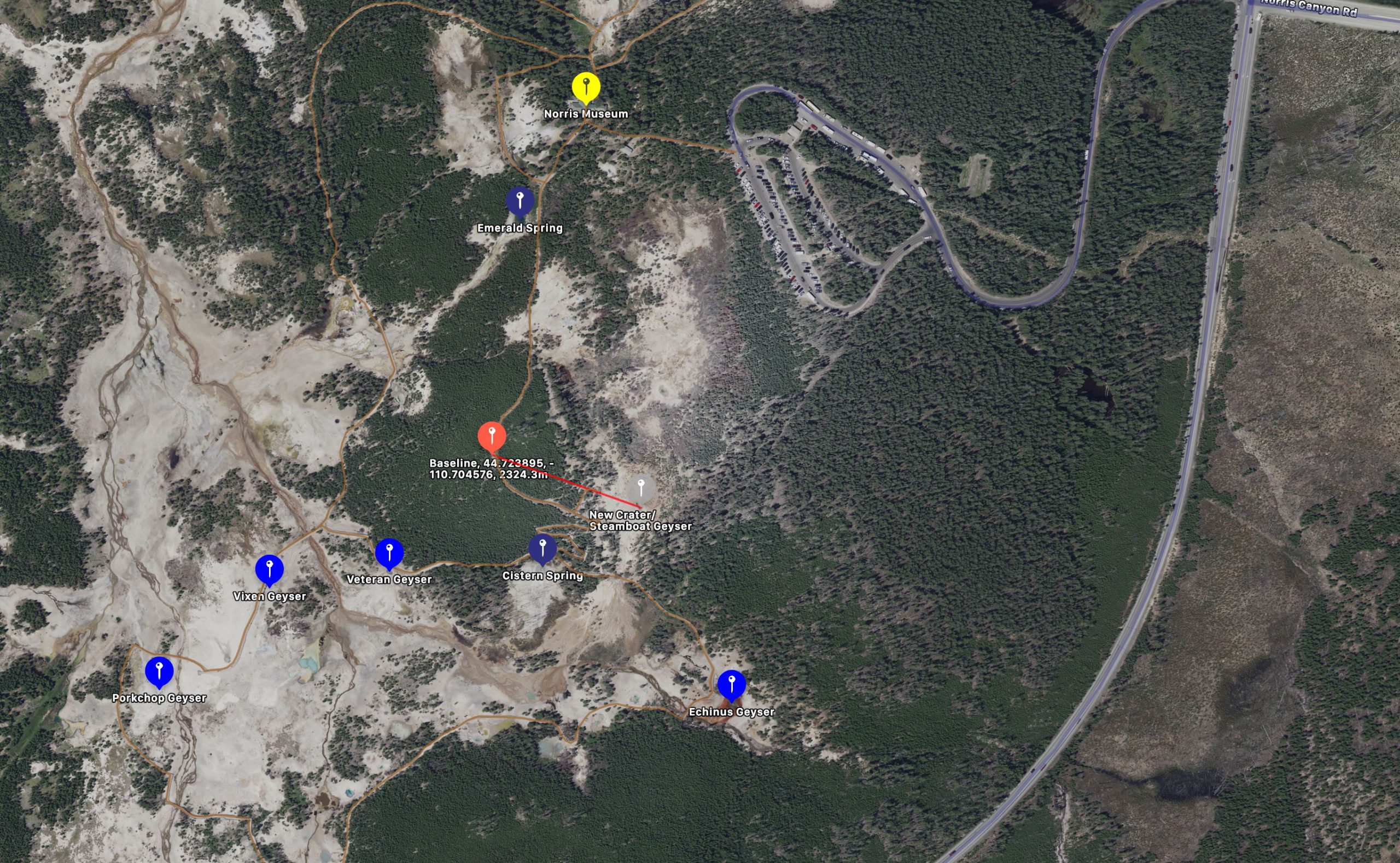
Size Comparison of Thermal Areas
While preparing for another attempt at visiting the thermal areas of New Zealand and Iceland, as well as the western U.S., it occurred to me that it shouldn't be too difficult to compare the sizes of the various area. In The Transactions Vol. 7, T.Scott Bryan does a comparison of the size of some thermal areas. He just presents some basic line drawings, while I figured I could download satellite maps set to the same scale, which would give a lot more details.
The two areas I couldn't include completely are the Upper and Lower Geyser Basins. They are huge compared to everywhere else. Instead I limited them to Geyser Hill/Old Faithful areas and the Fountain Paint Pots. The only other thermal area presented here that doesn't quite fit is Waimangu, where I wasn't able to include the lakeside thermal area.
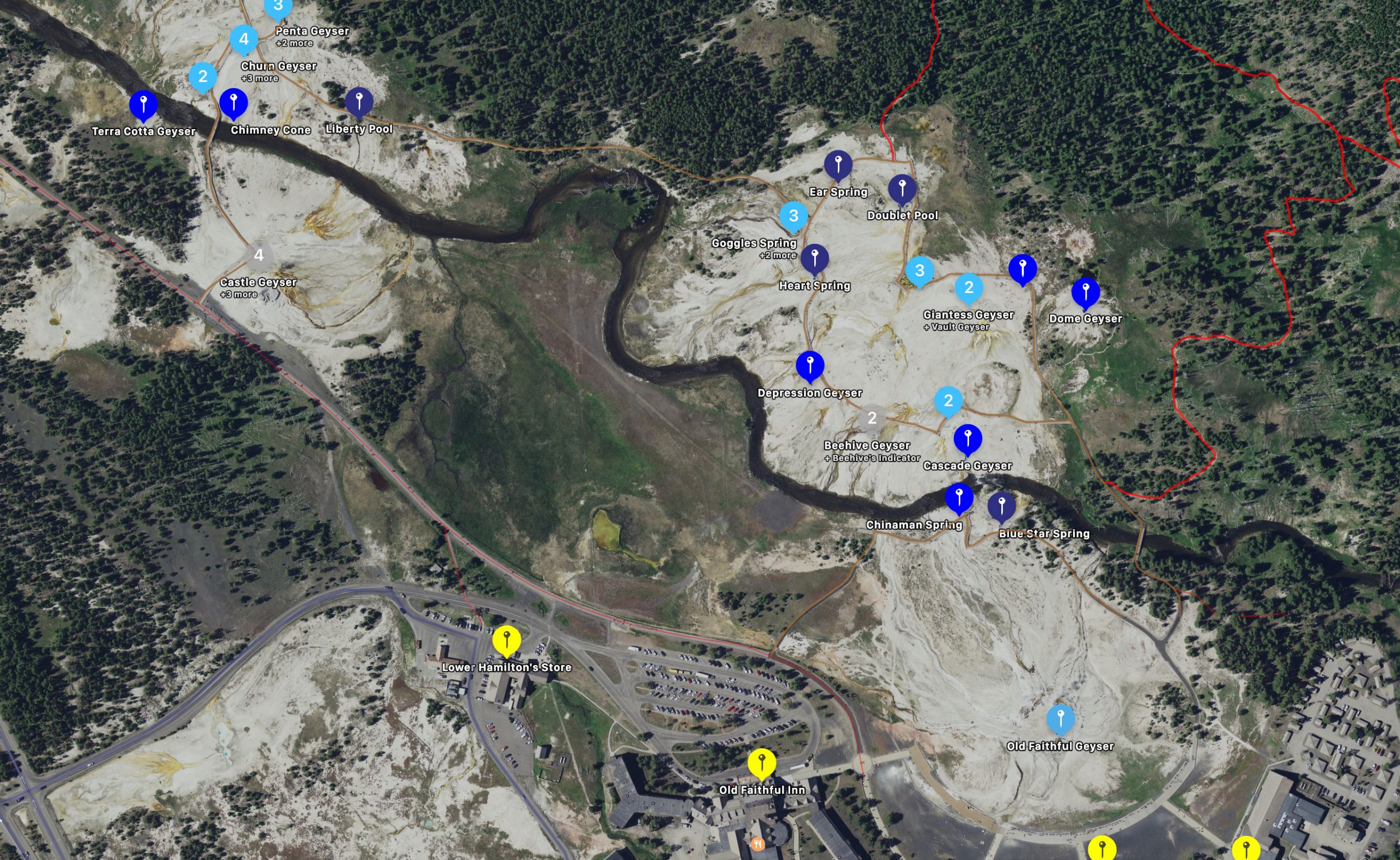
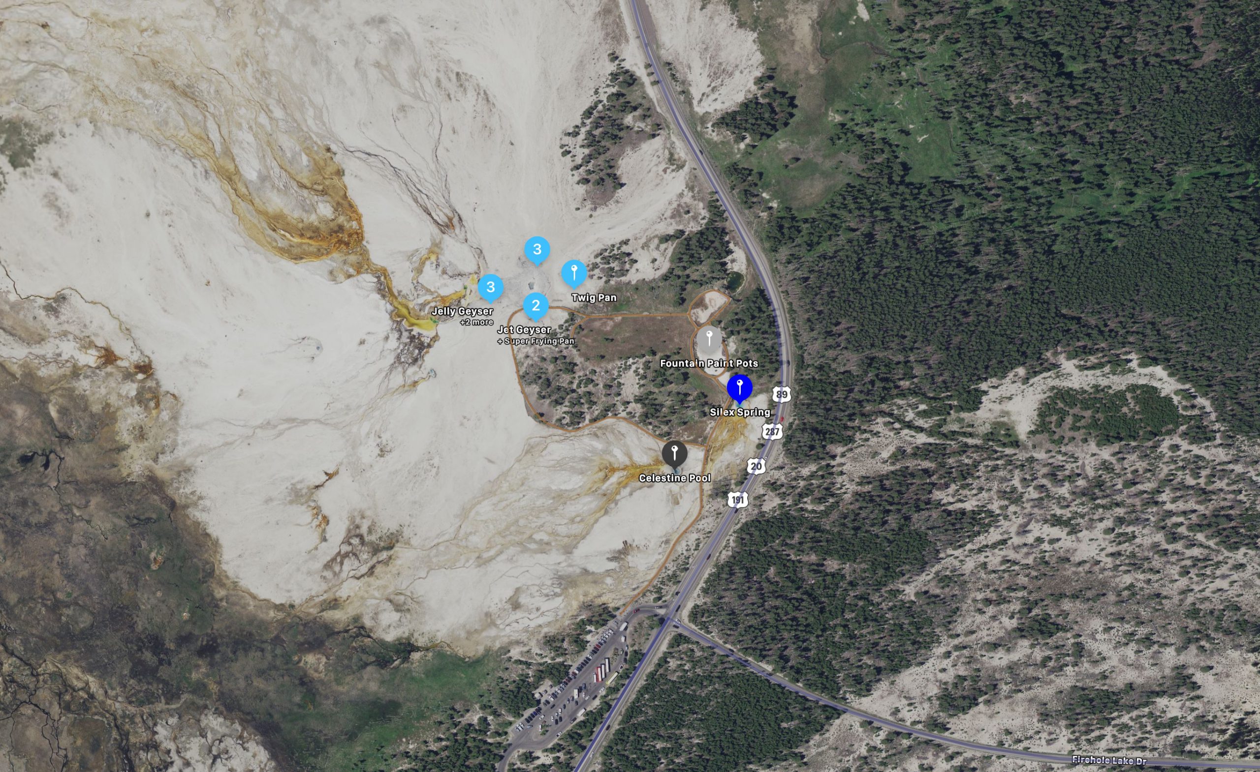
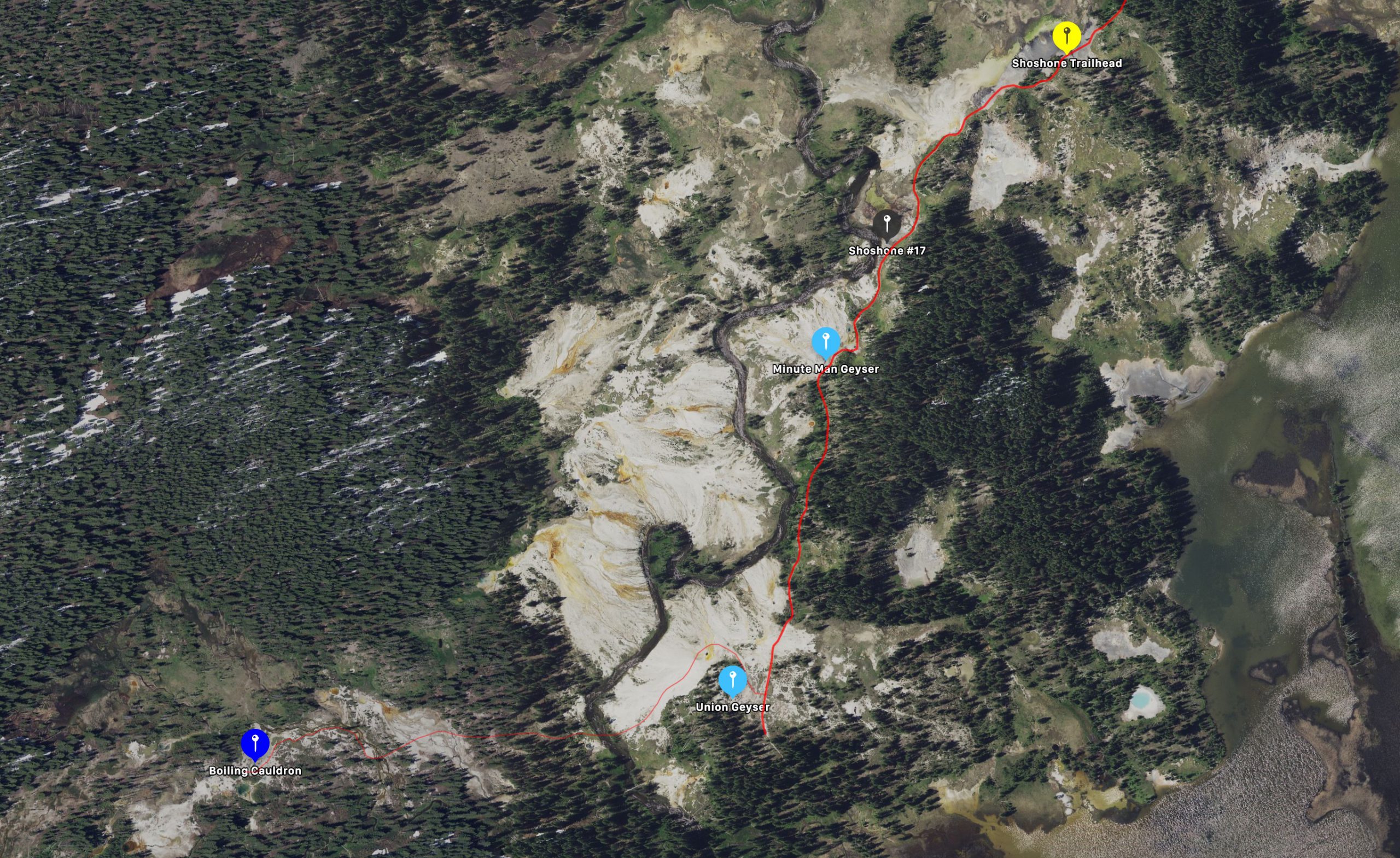
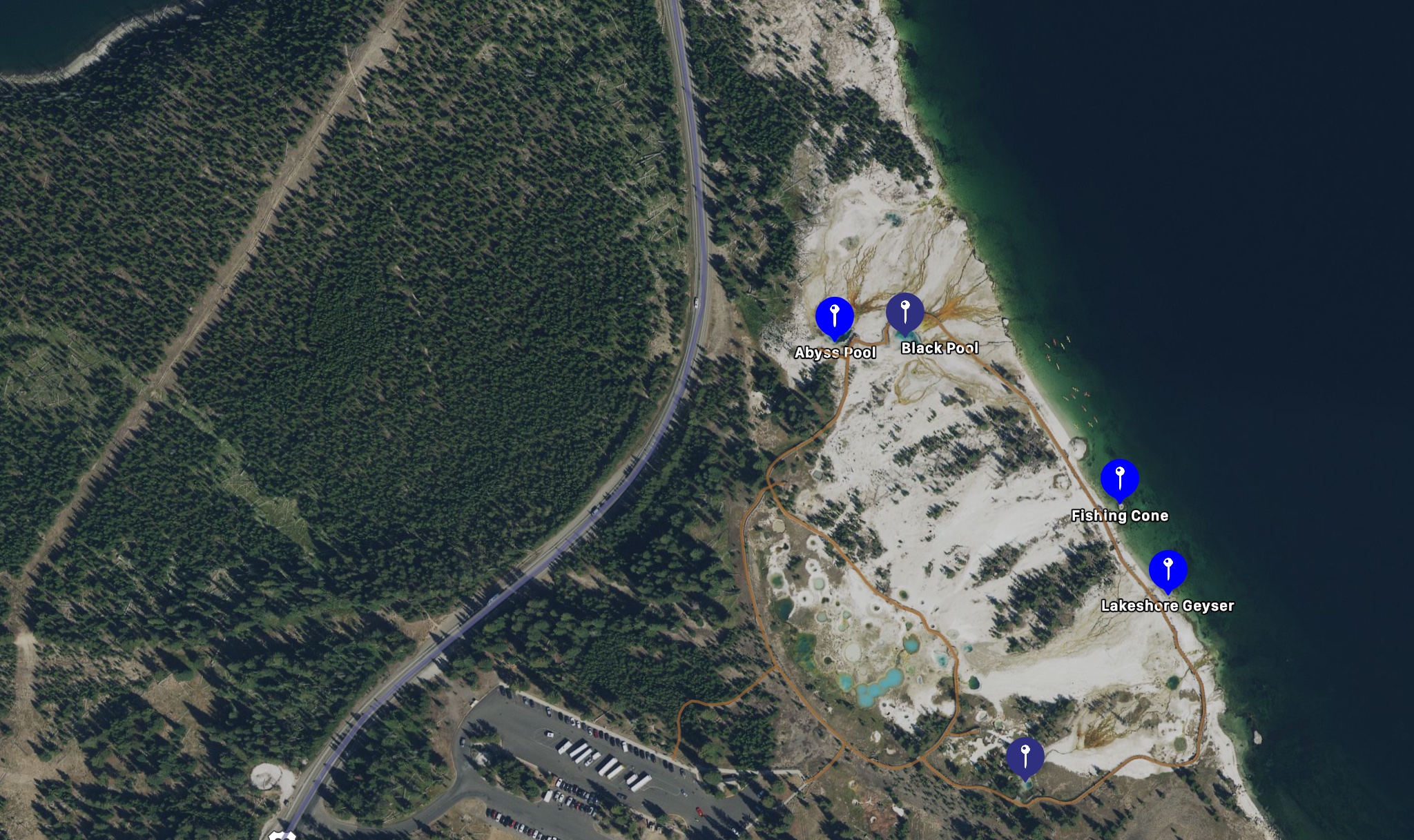
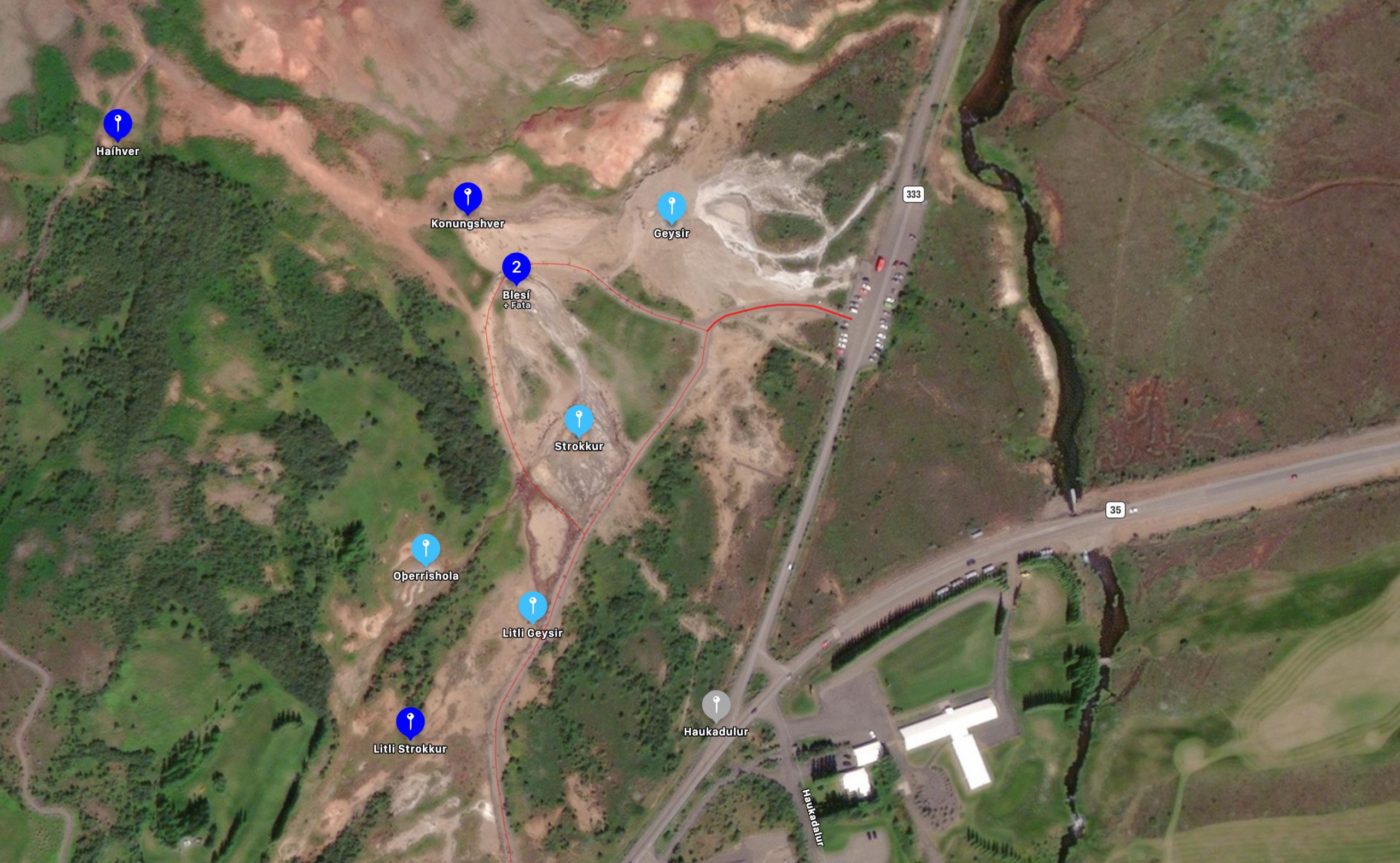
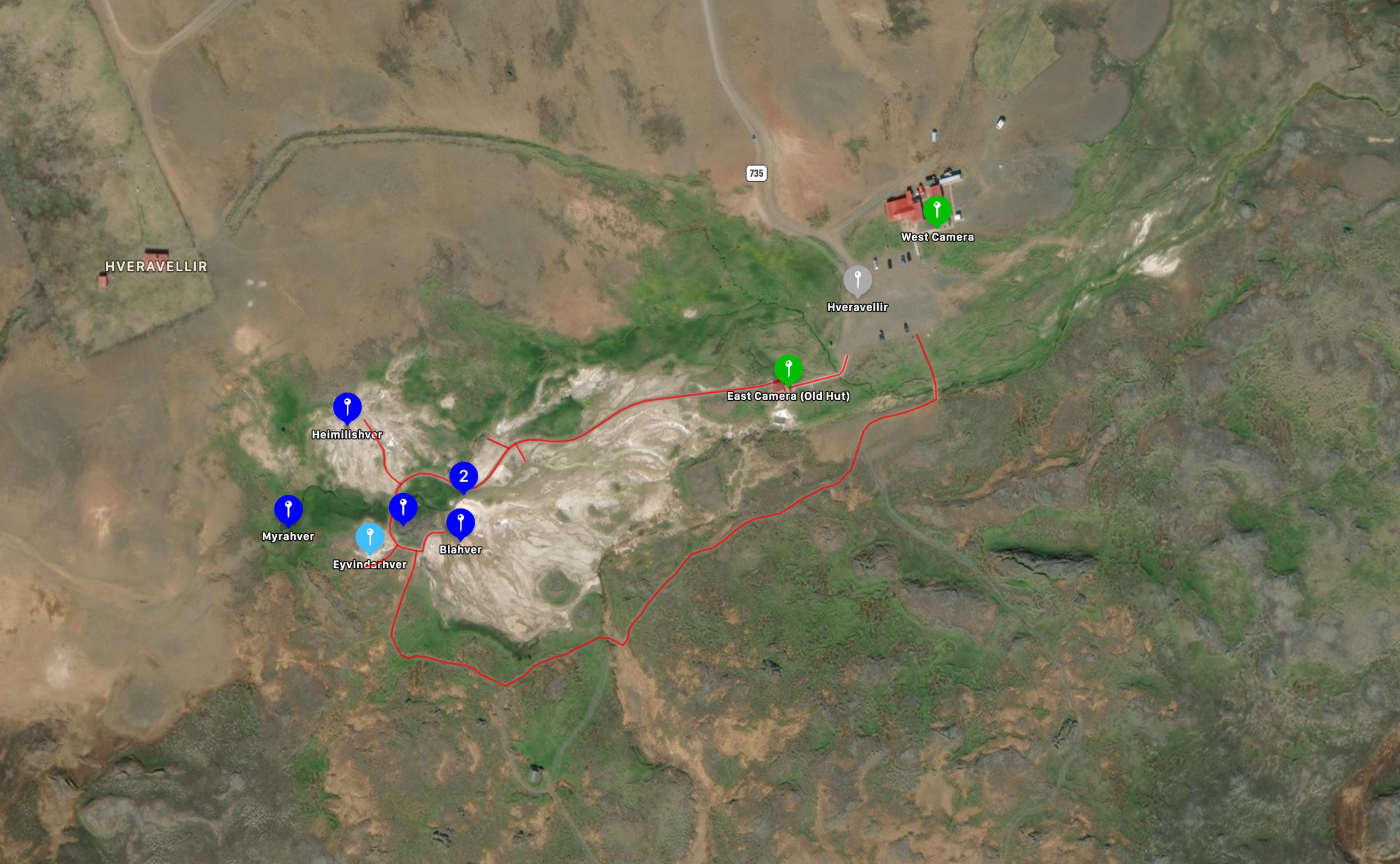
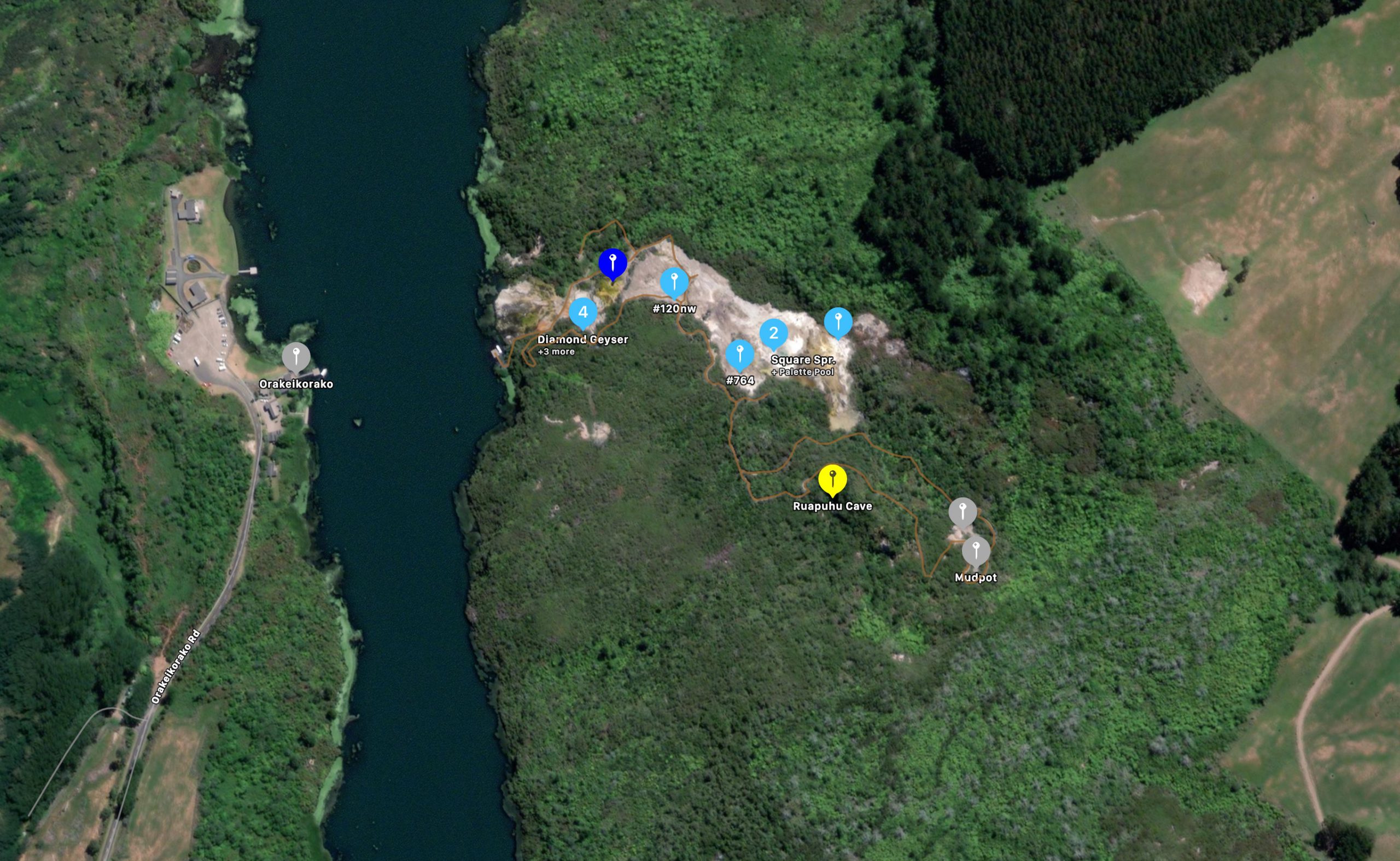
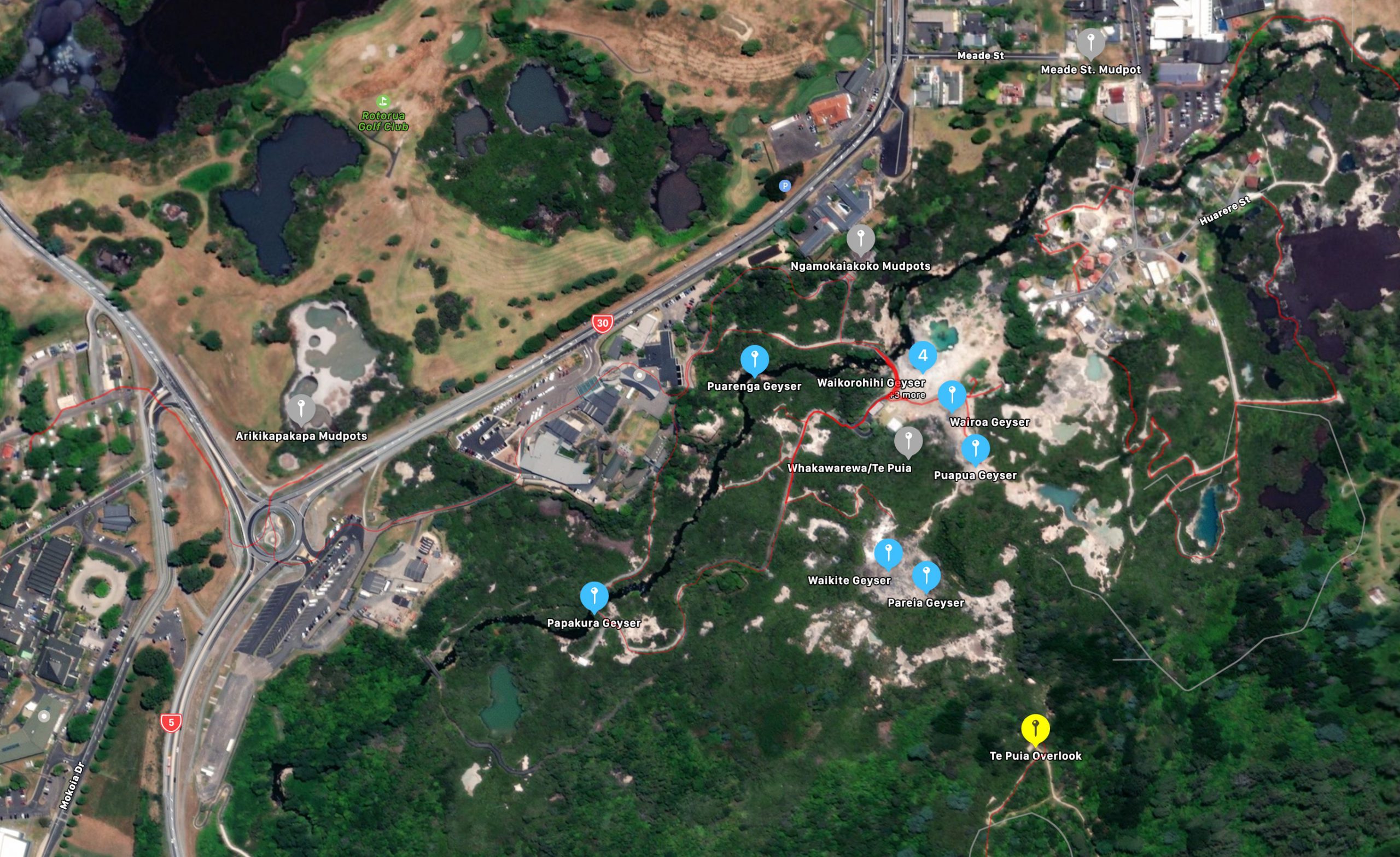
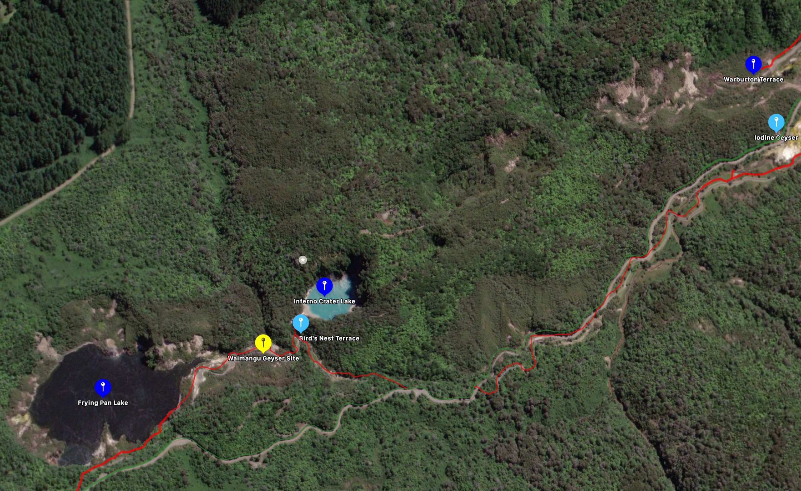
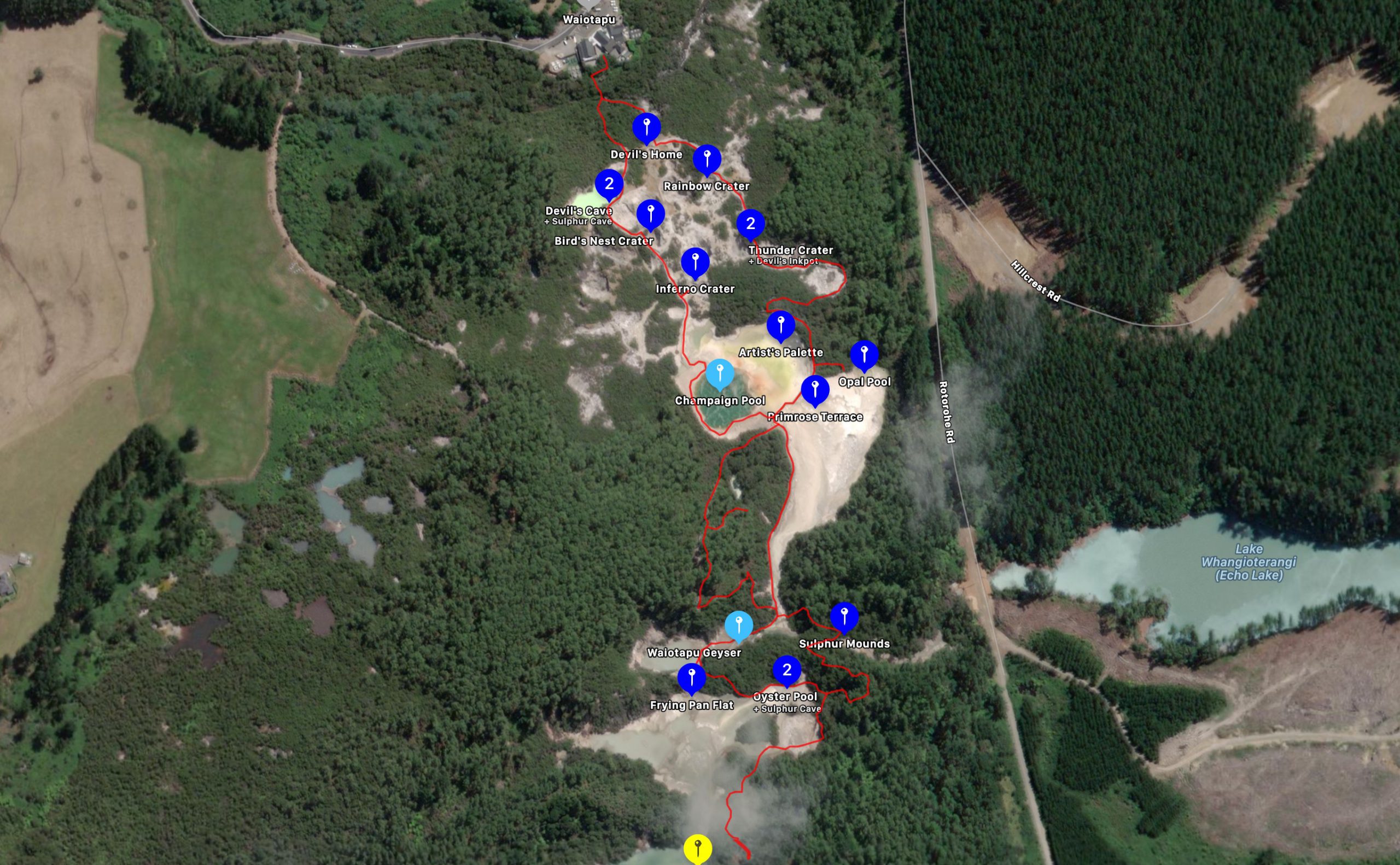
Update: Added Mickey H.S., and Steamboat Springs.
Posted on
Crystal "Geyser", Green River, Utah. 2020 October 16
Posted on
Champaign "Geyser", Green River, 2020 October 16
Posted on
Green River Observations for 2020 October 17
This morning we checked out Woodside Geyser. This feature is located on private property, part of the old town of Woodside and now completely off limits. Based on memory and satellite maps, we figured our best opportunity to see anything of the feature would be from the Union Pacific railroad embankment to the west, just north of the bridge across the Price River. Photos online of the geyser from a few years ago show it erupting quite high, maybe 40 feet, which would mean it should be easily visible. Reports back then also made it sound fairly frequent, something in the range of two hours.
The old route of U.S.6 used to run right next to the geyser. It's location seems to be visible on the satellite map, and we eventually figured out where that area was visible from our embankment vantage point. It was between a couple of abandoned buildings.
Unfortunately, that area seems to have changed, It seems to have been torn up, with the tan formations disturbed and broken up. It seemed like there was some new (as in the last year or so) piping and plumbing around there, along with a couple of unweathered power poles. This is in contrast to the rest of the area, which has that weathered look. A tree visible in the photos from then appears now must be a stump. And nowhere did we see any evidence of water flowing or pooling or even damp areas.
Were there about 90 minutes before finally coming to the conclusion that the geyser there has been considerably altered, if not destroyed. No point in sticking around.
Posted on
Green River Observations for 2020 October 16
Made a road trip to visit the cold water geysers of Utah along with the Keller family. I've never been to any before, so was all new to me.
Champaign Geyser is about a 25 mile drive south of Green River, Utah, mostly on well maintained gravel road. The washboarding on the road tended to get worse the farther one went. The feature lies just north of the San Raphael River, and we arrived there to find it in eruption.
It's a drilled well driven by carbon dioxide, with a water temperature barely above the air temperature. The vent is tiny, in the middle of a small semicircular cone built up from mineral deposits. Surrounding that is a broad platform with lots of terracing.
The nature of the eruption is unlike that seen when the water is boiling. The water ejected consists of a column of foamy water thrown to about a meter high, frequently cut off by gas causing droplets to be expelled up to three to four meters. These noisy cutoffs would also cause the formation of small water droplets, so we could even get an occasional rainbow.
The eruption continued for the half hour we were there, considerably weaker toward the end of the visit. Since the intervals seem to be something in the range of eight hours, there wasn't going to be another eruption until around sunset or later.
From there it was backtrack and head to Crystal Geyser. The road starts out as unmaintained but paved, then turns to gravel. Unlike Champaign, we weren't alone. There were a number of campers along the river, and people playing with their motorized toys came and went in waves.
It appeared that the last eruption had been a while, since much of the platform was dry, and there was only a little overflow. There are holes in the pipe making up the vent, and water would periodically flow more heavily from them. The intervals were about seven minutes. The water coming out was slightly foamy. There was visible distortion in the air over the vent from the gasses coming out. The foaming and gas bubbles could also be heard as we waited nearby.
There is a wide platform with numerous terraces and terracettes leading down to the river. These formations seem fairly strong, and some of the dry ones had dead tamarask growing on them, and scalloping was still visible. In the catch basins around the vent were numerous tiny to small rounded pebbles and stones. Most of the formations are a dark red or dark tan.
After a wait of about an hour, we witnessed some short, minor activity. This started with foaming from some small bullet holes in the casing. As the foamy water rose over the next minute, more holes, higher up, joined in. Finally there was some foaming about an inch high or so from the vent, lasting for about a minute. Then everything died down.
After another minor, and about 90 minutes later, activity started up again. This time, the foaming got stronger, and a true eruption started. This consisted of a column of foamy water about six to eight feet high, with a few bursts during the first minutes to about twelve to fifteen feet. At first we thought this might be just a strong minor, but as the activity continued, came to the conclusion that this is now the major activity. After about 20 minutes or so of this, we decided to leave, in part because it was mid afternoon, and the activity had attracted a lot of people.
It was instructive to see how people behaved here, when compared to what is considered normal and proper behavior among Yellowstone's thermal features. The most important difference is that here the water is not deadly. We saw multiple dogs off leash running through the shallow pool surrounding the vent. A few lapped at the water, but not for long, as I'm pretty sure the water isn't pleasant tasting. We saw children playing in it, and tossing the formation stones around. As the major started, there were several small children standing right next to the vent that needed rounding up. During the eruption at least two people doused their heads in the foamy spray. And that doesn't begin to take into account all the people wander all over the formations before the eruption.