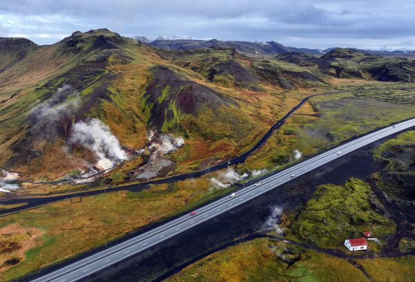
Passing along an online report on changes at the Hveradalir geothermal area in Iceland that were posted at Iceland Monitor site.
Increased visible steam has been observed along the national highway through Hveradalir.
Geophysicist Ari Trausti Guðmundsson says that steam vents often form at relatively shallow depths in areas of geothermal activity and near hot springs.
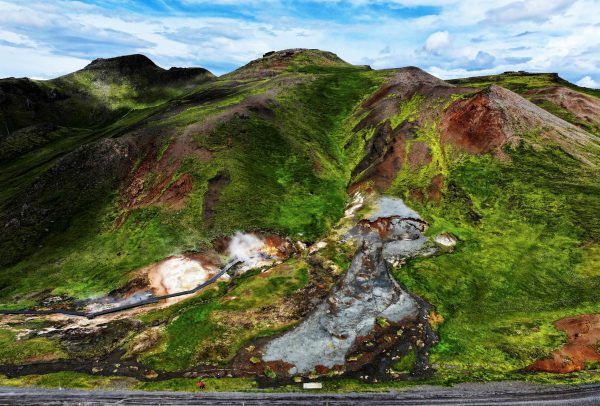
“The best example is in Hverahlíð, south of the road leading up to Hellisheiði, where drilling was carried out for the Hellisheiði Power Plant. Suddenly, steam began rising from the hillside somewhat farther east,” he says.
Back in August 2024 there was a landslide in the same area that exposed some buried features.
The landslide that took down material from the southeast side of Skíðaskálinn in Hveradalir in mid-July has probably broken the top layer of the soil above a steaming hot spring.
It is most likely that the combination of steam activity and high precipitation caused the landslide to occur at this time.
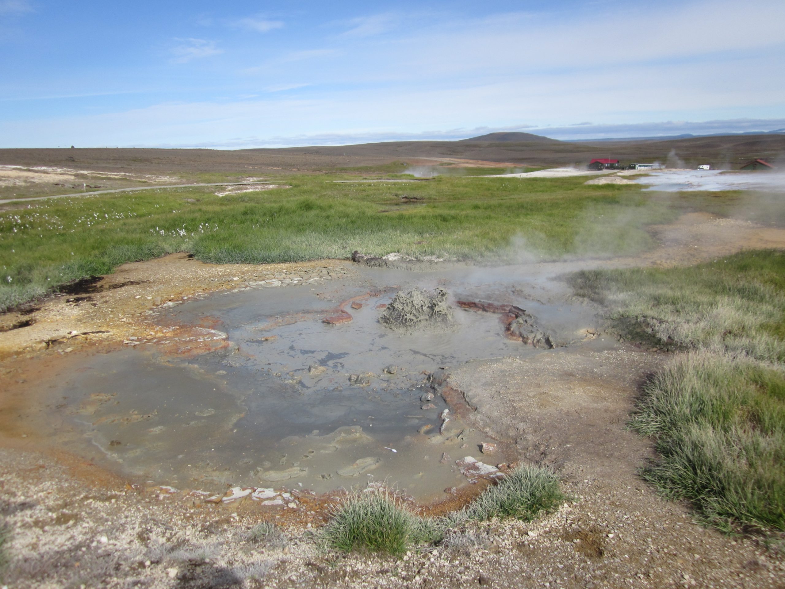
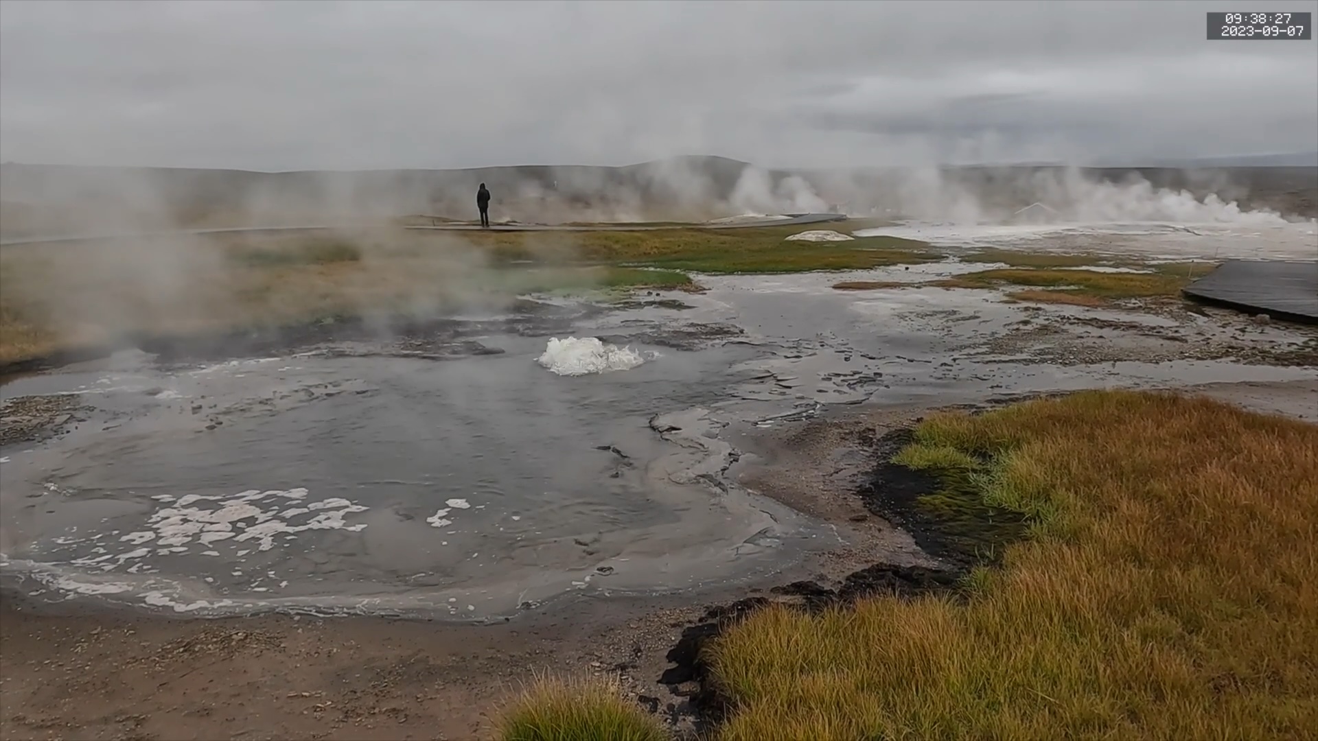
The main thermal area has a walkway and is easily accessible from the highway. We stopped in there when we visited in 2023. I remember a report from back then about steam appearing along the highway, visible in a traffic webcam view, but can't find that report now. So this activity may not be that new.
Tara Cross recently sent me some photos that she took during her visit to Hveravellir in Iceland on 2011 August 26. There were a number of changes between her visit and our visit last year. She also wasn't aware of the map of the area and not sure about the exact locations of some features in relation to what we saw. But we were able to figure things out.
Most notable was the difference in walkways. Some have been removed while others added. This made identification of changed features a little tricky at first.
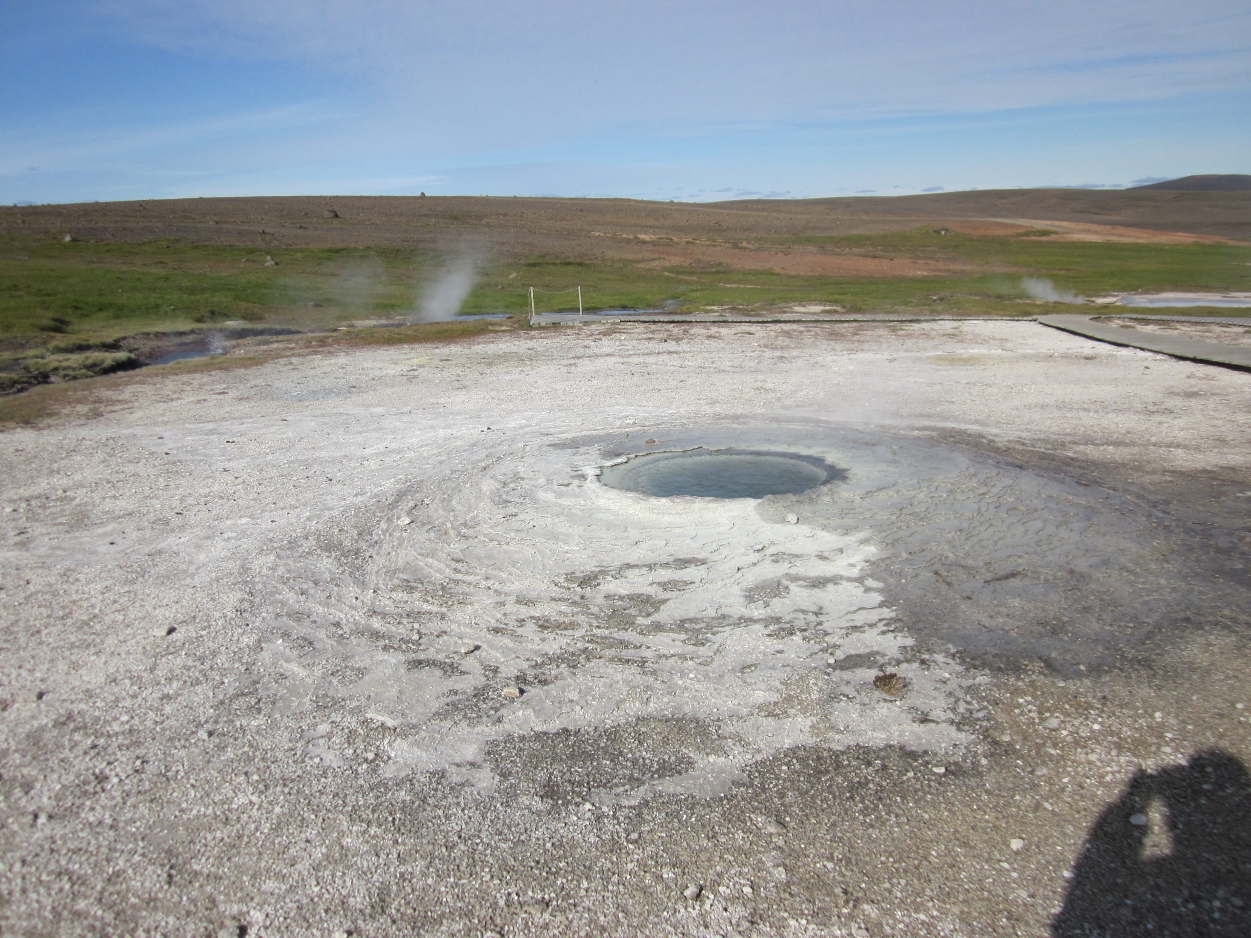
Fagrihver, Hveravellir, 2011 August 26. Photo by T.Cross
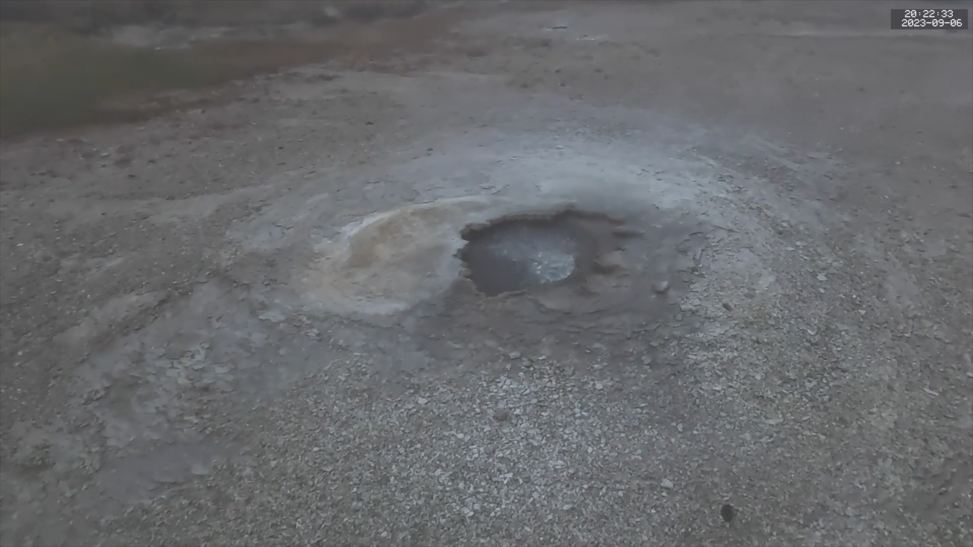
Fagrihver, Hveravellir, 2023 September 06. Photo by H.Koenig
This is a view of Fagrihver. The walkway in the back went over to Meyjarauga, one of the more colorful springs in the area. The walkway is no longer there because Meyjarauga has filled in and disappeared. In the decade since this photo was taken, Fagrihver has roofed over much of the left portion of the vent, as the recent screenshot shows. So it too may disappear in the near future.
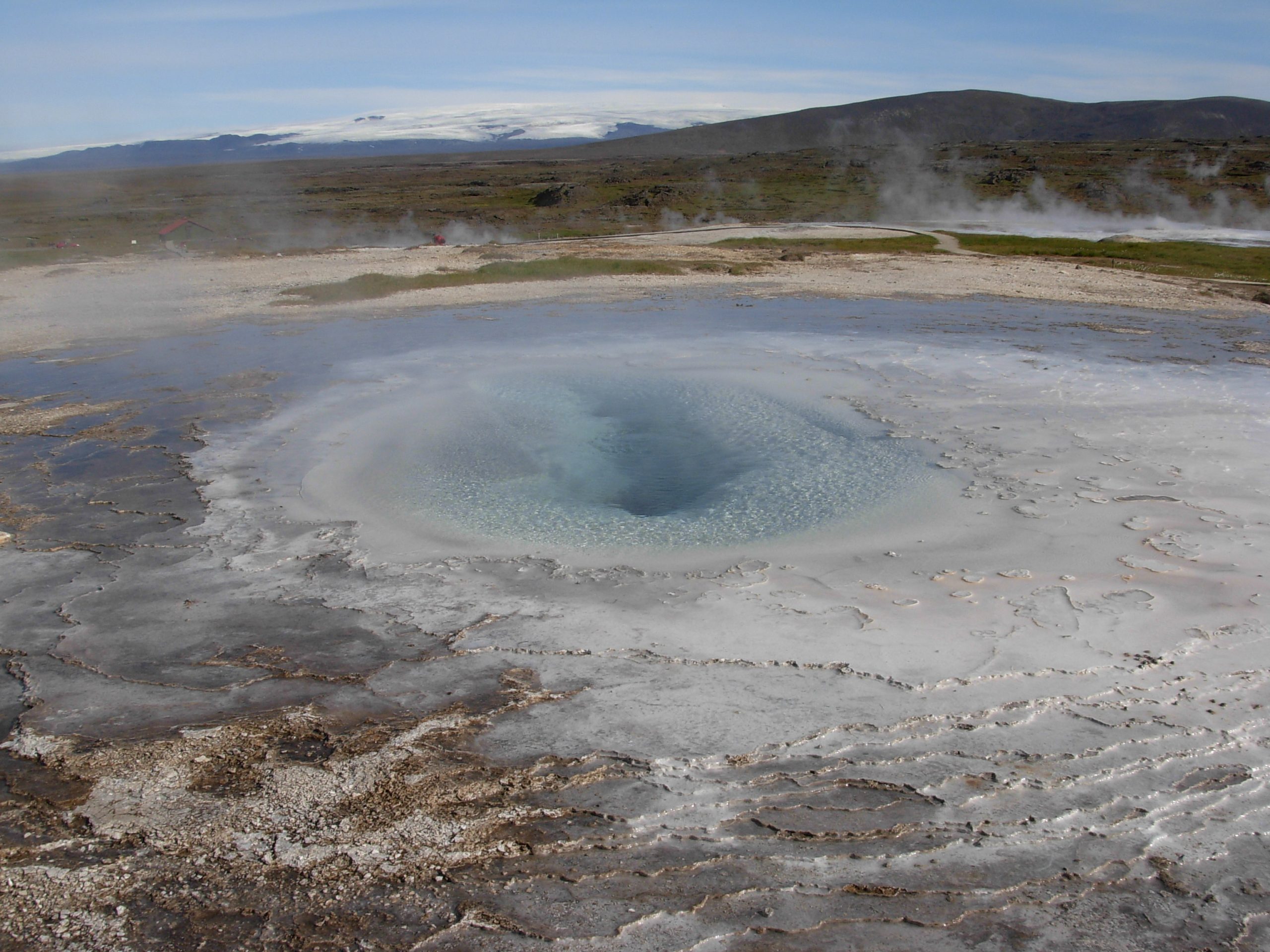
Rauðihver, Hveravellir, 2011 August 26. Photo by T.Cross
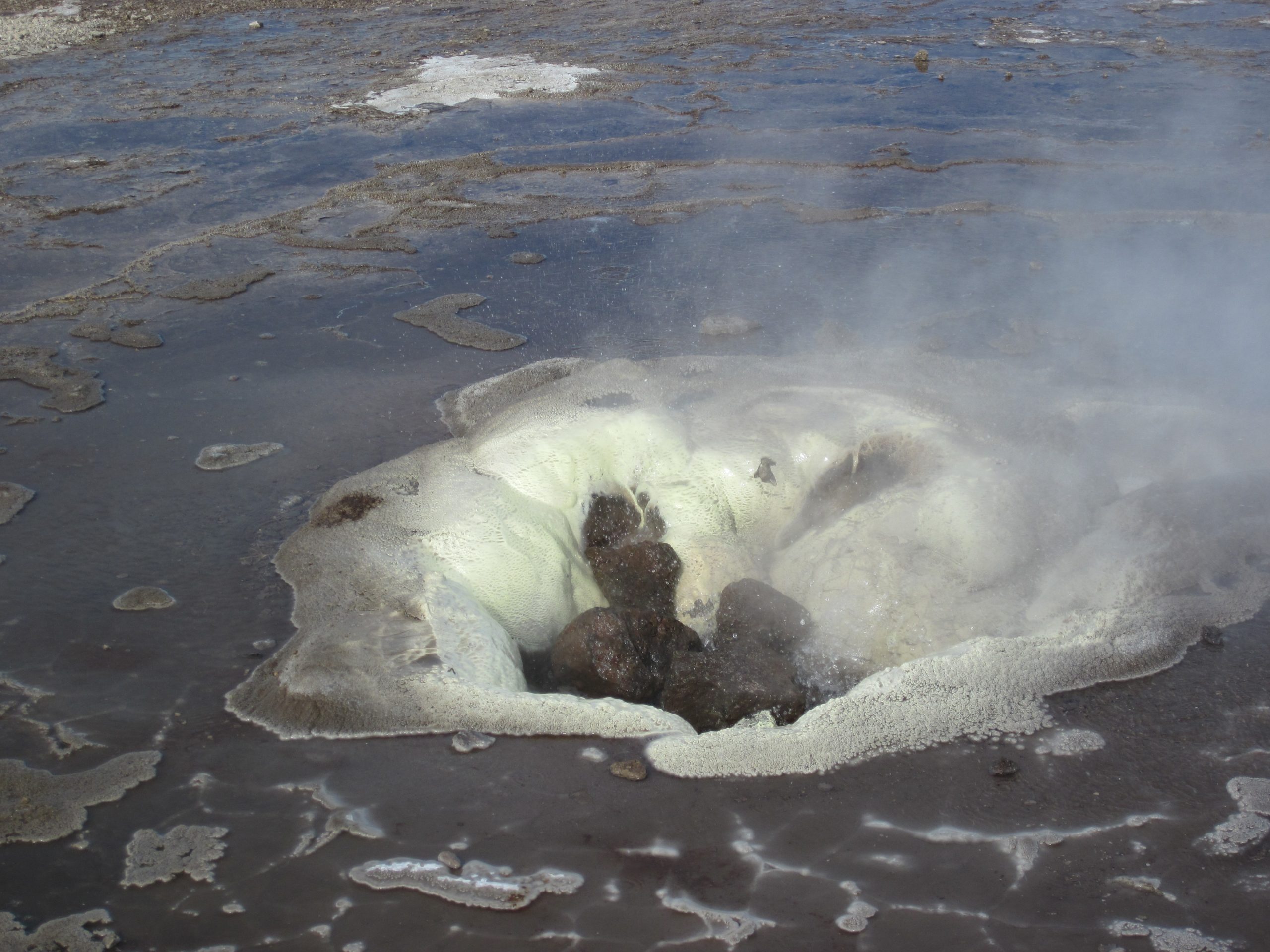
Rauðihver, Hveravellir, 2023 September 07. Photo by H.Koenig
Rauðihver (Red Spring) was also erupting during her visit. It's not as full as what we saw last year, but the activity is from the same vent area. I've seen online videos taken a few years ago where this feature was a hot, blue pool. It must cycle between ugly and active, and pretty but quiet.
Eyvindarhver, Hveravellir, 2011 August 26. Photo by T.Cross
This is Eyvindarhver, a spring that was altered centuries ago so it could be used for cooking. (It's the closest spring to Eyvindar's shelter to the west.) Years ago it was known to behave as a geyser. The photo shows some splashing from what appeared to her to be a steamy perpetual spouter. For our visit, it was acting like a fumarole. There are videos from a few years ago of the fumarolic action being more powerful and noisier.
Bóluhver/Heimilishver, Hveravellir, 2011 August 26. Photo by T.Cross
This is an overview of Bóluhver/Heimilishver, looking toward the east. There is now a walkway running along the boundary betweenthe runoff and the sinter area allowing a closer view of this feature and Gjósandi, which would be to the left.
H-204q, Hveravellir, 2011 August 26. Photo by T.Cross
This is H-204q, a small feature near Bóluhver/Heimilishver. It's not really visible from the current walkways.
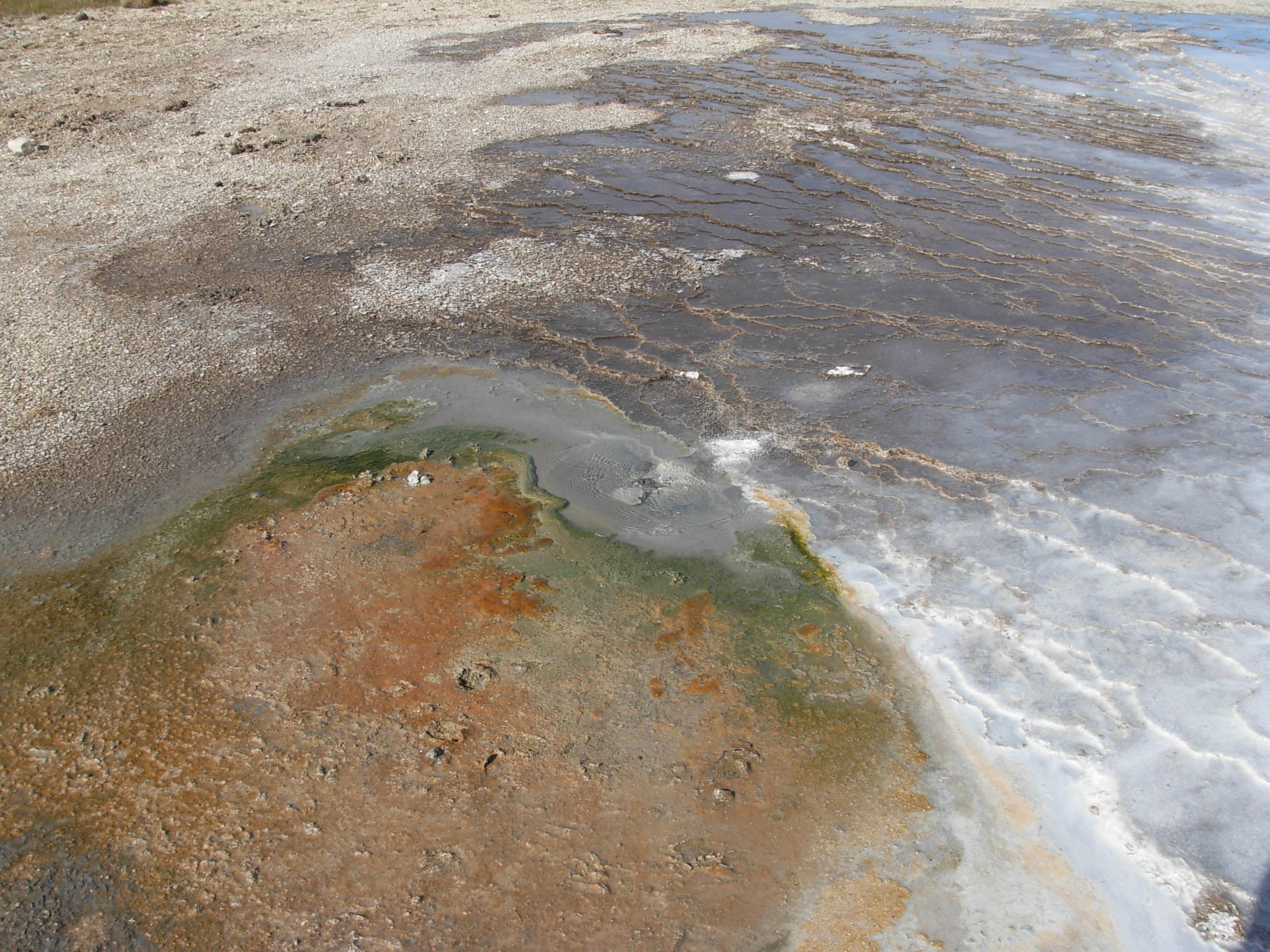
H-204m, Hveravellir, 2011 August 26. Photo by T.Cross
H-204m , Hveravellir, in eruption, 2011 August 26. Photo by T.Cross
This is H-204m. It's located near H-204q, and is a small geyser that Cross saw erupt while there:
I finally saw it at 1445 erupting to 1 to 2 feet with a duration [of] about 2 minutes. It erupted again at 1524, refilled at 1533, and had periodic bubbling episodes until it erupted again at 1601, d~2m50s. Only two data points, I know, but it’s quite possible that it is a regular geyser erupting at intervals of roughly 35 to 40 minutes.
[Sput, Dec 2011, v25n6, pg.19]
We didn't see it as it was partly hidden downslope behind Bóluhver/Heimilishver, and since we saw Gjósandi erupting nearby, didn't realize the complex actually had two geyser features in it. The Hveravellir base map has a small annotation next to the feature mark-- "gýs", a notation I don't see anywhere else on the map. I got a translation as that meaning "erupt". With all the little sputtering features located on the map, this was only one worthy of that special note.
Niermann in his Volcanic Springs website says that H-204m and H-204q were "small intermittent springs" and includes photos of both.