Posted on

Old Giant Geyser Photos


Here are a few old pictures of Giant Geyser. The first is of an eruption in 1912, taken, it appears, from across the river near Beauty and Chromatic Pools. It came from a series of photos taken in and around the old Army post at Old Faithful. Needless to say, the other ones I would have liked to have went for much more than I could afford.

The second is actually a photograph, probably from the 1930s. The third is also probably from the 1930s (does the "36" indicate the year?). It appears that some sort of activity might have just finished with Mastiff and Catfish, or it was just steamy.


Posted on

Photos from Steamboat Springs


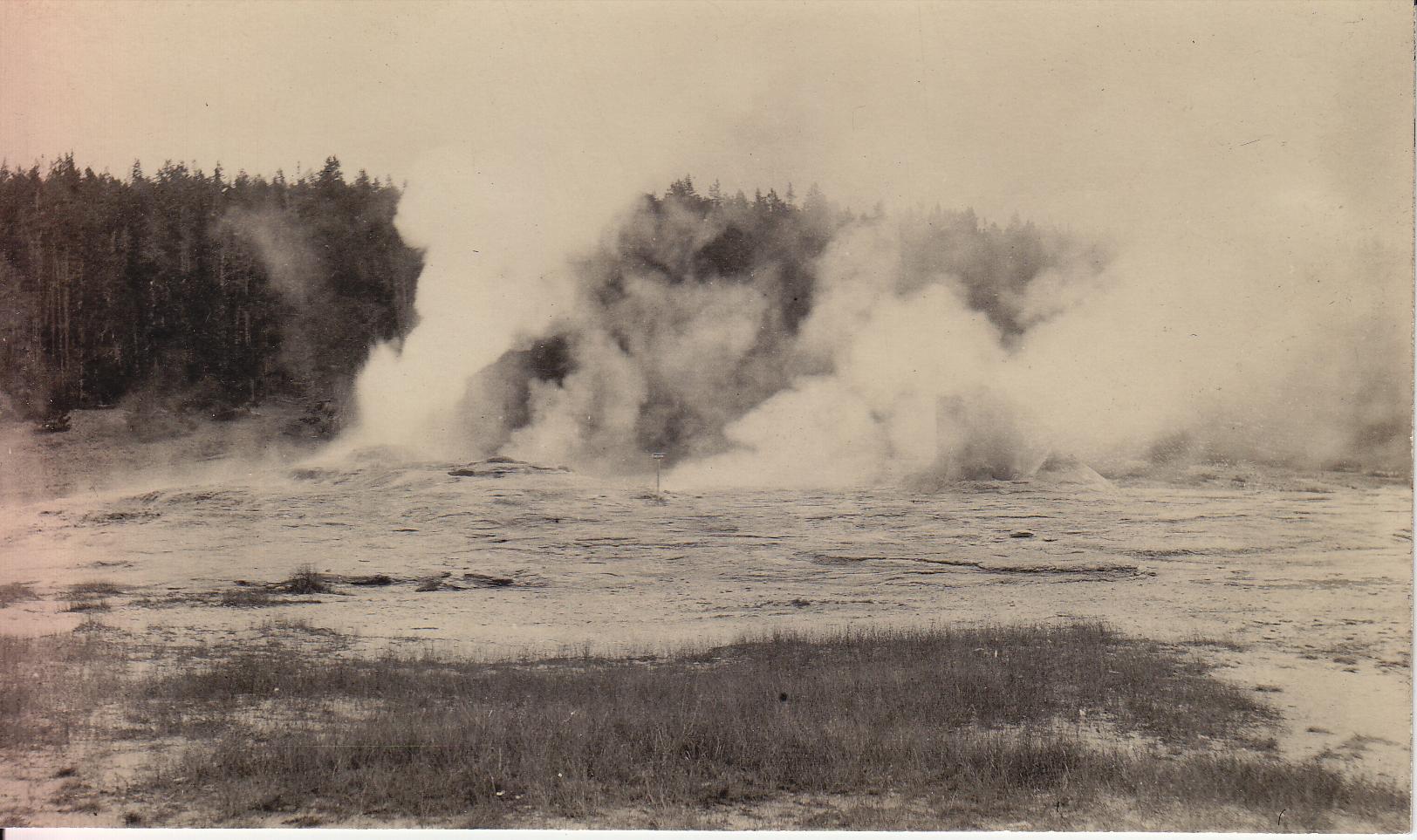
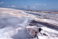
I was doing some research to see if a book listed on eBay was worth a bid (it wasn't), when I came across some interesting photos of Steamboat Springs, Nev. The first three were taken by Don Hudson in 1986, a year before testing began on the powerplants that eventually destroyed the geysers there. I met him on the terrace one day during the the activity of 1986-1987, maybe even the day these photos were made. Note also that I might have some of the feature number wrong, as it has been a couple of decades since I last saw these geysers. I did check my maps, so I got at least the names of what I think they are correct.

In the foreground is #41, while in the background the center of steaming is most likely #39. Both were quite active during that time. As you can see, much of the runoff of #41 went down into a nearby fissure. Many of these fissures were filled with rubble and debris, but when cleared, they were several meters deep. The previous year the Strassers and I visited the terraces around the end of June when #41 was dormant. Because of the high angle of the sun, one could catch a glimpse of a reflection of water about 3 meters down in the vent.

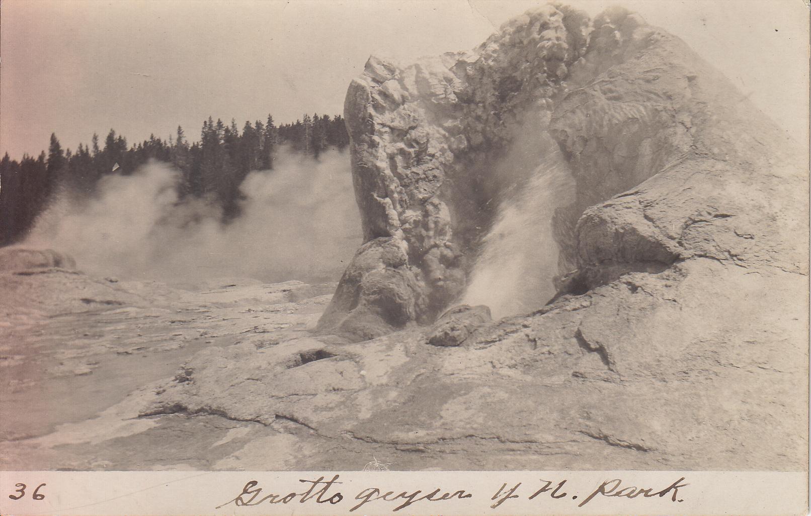
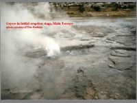
I believe this is a close-up of #102 in eruption. Its vent was not marked on the 1950s Don White maps we used, so I gave it a new, three digit number. It was the only geyser along the top of the terrace which had any sort of pool. The other geysers were often just wide spots in a fissure, or a void in rubble filled fissure. Like nearby #39, which was a a long fissure, this feature appeared to erupt continuously during the several hours of several different visit.s But since the activity here only lasted about a month, I believe it qualifies as a geyser, just one with a very long duration.

Here we have minor activity from the fissure vents of Geyser #42. Over to the left, and not visible, is the vent of #42w, the tallest geyser we observed in all our visits. The main vent of #42 is in the large, wide southern end. Both #42 and #42w could be induced to erupt, both together and separately. On most visits, the first activity we'd get would be a simultaneous eruption of #42, with solo eruptions of #42w afterwards. But on at lest one occasion we did get a series of eruptions of #42, but nothing from #42w. Even during a major eruption, the little sputs you see here didn't get much taller, although they did turn into little columns of suds about a foot high.

In the background you can see the white fresh sinter and dark runoff that surrounded a string of geysers and springs, #12, #13, and the various vents of #14, #15 and #16. Back in the 1950 White reported geyser activity from the first two, while we observed sputtering from a number of vents from #15 and #16.


Steamboat Springs 1867-1


Steamboat Springs 1867-1


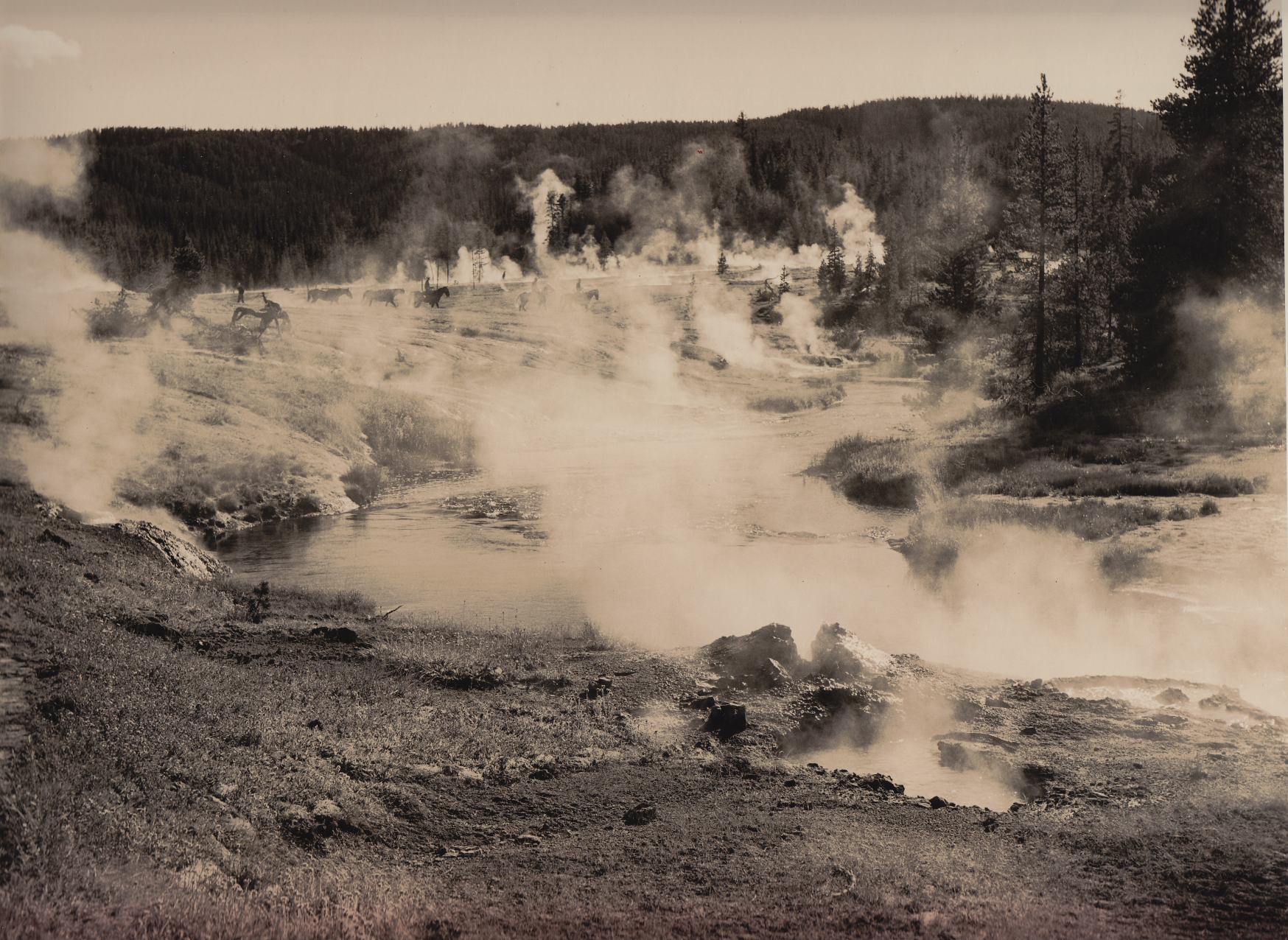
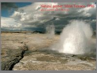
Steamboat Springs Main Terrace 1867

Finally, here are a couple of 1867 photos which show how little the look of the surface features had changed over a century. That road now appears to be bordered to the left by Steamboat Ditch, a channel that diverts water from the Truckee River to Steamboat Creek, with the features of the first two photographs located in the vicinity of the middle of the leftmost fissure.


Posted on

Mickey Hot Spring


Last night I was killing time in the worst possible way: flipping channels on the television. But every so often you get rewarded. In this case I stumbled across a documentary which had a segment on small fish living in Borax Lake in Oregon's Lake Alvord desert area. The narrator mentioned geothermal activity being important, and knowing that there are geysers in the area, I decided to stick around and see if they had any real information.

The show was Oregon Field Guide, produced by Oregon Public Broadcasting. This episode was first broadcast on 01 February 2007,which means that it was probably filmed during the summer of 2006.

After the segment ended began a "photo-essay" on Mickey Hot Spring. So there was more information. Mickey is known to have geyser activity, and would it appear here? After the usual obligatory shots of things like dead dragonflies in a tepid, watery mud-pot, the camera operator concentrated on a small sputtering feature. I noticed that it appeared that the intensity of this sputtering varied, and in backcountry areas, that's always a good sign that a feature is worth watching some more.

In this case, the payoff came just as the credits started to roll. Suddenly the little pool next to the sputtering vent started to erupt, to maybe a foot or so, but it was a definite eruption. It might have lasted only a few seconds, but that's hard to tell thanks to the editing. But at least we have documentary proof of geyser activity at Mickey in 2006.

Unfortunately, the show's website doesn't include this clip, so you'll have to hope your local PBS station(s) show it. Here in the Seattle area, according to the listings it was suppsed to be rebroadcast again during this week on KCTS Channel 9, but now the updated listings don't show it.


Posted on

Photographs from August 1917


I recently acquired through eBay a set of photographs taken during a tourist visit in August 1917. A number of them are of the usual tourist activities back then: watching Old Faithful erupt and touron foolishness like the molesting of bears. But a few of them contain geyser views of interest.

This first one shows Castle Geyser steaming in the foreground, but it's the background that caught my eye and why I acquired the lot. Back there we not only see the old Army post buildings, but what appears to be an eruption of Lion Geyser. (I could be wrong, in which case this photo gets even better.) It's rare to see eruptions of any of the "other" geysers in these old photos, and nice to have some photographic record of that activity, no matter how small.

Here's a view of Castle slopping, but taken from an unusual position. In the foreground is Shield Spring, which today is that feature enclosed by a corral and a frequent receptacle for touron trash. To the left of Castle a surging Tortoise Shell Spring is also visible. The old road can also be seen running just behind Shield, and in the right background, we can see the Army post buildings again.

A nice shot of the Old Faithful Inn, probably taken from the porch of today's Lower Hamilton's Store. Despite the lack of the West Wing and the parking lot, it looks quite similar to the view today.

This is what a tour group somewhere on Geyser Hill looked like 90 years ago. The difference in dress is remarkable, but also notice that the boy on the left is holding what appears to be a camera in his left hand. This photo also is the only one with a typewritten caption on the back:

Photo by Edward Frank Allen

Groups of tourists of all ages, but unified in their rapt attention, follow a guide about the formations and listen to the wisdom he pours through a megaphone[.]

It's a little hard to see what's going on in the scan here, so I've attempted to enhance the contrast. The band of light seen above the person is in the orginal photo, and my adjustments didn't make it any better. There's a feature erupting on the right, throwing water droplets as high as the ridgeline. But I can't figure out what this might be. It appears that it's in the Lower Basin, but could be Crater Hills. If it were in the Upper Basin, which I doubt, it could easily be Tardy Geyser or Sawmill Geyser. If it's Lower Basin, then could this be Twig Geyser, just to the east of Fountain Geyser?

But this demonstrates one of the problems with old photos. Often they aren't labeled. Not surprising, since people didn't seen them until they were back home from their trips, and didn't really care about much more than "it's a geyser erupting next to what's-his-name". But they also often don't contain enough framing or background to tell what it might be. What's worse is that cultural landmarks can change, too. Roads and trails can shift, and what's an important feature then could be today's scummy hole (like Economic Geyser).