Here's a little something I'd love to bring on a hike to Shoshone:
Here's a first hand report from someone who actually tried it.
Would definitely be a change of pace from the usual Cup-o-Noodles I usually bring. And no carrots to escape.
Notes and Observations on Geysers in Yellowstone and Elsewhere
Here's a little something I'd love to bring on a hike to Shoshone:
Here's a first hand report from someone who actually tried it.
Would definitely be a change of pace from the usual Cup-o-Noodles I usually bring. And no carrots to escape.
Recently on eBay I picked up an interesting item. It's a flyer for the old Steamboat Springs Spa. The mention of access via passenger service on the Virginia & Truckee RR puts the date of this flyer before 1950, as that's the year the railroad ceased operations.
But what interested me was the mention of "Chicken Soup Springs". Don White mentions it in one of his USGS Professional Papers on Steamboat Springs [#458-C, 1964, pg. 74], as being #33, a spring located near Steamboat Creek south of the present-day spa buildings. I never visited it myself, as we always avoided the spa grounds.
White says that during the 1950s the discharge from this spring was fairly high as long as the discharge from nearby wells was low. The water in that spring must have been pretty bad to taste that way, and I doubt it had much nutritional value.
On the other hand this history of the Compstock Silver Lode & Mines claims that there was a "Chicken Soup Spring" located at Shaw's hot springs "a mile west of Carson City". (Waring, in [USGS PP-492, Nev.#59], lists it as 2 miles north of Carson City.) It also mentions another spring known by that name near Elko. So it may be that "chicken soup spring" was almost a generic term applied to any foul tasting or smelling spring in Nevada.
So now the question becomes, did Spring #33 acquire the name because every location with brackish springs in Nevada require it, or was it an original name that spread to other areas? And why doesn't Yellowstone have a spring with such a name?
The name of the most famous geyser of its day, Geysir at Haukadulur in Iceland, ended up becoming the generic term in many languages for all erupting, boiling hot springs— the word "geyser". I propose that something similar be done to identify and distinguish artificial geysers, or erupting wells, from their natural counterparts.
Most of these features are out of the way, neglected, or at best, local curiosities. But there is one with delusions of grandeur, and I propose that it's name become the generic term for all of these features.
Throughout the Western U.S. are a number of these features. They can be the only feature, as at Lakeview, Ore., or the dominant feature with other, natural springs nearby, as at Green River, Utah., or one feature among many natural features, including natural geysers, as was the case at Steamboat Springs and Beowawe, Nev. The driving mechanism can either be heat and boiling temperatures, as at the Nevada sites, or gases in the water, as in Utah.
Located in Northern California is a tourist trap based on an eruptive feature, the so-called "Old Faithful Geyser of Calistoga." Billed as a true geyser, it is the last of what seems to be several erupting wells in the Calistoga area in the early 20th century. Early 20th Century postcards make reference to a whole host of them, including one card that shows two features erupting together.This feature should not be compared to Old Faithful Geyser, but the name "the Firehose of Calistoga" just doesn't have the same effect.
But we should give this feature some credit, I've proposed that an erupting artifical features be refered to as "a calistoga". The word has a nice ring to it, and in the realm of true geysers, is otherwise completely meaningless. And because the word has been in use as a placename for over a century, it doesn't have the artificial feel of modern corporate names, or of deliberate attempts to coin a descriptive term.
About a decade ago, there was even a calistoga in the Old Faithful area. Well, sort of one.
If the specifications require that a fire water line be laid at a depth of six feet to prevent freezing, do so, even if the ground is so hot that small thermal springs are breaking out in the trench. This is what happened when a new fire line was placed along the service road behind the Lower Hamilton's store around 1978-1979. Immediately afterwards several hydrants behind the store along the service road were found to be so hot that they were unusable for emergencies. Some still are. Around some of the hydrants, the discoloration of thermal alteration of soil and rock, normally only visible around natural thermal features, are easily visible.
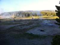
These photographs show another one of the results that were a common sight in the last few years of the 1990s — pressure build-up that several times a week had to be released by NPS maintenance. After a few years, like most thermal features, it went dormant as the heat and pressure subsided.
There might be some who object that the hydrant wasn't a true calistoga, since eruptions had to be initiated by someone using a wrench to open a valve. But many other calistogas are subject to human control (most notable, Lady Knox Geyser in New Zealand), and that is hot water being thrown in those photos.
[Parts of this posting appeared on 2002-Apr-19 in an earlier version of this weblog.]
The Old Faithful streaming webcam came back. At the left are the latest image from the old still camera, and below it is a snapshot from the new camera. That still image can become a live image by clicking on the green button at the bottom right of the image. Clicking on the red button will stop the stream. Clicking anywhere else on the image will take you to a full webcam image page where you can do other things. The black button turns on the audio commentary stream. The blue button will zoom the image to full screen. Clicking on the still image will zoom it to full size. The status bar from that image is also being displayed at the bottom of the streaming image.
Displaying real-time images like this is CPU intensive, and I decided that on the front page it was better for visitors to this site to have the option of turning off the stream, as the only other alternative was to close the page. And driving people away from my webpages seems counter-productive.
If anyone wants to add similar support for this webcamera (or others) using Silverlight, please don't just steal my work. You are welcome to contact me for help, advice or even a copy of the code.
I recently acquired through eBay a set of photographs taken during a tourist visit in August 1917. A number of them are of the usual tourist activities back then: watching Old Faithful erupt and touron foolishness like the molesting of bears. But a few of them contain geyser views of interest.
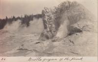
This first one shows Castle Geyser steaming in the foreground, but it's the background that caught my eye and why I acquired the lot. Back there we not only see the old Army post buildings, but what appears to be an eruption of Lion Geyser. (I could be wrong, in which case this photo gets even better.) It's rare to see eruptions of any of the "other" geysers in these old photos, and nice to have some photographic record of that activity, no matter how small.
Here's a view of Castle slopping, but taken from an unusual position. In the foreground is Shield Spring, which today is that feature enclosed by a corral and a frequent receptacle for touron trash. To the left of Castle a surging Tortoise Shell Spring is also visible. The old road can also be seen running just behind Shield, and in the right background, we can see the Army post buildings again.
A nice shot of the Old Faithful Inn, probably taken from the porch of today's Lower Hamilton's Store. Despite the lack of the West Wing and the parking lot, it looks quite similar to the view today.
This is what a tour group somewhere on Geyser Hill looked like 90 years ago. The difference in dress is remarkable, but also notice that the boy on the left is holding what appears to be a camera in his left hand. This photo also is the only one with a typewritten caption on the back:
Photo by Edward Frank Allen
Groups of tourists of all ages, but unified in their rapt attention, follow a guide about the formations and listen to the wisdom he pours through a megaphone[.]
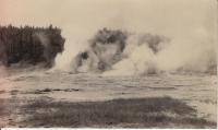
It's a little hard to see what's going on in the scan here, so I've attempted to enhance the contrast. The band of light seen above the person is in the orginal photo, and my adjustments didn't make it any better. There's a feature erupting on the right, throwing water droplets as high as the ridgeline. But I can't figure out what this might be. It appears that it's in the Lower Basin, but could be Crater Hills. If it were in the Upper Basin, which I doubt, it could easily be Tardy Geyser or Sawmill Geyser. If it's Lower Basin, then could this be Twig Geyser, just to the east of Fountain Geyser?
But this demonstrates one of the problems with old photos. Often they aren't labeled. Not surprising, since people didn't seen them until they were back home from their trips, and didn't really care about much more than "it's a geyser erupting next to what's-his-name". But they also often don't contain enough framing or background to tell what it might be. What's worse is that cultural landmarks can change, too. Roads and trails can shift, and what's an important feature then could be today's scummy hole (like Economic Geyser).
Well, just as I was about to make some more modifications to make the streaming camera work better on these pages, it disappeared. Don't know if it got turned off, or how long it'll stay off or if they just changed the URL to keep people like me out. Oh, well.
I've changes a couple of items on this page.
First, the "Current Geyser Activity" has been removed because there's no current information to report. During the past couple of months Mary Beth Schwarz allowed me to keep it fairly current by reporting activity of Grand, Beehive, Fan & Mortar and Giant, but with the end of the season, so have those reports.
But I've also added the new streaming video webcam. In order to view it, you will need to download the Silverlight plugin from Microsoft. Once you do that,you will see a small thumbnail of the realtime video direct from the broadcast server. If you click on the image, you will be taken to a full image page, which also show the old static webcam images. Clicking on the blue dot will zoom out to full screen mode, while the red/green will start and stop the broadcast. Unfortunately, because of network latencies and buffering, it doesn't stop or restart immediately. But it will allow screen captures. I'm hoping to add some other new features, like zooming the staic camera and a "bozo blocker" once I figure out how.
Why am I using a new proprietary technology from the Evil Software Empire? For two reasons. One is that it quickly allowed me to create the code necessary for these pages, since the Mac doesn't seem to have native support for the protocol used, and I wanted to see it. The other reason is that I've been the "Mac Guy" on this project for the last year and a half, and I think it's nice demonstration of its capabilities and what we've done. It took me only 20 minutes to get the basic display working. And since it's not using Flash, people who block out all those annoying and stupid twitching ads can still see this. (Off the record, as far as we're concerned, Adobe's welcome to that market.)
If anyone wants to add this sort of thing to their website, contact me if you can't figure out the code. It's easy, and the network load is entirely on the video server. Just make sure you credit me.
This is probably the last posting here. Since I'm no longer in the park, I don't have access to any of the information necessary to make them. I attempted to see if I could interest anyone else in helping to continue it after I left, but found no takers. I am getting some information on Grand, Giant and Beehive and such, but in the "Current Activity" panel, I've disabled several other geysers on which I won't be getting any up-to-date information. The postings will stay here for the foreseeable future.
If I have accomplished anything, it was to show that doing these things, right from Yellowstone, is not only possible, but fairly easy. (I've learned that one can also buy web modem-like access through some cellphone providers, too.) With cellphones and text messaging, it should be possible to set up a server on which people can report geyser times and info, which doesn't require them yelling into a radio and the Visitor Center starting yet another Abbot and Costello "Who's On First" routine. Which then raises the question, why doesn't an entity like GOSA do it? A cynical guess would be because most groupies are happy with the current chaos, both within the park and from home. More likely, it's just because it's not occurred to anyone to try this, and leadership has always been lacking among gazers (not an opinion here, but fact based on a couple decades of experience). I'm open to some consulting and when it comes to commercial programming, my rates are reasonable and competitive.
Mary Beth Schwarz reports that since I've left, the mode shift at Grand continues. There have been several more false Vent overflow delays, and then yesterday (04 July) Grand had it's first known "boop" delay in several years. (A "boop" is when, during a Turban heavy overflow delay, Grand has boiling to up to several feet over its vent which does not result in an eruption. )Like the false Vent overflows, this usually results in several Turban interval delays.In this case, six. Fortunately, the delay took place early in the Grand interval, which kept that interval from being excessively long.
The migration home (every migration is a round trip) was boring and almost uneventful. As always, I packed up the night before and then left before dawn at 04:45. Took me 13 hours and 22 minutes to travel 752.9 miles. Not too bad considering there were stops along the way, a few passes to climb, 30 miles in the park, and the last thirteen miles taking 40 minutes along the beautiful West Lake Sammammish Parkway into beautiful downtown Redmond.
One small incident at the very beginning. On the way out, encountered the first oncoming vehicle north of Nez Perce Creek. Was still getting used to not having driven for 6 weeks, and the lighting was such that it was still hard to see details despite moonlight and dawn. Came around a curve and wondered what was it about the road that didn't look right. It was a large elk standing in the other lane, just sort of staring stupidly at me (about as stupidly as I was staring at him as I approached). I swerved around, and that was it. Like I said, other than the radio stopping working when I left the last rest stop (Elk Heights, hmmm...) it was perhaps one of the most boring trips I've had on that route.
Grand decided that it needs to not only have more long intervals, but to resurrect a pattern I've not seen this trip: the one where every Turban interval is about 30 seconds shorter than the previous,and Grand won't even try to erupt until there's an interval of about 17 minutes or so. And even then, there's no guarantee that you won't just get some sort of Turban delay. But this time everything cooperated and we got a less than ten minute long two burst eruption.
Then while starting to pack up the truck for the trip back, I got a bonus. Haven't really seen Beehive all trip, because so many of the eruptions have been without the Indicator. The previous eruption someone announced that water was rising in the Indicator, and within a minute, Beehive was in eruption. I was in my cabin, and barely got out the door from one radio call to the next. Weeks ago I'd resigned myself to seeing Beehive no closer than from the river overlook, if I was lucky.
Today we got another such call, but this time the Indicator cooperated. I was able to walk fast and get to about Anemone when Beehive took off. With the prevailing winds, that meant I was on the wrong side, and took the cold drenching to get to the other side. There were full 360° rainbows in there somewhere, but I didn't stick around for them. That water was cold. I wish I'd brought the camera, because not only was that the first time I've seen the Second Indicator, for much of the eruption it appeared taller than the Indicator itself. And I still don't know who exactly it was who gave out the call.
For the second afternoon in a row, Grand had a false Vent overflow. Today at least Grand finally did erupt during West Triplet, but I don't like this sort of behavior, and almost thankful that I won't be around to have it frustrate me. While waiting, we did have a herd of elk and their calves appear below Castle and head off across the walkway and north.
Lately Grand has been having a long interval followed by a couple of shorts, or some sort of variation on the theme (like two longs in a row, or three shorts, etc.) Today it tried something different. The early morning interval was a long, so I expected a short. Instead we got one of the longest intervals of my stay. It seemed to break all the rules. We had a false Vent overflow, West Triplet erupted a second time without Grand following along, and had several short (under 17 minute) Turban intervals, and Grand finally initiated the eruption for The Burst and Quit. It was a hot day and fun was had all around.
At least it kept to form for the nighttime eruption, with a little over seven hour interval putting the start in the second minute of July. But what I don't understand is why tourists come out on a moonlit night and then proceed to wave weak flashlights at the eruption. Fortunately the moon was so bright that they didn't matter.
... who want to progress to the next level.
In no particular order, here are some words of advice for those new to Yellowstone's geyser activity:
Coming back from downbasin, I always look over on Geyser Hill as I bike up that well-despised hill the Inn sits on. It's mostly to check for a Beehive Indicator, but occasionally I do get to see something else of interest. This morning, after Grand, I noticed that Giantess was putting up a strong, well defined steam cloud. Now it was around 08:45, which is a bit late for any dry ice effects, but the last few days we've been having calm mornings, and those are excellent conditions for Giantess to have its big boils. Not making any predictions, but just noting that this is the first time that I've seen anything at all from that pool.
The second burst of the mid-day Grand eruption was had a long second burst that featured lots of Big Sawmill action. During the last half minute, Vent was reduced to a steam jet with little to no water visible. The post-eruption pause, at over 23 minutes, was unusually long, too.
I was a bit surprised that for a Grand eruption that would take place just after sunset with a full moon in warm conditions, there were just a few tourists out beside me. No gazers or even geyser groupies. I remember years past where there would have been a dozen or so of us out there. Then again, most of those people have gone, been driven away, or gotten older. But still, you'd think that some of the newer gazers would take advantage of such opportunities.
Thanks to Grand once again deciding to have a long interval when it could instead have erupted by moonlight, I got to see that Grotto was still in its marathon eruption when I left at 04:30. Which, it turns out, was just about the time it shut down. Grotto was off and dead by 05:20. So once again, the Bijou Monkey Cage would be filling mid-morning and overflowing by noon. Grand had a consecutive long interval, and despite the breeze, it was a hot wait there.
Had already decided earlier in the week that if a Giant hot period started while I was at Grand, I was not going to race down to the Cage with the rest of the herd, but stay there and, should it actually erupt, try and get some photos, and get to see what it looks like from there. Today I got my chance. Unfortunately, some of the pictures were blurred because I was in such a hurry and the camera is so slow to respond. As with last week, the time between the start of Mastiff's surging turning into actual jetting until the start of Giant seemed to last forever, despite it being just a bit under two minutes.
I do sort of wish that the circumstances of the two eruptions, this one and last week's, were reversed, as I'd really have liked to have heard just how high this one was. It was definitely larger that earlier, but by how much? (Maybe someday, instead of immediately yakking into their cell phones from within the Monkey Cage every time, some people can put the effort into seeing and recording eruptions from other locations like I've tried to do. And I do resent, just a bit, how a number of geyser groupies just assumed I'd be measuring this height like last time.)
The Grotto that started the night before didn't last, so when I came out for the middle of the night Grand, nothing much was happening down there. Giant's platform looked like there hadn't been an event in hours. Thanks to Grand having a 9 hour interval, I got to see the platform again, when it looked unchanged just before a short, weak hot period. But then Grotto started, and it became apparant that this was going to be the hoped for marathon.
The marathon meant that it was possible to be elsewhere, and I was able to fulfill other obligations, as the photo shows. I'm told that while I was gone, Beehive had an eruption that was actually preceded by the Indicator. That evening, thirteen hours after the start, Grotto was still erupting.