
Posted on
Posted on
Posted on
Observations for 2026 March 09
[2026 Mar 22: Updated with photo of new feature location]
Went back to Te Puia today, and the day started out looking pretty good. In the waiting room at the entrance they have a large video screen with a view of the geysers on display as you wait for your start time. While we waited, I noticed nothing that would indicate that Kereru was having minor eruptions. When we finally got out to the geyser area, we quickly confirmed that the geyser appeared to be in the pause mode before a major eruption.
The day was cool, a bit damp, but bright and sunny. The entire day, except for on ten minute period, what little wind there was blowing the steam away from us. But for about ten minutes, the wind shifted and we started to feel some of the spray from an eruption of Pohutu. That's when Kereru suddenly started to look in it was going to erupt.
The eruption was a mass of steam hidden behind the mass of steam generated by the runoff from Pohutu. There was a tour in process, so the bridge viewpoint was noisy, so not only were we unable to see the eruption, we pretty much couldn't see it, either.
That was at 09:44. Until we had to leave at the closing time of 17:30, Kereru had minor eruptions averaging about 2-1/2 minutes apart. Occasionally the interval would lengthen to about five minutes, and we would wonder if we'd just missed an eruption. There were other times that the minor eruption was so strong that we could see the water starting to flow off the terrace, as it does in the major eruption, only for the duration to be normal. So today we learned that the period of minor activity can last up to eight hours, and confirmed that it still appears that major eruptions can't be part of a minor series.
Once Kereru had the major eruption, we knew that it would be a few hours before the next opportunity, as the shortest major series has been about an hour, and the shortest pause around 45 minutes. So I took the time to walk and video the trail running from Geyser Flat to Papakura Geyser. (Pretty much the trail we took last night.) Also took the side trails to Waikite Geyser and Puapua Geyser, both of which are dormant.
At least Pohutu continued to exhibit the expected behavior it showed last night, erupting with intervals of around an hour to 1-1/2 hours. Waikorohihi and Mahanga were also fairly active. I saw several eruptions of Waikorohihi that lasted well over half an hour, and several series of Mahanga eruptions where it would erupt every minite for a few seconds.
It seemed like a fitting ending to our New Zealand geyser visits, where the activity was pretty good, but there always seemed to be a bit of a disappointment (no Waiotapu or Taumatapuhipuhi or Cascade Geyser activity, or just missing Inferno Crater overflow, for example.)
Update: During their visit back in December, Henning and Beatrice Rieske saw a new feature erupting across the bridge from Pohutu. We never saw any activity from this area, and the staining on the plant life was less than I'd have expected if it was still active.
Posted on
Observations for 2026 March 08
After five busy days, it was time to take it easier. This morning was overcast and foggy, and there was a distinct thermal smell in the air at our Rotorua accomodations.
In the afternoon, we spent a couple of hours in Kuirau Park. There have been a few changes there since the last visit. More of the area around Kuirau Lake has been inundated, for example.
Over by Tarawa Road there have were some significant differences. Many of the trails have been closed because of heavy overflow from a set of springs along the western edge. One of these was boiling heavily and continuously to splashing up to 1/2 meter, and putting out a correspondingly large amount of water. (Update: It appears from the 1998 map that this is Spring #648)
In the evening we went to see the Te Puia nighttime experience. Lots of colored lights and lasers, and two eruptions of Pohutu. And Kereru minors the whole time, and activity from Mahanga and Waikorohihi. The latter two were hard to observe due to the lighting, the darkness, the wind direction (or lack of wind) and the frequency of Mahanga eruptions.
Twice while standing on the bridge watching Pohutu, I heard a noise behind me, only to see an Australian possum scurry across the bridge to the other side.
Earlier in the day Te Tohu had some sort of wild phase, and Pohutu only had a couple of minor eruptions, so it was nice to see it had recovered. These eruptions seemed to start much more quickly than our earlier observations, and to last about ten minutes longer. Eventually I'll post some video of the Pohutu light show eruptions.
Posted on
Observations for 2026 March 07
Today was the day we took to the waters of Rotomahana by kayak to see geysers. Turned out to be an excellent day. It was cloudy at first, but quickly cleared into a cool, mostly sunny day.
We met our guide at a little after 0900 at the Waimangu visitor center and cafe. Turns out she was the same guide we had had three years ago, and was late because sheep were being moved between paddocks. (We are in New Zealand, remember?) This time we were joined by Graham Meech.
Took the bus down to the water and were on the lake by 0930. The features are all along the lakeshore, both above and below the water. There were perhaps a couple of dozen little spouters right on the water's edge. Which is surprising, as the lake level varies, and the activity depends on that level.
Recording activity while operating a kayak can be difficult, so I tried something different this time. I bought a mount for my GoPro camera that consists of a neck collar with a camera attachment, and wore this. It makes it easy to turn on/off, and just let it record while paddling. It can also be held and pointed manually when needed. The only problems were that it sometimes would get tilted, or blocked by my paddling. But with the timestamp, it made it possible to save all the times of eruptions we saw, and to review what was seen on an overwhelming day.
There are several bays separating the thermal activity, so it's not all visible at once. [I will probably update this posting in a week or so after we return home with proper or corrected names. I don't have the reference materials and maps here.]
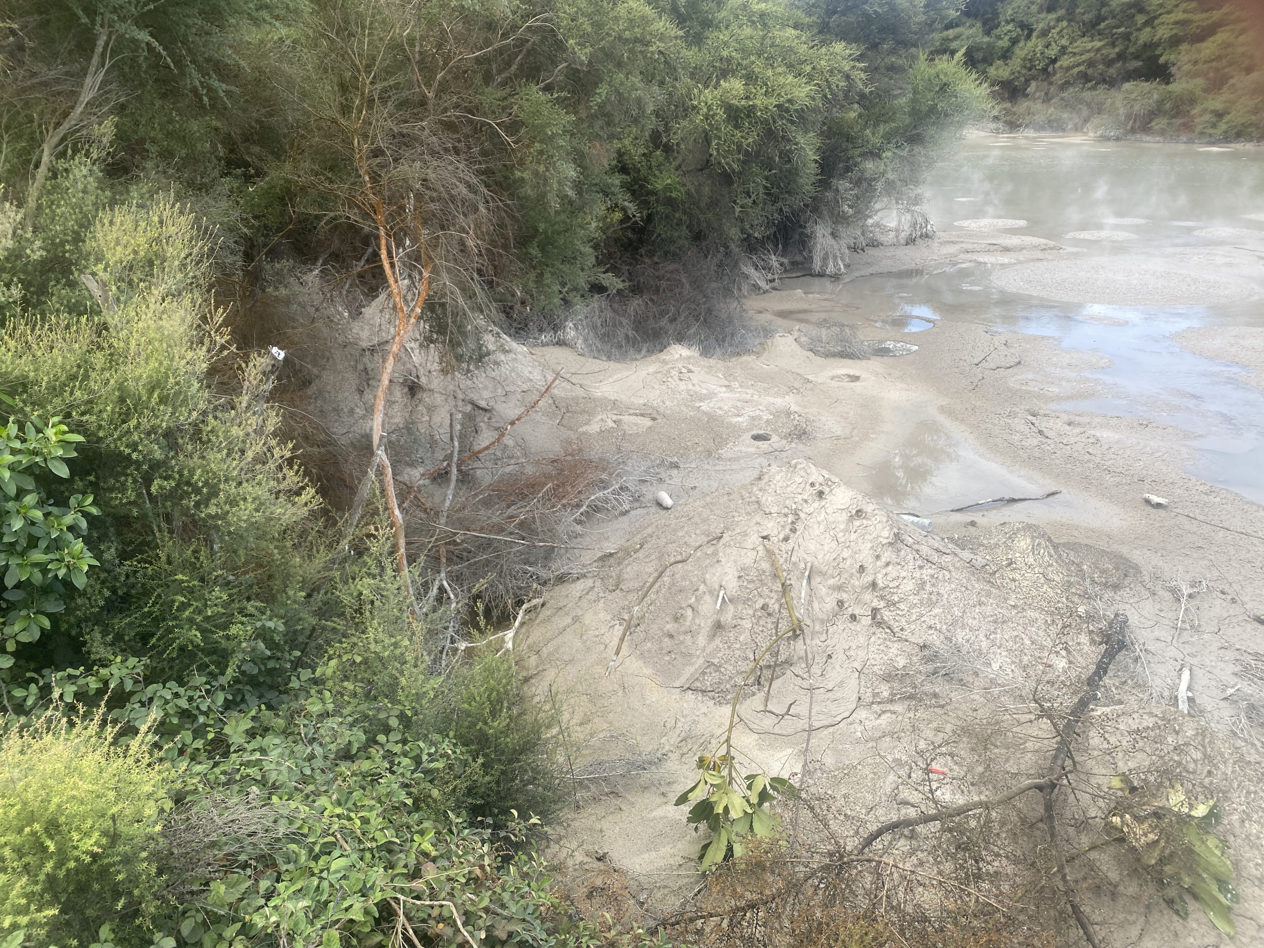
In the first bay, we saw a number of fumaroles and steam vents well above the lake level, but the only water was from a small vent about 1/2 meter above the lake that was pouring out water.
The next bay is where the Angel Wings is located. [I need to verify names here.] Most noticeable is a perpetual spouter erupting up to a couple of meters high inside an alcove, The alcove is surrounded by golden yellow thermophilic slime. Along the lake were a couple of small spouters flowing directly into the lake.
Also here is a set of unique formations. I've referred to this as "Angel Wings", but it appears that I was wrong. Our guide didn't known of a name, but said she called it "Oyster", and that's good enough for me to use as a name. It consists of a couple of sheets of sinter and does look like an oyster or clamshell. (There's also a "Clamshell Spring" located along the creek leading from the Frying Pan Flats.) Every couple of minutes it would erupt a meter or two high for a few seconds. The force of the eruptions varied, from weak to once threatening Graham when get got a little too close.
At the point separating the next bay were some features just at or below the surface of the lake. A couple of areas of strong upwelling and splashing on the lake surface, and to the left a small spouter on a slightly raised platform noisily sputtering away. Farther into the bay were more fumaroles just above the surface of the lake.
The next bay didn't have any thermal activity, so we didn't enter into it.
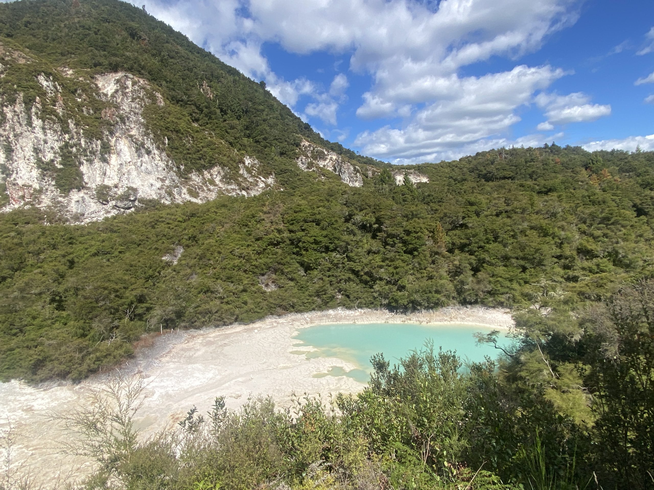
In the next bay was the primary attraction for the day— Pink Terrace/Otukapuarangi Geyser. One of the goals of this trip was to maximize the amount of time to observe this geyser, and were successful. After seeing few eruptions we went on to the point separating the bay from the next one. This was the last area of thermal activity.
After seeing at least seven eruptions of Pink Terrace/Otukapuarangi from the kayaks, our guide suggested we put ashore for lunch. This was a surprise, and we did not expect to be going ashore. As it turns out, it's common on this tour to have lunch on the beach of the bay we skipped, but I guess we were so enthusiastic about the geyser that she was willing to do us a favor. So sat down on some on some rocks at the edge of the lake, rocks that were warmer than just being out in the sun. (Graham said he had a small steaming crack a couple of feet from where he was sitting). We ate our sandwiches and pastries while the geyser erupted three times. The only disadvantage was that it was not possible to see the splashing at the start.
The intervals were about 8 to 9 minutes apart, and the durations varied a bit. At first they were about 100 seconds, while later they were over two minutes long. I would estimate the height of most of the eruptions to be about 10 meters, but some of my videos show some nice spikes going well above the general mass of the eruption. It was comparable to Kereru in height.
After the lunch we watch one more eruption from the kayaks, then headed back the way we came. We stopped in for a couple of eruptions of Oyster, then returned to the starting point.
Due to storms and wet weather of the past few years, a number of the trails have been re-routed or closed. A portion of the walkway following the creek is closed, a stretch with a number of small fumaroles and spouters. The Mt.Haszard side trail is closed, but when we walked that in 2019, we figured there was no need to do it again as there is a lot of climbing up and down and nothing but overgrown former viewpoints.
There was also a collapse of a cut in the trail near Iodine Spring requiring the rerouting of the trail up and around. This had the effect of making it much easier to see into Iodine, an actual improvement despite the steepness of the bypass.
On the morning bus ride out, the driver mentioned to the guide that Inferno Crater was overflowing. This was great news, as Inferno Crater has a cycle lasting around 38 days where it will come up to overflow for maybe a day. One of the reasons we weren't reluctant to leave the lake was because of this. As it turned out, the overflow probably stopped around the time we were having lunch. There was just slight overflow at the base of the runoff when we got there.
Another change from our previous visit is the change in the availability of toilet facilities. Previously the only indoor plumbing in the valley as at a building at the Warbrick Terrace. That building is now gone, so much so that I couldn't see where it had been. Instead there are more modern flush-type toilet as the three bus stops.
Posted on
Observations for 2026 March 06
Today it was time to visit the other half of the Wakarewarewa thermal area, the Maori village.
In order to get to see Parekohoru and Korotiotio up close, one must take the 1-1/2 hour long Village Guided Tour. Unlike the Te Puia tour, at least you are in and around thermal areas for much of that time, and it's a much better introduction to the Maori culture than just wood carving. Also you get to sample a portion of an ear of corn that's been boiled in Parekohuro.
At the conclusion of the tour you end up at on overlook onto the Geyser Flat and Bluey Pool over in Te Puia. We also bought the Geothermal Walk, so could stay all day and leave and return to the overlook. Pohotu ended within moments of our arrival.
Graham Meech was over at the bridge across Puarenga Stream on the Te Puia side, and had witnessed the last Kereru minor eruption just after his arrival, well over an hour earlier. So we knew we were about to wait for however long it took to see the expected major eruption of Kereru.
Over the next hour we saw another eruption of Pohutu start, as well as activity from Waikorohihi and Mahanga. Because of our locations, we had the better view of the latter two geysers. They can be difficult to tell apart from the bridge overlook because of their close proximity and the viewing angle and the wind direction.
Kereru's vent isn't directly visible, hidden just out of sight by the mass of sinter forming the Geyser Flat platform. But it is possible to get an idea of the intensity of the activity.
Just over an hour later we notice an increase in the steaminess coming from Kereru. At the same time, a non-English speaking tour (probably Japanese) appeared on the platform. I don't know why, but these tours seem to have to make lots of noise as they spend their time taking selfies and staring at the little view screens instead of the scene in front of them. Of course, that's when Kereru erupted, especially since the wind direction shifted so that it was headed directly toward us. (And it didn't help that my camera glitched so that I missed the lead-up to the start of the eruption.)
After than, we figured we were free for a while, and it was time to do the Geothermal Walk. We took our time, and about 3/4 hour later we were only part-way along when we got a message from Graham telling us that the minor activity from Kereru had stopped and all was quiet there. So we returned to the platform.
We didn't need to hurry back, and saw a couple of Pohutu eruptions during our wait. The second eruption seemed to take longer to start, with Te Tohu erupting for nearly twenty minutes prior, when otherwise the interval was closer to twelve minutes. This eruption of Pohutu was also different in that there wasn't much of the preliminary splashing, but instead it started climbing almost immediately, while Te Tohu got bigger and noisier.
It was the strongest and tallest eruption of Pohutu we've seen this trip. I would estimate the height in the 25-30 meter range, definitely taller than a Daisy eruption. It could easily be heard from the overlook, and it maintained the height for several minutes before subsiding.
Right after this eruption, which had a typical duration of about 24 minutes, had ended, the steam from Kereru picked up. This time the platform was empty except for a quieter couple that I think were Italians. The wind direction cooperated, and I was able to record the full eruption showing the height.
Following that, with a bit over an hour left before closing time, we again went on the Geothermal Walk portion of our visit. This is an area of trails and boardwalks outside the limits of the village proper that winds through an area with large pools both clear and boiling and gray and sludgy. There are some perpetual spouters, but no true geysers in the area.
(Over at Te Puia, Graham had to stay because well over an hour before closing over there, once again he saw the Kereru minor series end. Unfortunately, he had to leave before the major eruption.)
One of the noticeable things on the first visit was the color of the Bluey Pool and its low water level. This was even more obvious from the overlook. This feature is not a hot spring, but more of a large catch basin used for swimming. Several of the guides on the tours mentioned that the prevailing winds have been from the wrong direction, preventing the water from the Pohutu eruptions from filling the pool. I notice also that there were signs up prohibiting the use of the pool, including a Rāhui, which is a formal Maori closure used for resource protection (and after accidental deaths).
Posted on
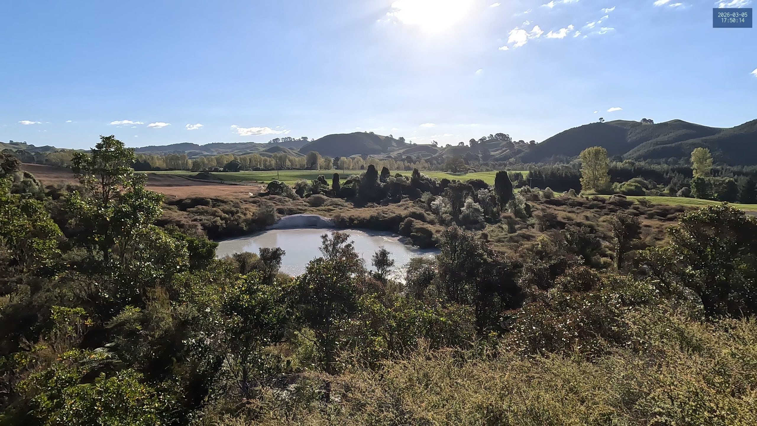
Observations for 2026 March 05
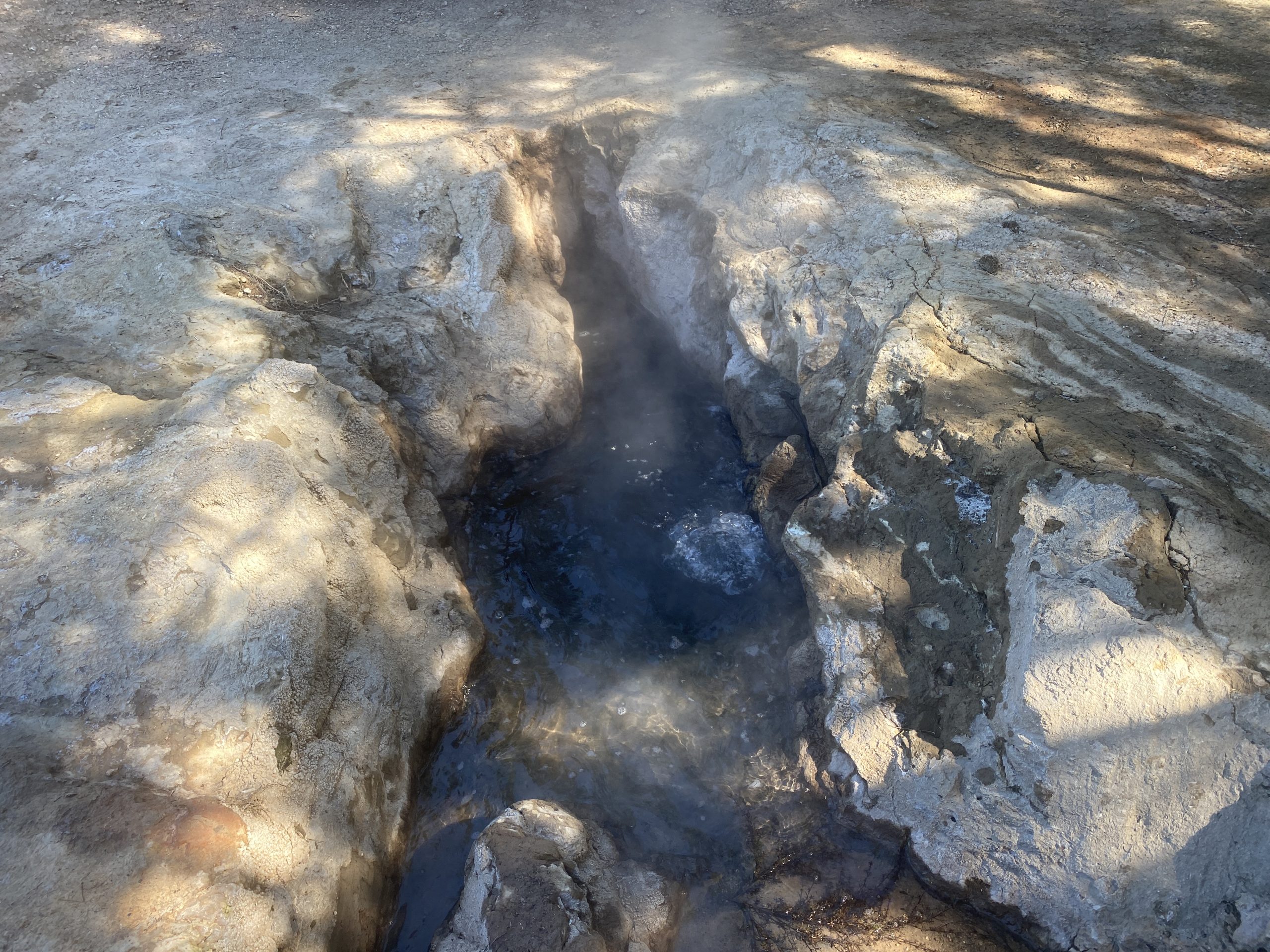
[Update: Added photo of Mud Geyser eruption for reference.]
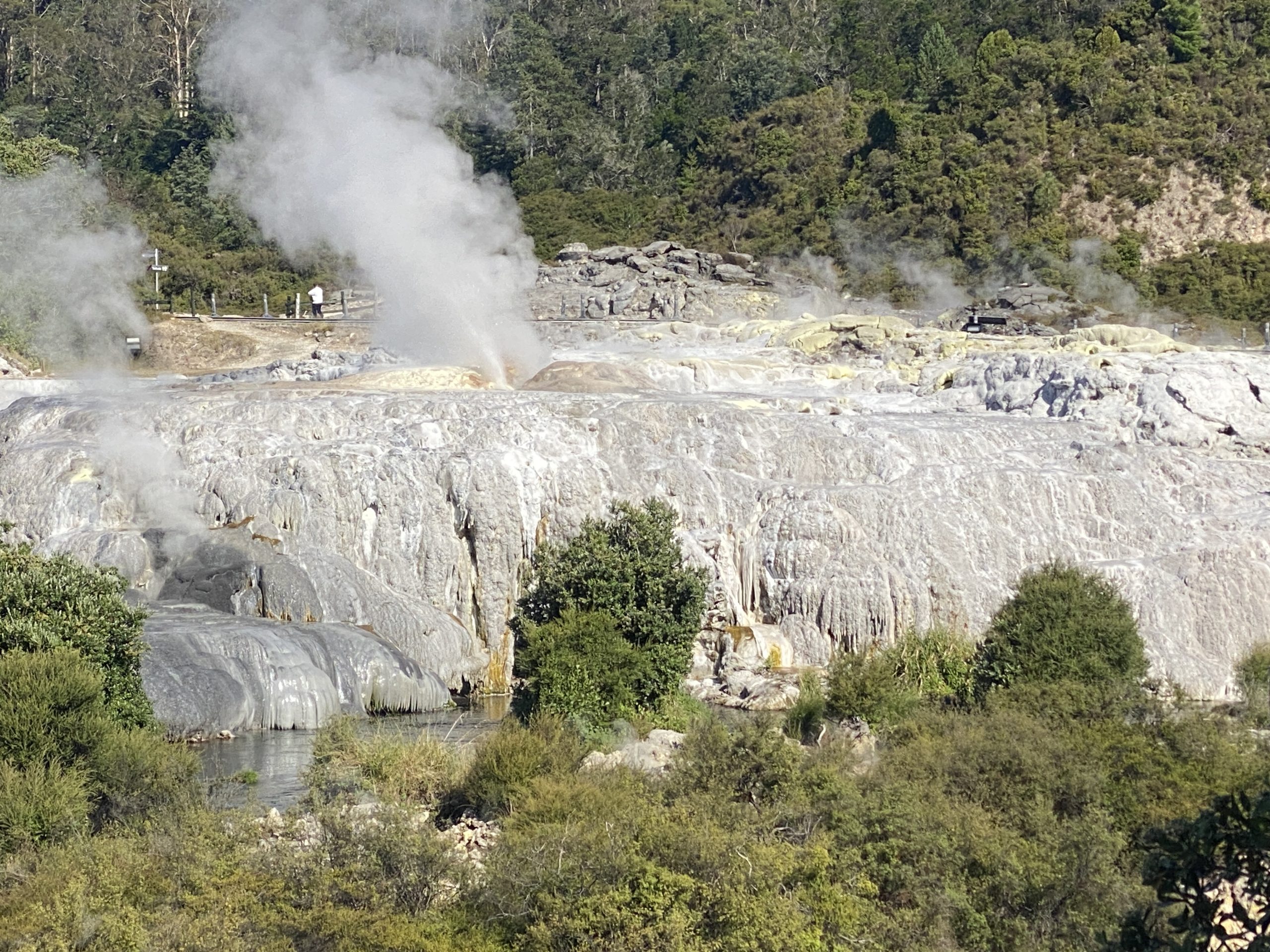
Today it was a visit to Orakeikorako. We didn't get the earliest start, and due to fogs along the way (especially thermal fogs near Waiotapu and Waikite) the drive was a bit slower than expected. So we arrived a half hour after the opening.
Immediately after we got off the ferry boat we were greeted by an eruption of Sapphire. The intervals varied, with some as short as half an hour, but we managed to catch most of the eruptions during the day. We waited for the next eruption from the overlook, which has a nice view of the entire terrace, and verified that Cascade was huffing and rumbling, but not discharging any water.
After the next Sapphire eruption, it was time to visit the rest of the area. The boardwalk near Manganese and the new collapse features has been rerouted yet again. The new features (what I called #120nw) are mostly filling in with overflow from Manganese and other features at the base of the Golden Fleece Fault. Manganese was still boiling with variable intensity. So it was time to go up to the Artist's Palette.
It was still early and a bit foggy, making it hard to see what features were making all the noise. It was obvious that on the west half of the Palette almost all the features were devoid of water. That included the large Palette Pool, where plantlife could be seen growing on the floor within the crater. Only a couple of vents (like #743) had water in them. Square Pool was steaming, and occasionally the steam would thicken as if there was an eruption down deep in the vent.
On the other size of the Palette there were a number of pools (like #797, #735) that were full and boiling heavily. At the top of the Pyramid of Geysers there was a small sputterer making a lot of noise (it was what could be heard in the fog earlier). At the base of the Pyramid, #812 was full, but not erupting the way it was in earlier visits.
After a half hour or so, I returned to Sapphire. During the wait, I saw what could be called a minor eruption, as it only erupted to about a meter high and lasted about half a minute. Twenty minutes later there was a full eruption like those seen before.
Later in the morning, right after an eruption of Sapphire, I heard noise coming from the plants to the right of Cascade. It was an eruption of Bush Geyser, which consists of splashing down in a vent hidden in, the bush. The eruption lasted just over five minutes.
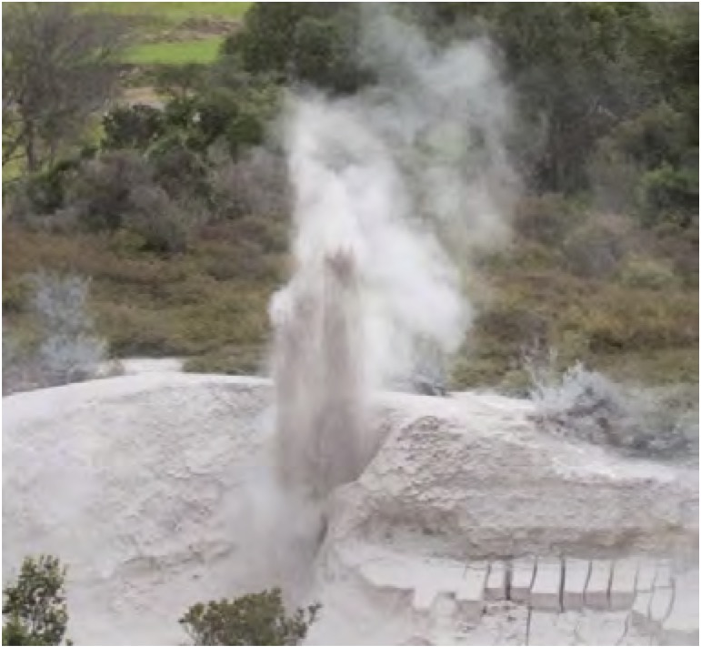
It was around then that Suzanne saw a new geyser erupt. It was a small vent located on the fault scarp wall just behind The Cauldron at the base of the Golden Fleece Terrace. A check of the map showed this to be feature #123 (with Cauldron #124), and at one time it, or a feature in that vicinity, was called "Prince of Wales Feathers Geyser".
While watching and waiting to see what might happen next, I noticed that Manganese Pool was no longer in overflow. This condition lasted for several minutes, at the end of which Manganese became calm and quiet. When it reactivated, the pool rose and began to overflow again. Later I was able to determine that for the rest of the day, Manganese was having a 15 minute cycle with it not overflowing for about 5 to 7 minutes each cycle.
Back up on the Artist's Palette, I managed to miss eruptions of #760 and #772. #760 continued to have activity down in its vent every 2 to 3 minutes, but I never seemed to be able to record any of this as the wind always seemed to cause the steam to head right toward me, and there were few available viewing options.
Two hours after the first eruption was observed, we all got to see a second eruption. The splashing from the small vent increased in size and vigor and a few moments before the eruption a second vent seemed to join in. The eruption itself was angled to a height we estimated as about 1-1/2 to two meters, and only lasted about 45 seconds.
Based on the interval we'd just seen, we figured there was a chance to see another eruption before the last ferry trip at 17:00. With some time to kill, I went back for another Cascade eruption, and caught the end of a Bush Geyser eruption, too.
As it turned out, this time the geyser #123 erupted with only an hour interval, catching us unaware, but luckily Suzanne was passing by moments before the start. I had decided to walk the mudpot loop, and got a text message about the eruption while I was at the farthest point on that walk. I didn't need to cut the walk short, but got out of there quickly.
We did more calculations, and determined there was a possibility of another eruption just before closing. As it turned out, we reached the hard deadline for leaving with the geyser splashing but nowhere near looking like it was going to erupt.
Finally, on the drive back, we drove the Te Kopia Road so that we could stop in at the Te Kopia Mudpots Reserve. The trail was overgrown the last visit three years ago, so I was pleasantly surprised to find it in not much worse condition. Seems that there are enough visitors there to keep the path beaten down and not completely overgrown.
The mudpots looked the same, and this visit I knew were to look for the Mud Geyser. It showed no signs that there had been any recent activity there.
Update: For reference, I'm adding the photo of the Mud Geyser in eruption that was taken in 2009 and can be found at Sinter-forming springs and geysers of the Waikato region [Ashley Cody, Ron Keam, Jesse Lebe, Bridget Lynne, Katherine Luketina
July 2021].
Posted on
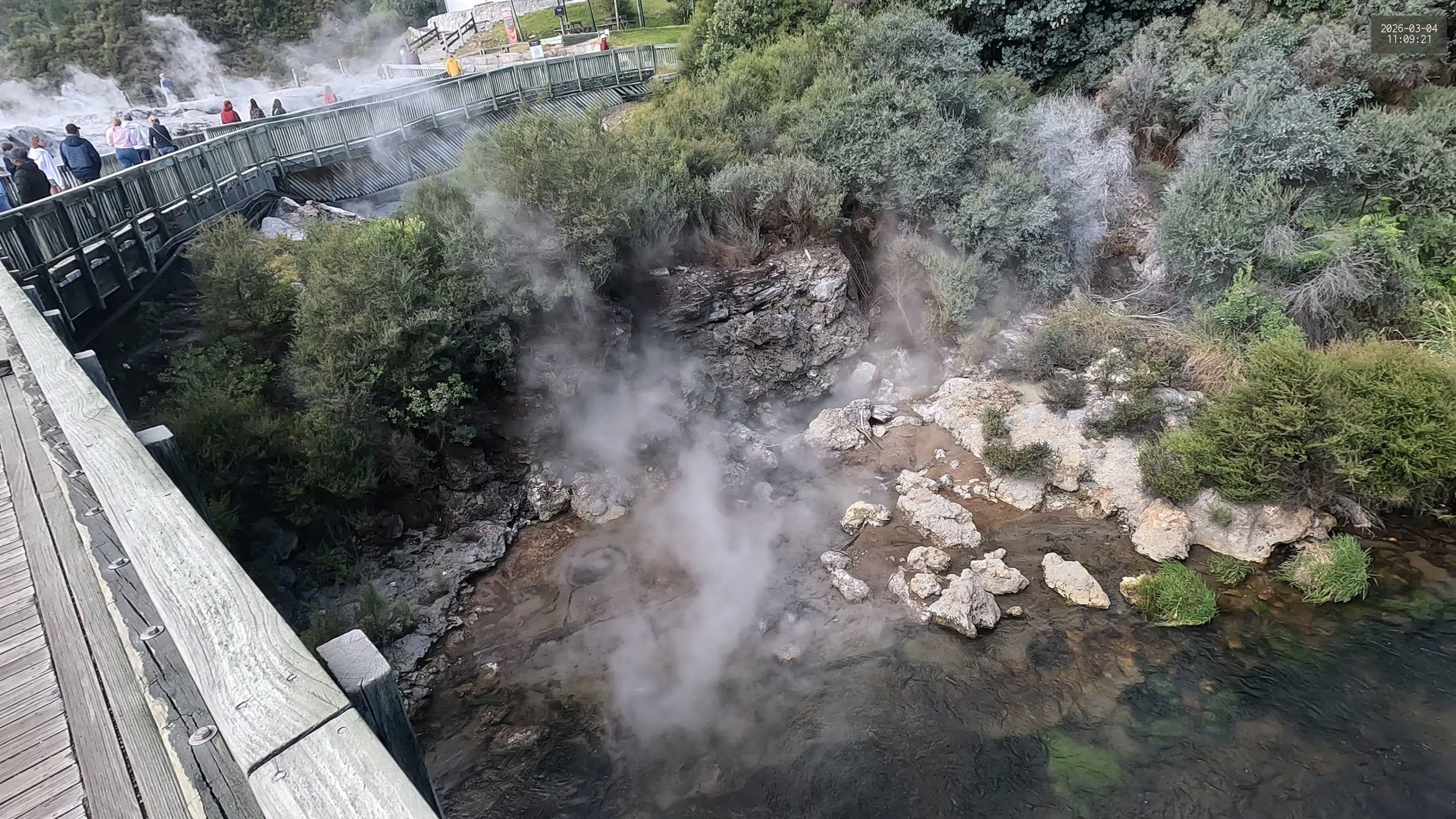
Observations for 2026 March 04
We managed to skip the tour and head straight out into the geyser area at Te Puia (Whakarewarewa). It was a fairly cold morning (this whole trip the weather has seemed more like late Spring instead of Summer). Arrived with Te Tohu in eruption, so we knew that we would soon see our first eruption of Pohutu.
We also saw our first minor eruption by Kereru. We quickly established that they were coming every two to three minutes, and were stronger and taller than what we had seen in earlier trips. Despite the size, there was never any evidence that it was going to flood the platform the way it does with the start of a major eruption.
Beyond Pohutu we saw another geyser erupt. At first we thought it was Mahanga, but later determined that it was Waikorohihi, located right next to Mahanga. Mahanga was mostly quiet, but I did see a couple of eruptions up close, and once I knew the relationship between the locations of the two, I was able to identify another eruption from down on the bridge where we observed Kereru.
The lead time from Te Tohu to Pohutu was fairly consistent at a bit over ten minutes. The start of Pohutu can be a bit hard to determine, as it does a lot of slopping around after Te Tohu has been active for a few minutes. At some point the slopping becomes continuous, and then a few minutes later, there was a definite pickup in the strength of the activity. Te Tohu also becomes stronger at that point, so both geysers are starting to make roaring sounds. The heights varied, but I'm pretty sure there were a couple of Pohutu eruptions where the water column had jet spikes around 20 meters (taller than Lion).
The minor activity from Kereru lasted about 3-1/2 hours, with the last one we observed coming at 12:55. For about an hour, the only activity were some barely visible single splashes. Over the next few hours, that activity continued, with a series of strong splashing every 45 to 60 minutes. These were the time when it looked like Kereru was going to have a major eruption.
But it took another 3-1/2 hours before that major eruption finally occurred. Not only did it make us wait a long time, the major came after I exhausted the final battery on my camera. But that didn't matter because at the same time I had completely filled the memory card.
Several of those periods of surging came at times when tours would come through, and I expected to have that noise (along with the shuttle trolley) in the background when the eruption finally occurred. Instead, the major came at one of the few times when the wind had not only died down, but reversed direction, so instead of a clear view, we got to seem a mass of steam for much of the eruption.
Originally we had intended to see an eruption of Kereru, then spend some time going to other parts of Te Puia. But the major eruption came so late that we had no time to do much else. The Kiwi House was already closed up for the day, so we did go over to the mud pots, where it turns out that there is a pretty good view of Kereru. For our final time in the area we watched a final eruption of Pohutu (and Waikorohihi) and timed Kereru minors. Should we visit again, that spot might be the place to watch the minors until the pause starts.
Waikorohihi was interesting. I did see and record some activity from up close, but most of the time we saw it as background to the Pohutu eruptions we saw from the bridge. The durations had a wide range. Some of the earlier ones, when we thought it was Mahanga, lasted only a minute or two. Then we saw some that lasted at least seven minutes. The final eruption we saw from near the mudpots was still in eruption as we left, with a duration well over half an hour.
The Pohutu durations were fairly consistent, from 22 to 33 minutes until the final eruption we saw, which lasted about 37m15s. The last six or seven minutes consisted of intermittent tall splashing and I thought the eruption had finished several times only for it to restart. The intervals ranged from just under an hour to almost 1-1/4 hours. I did manage to record several full (or nearly full) eruptions of Pohutu from various vantage points around it.
Posted on
Observations for 2026 March 03
Today was the day to visit Waiotapu. As usual, we arrived as early as possible. The objective was to quickly assess the situation at the Waiotapu Geyser (#70) and then based on those observations, either wait or go watch the Lady Knox spectacle.
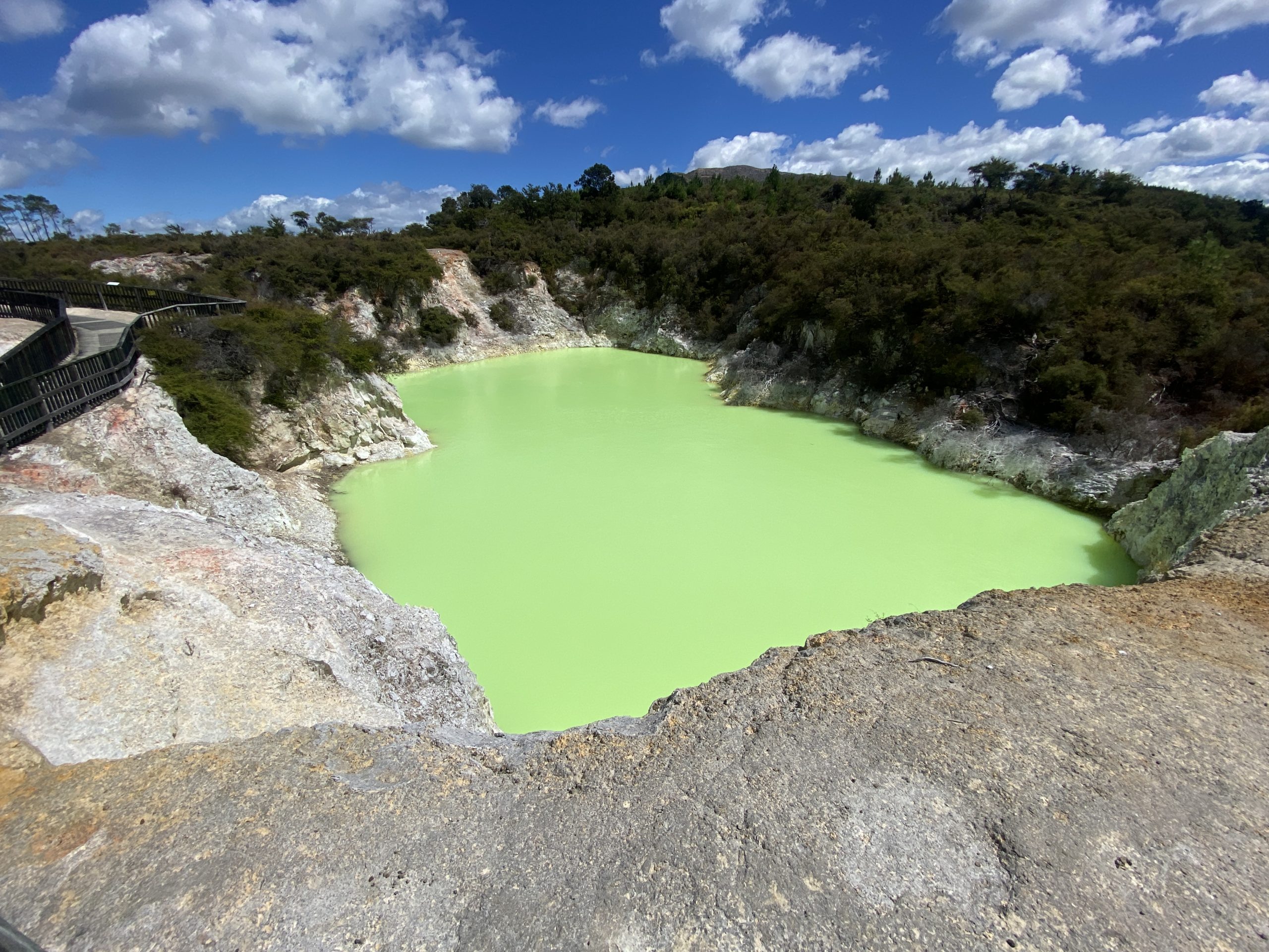
The first thing noticed was that the water level in Rotokarikitea/Devil's Cave appeared to be down at least a meter, based on the yellowish bathtub ring above the current water line. When the sun came out, the water was the brilliant greenish, almost phosphorescent color we'd seen during previous visits.
When we got to the geyser, it was pretty obvious that it had not erupted recently. The formations surrounding the vent were completely dry, despite it being a cold, humid morning. The vent was mostly in shadow, but there was no indication of any water visible in the vent. Twenty minutes later, everything appeared to be the same, so we decided to join the crowd headed to see the induced eruption.
There was a long line of cars headed that way, and we learned that it was possible to pay for admission at the gate there. I don't remember that being the case when we went there in 2019. In any case, that would not have altered our plans. We found some open seating down at the front, in what at the time appeared to be a location that wasn't down-wind.
The stadium was packed, more so than our previous visit, which was still pretty full. Previously, there had been a small talk about the history, the soap was introduced and once the geyser started to overfoam the guide let it be the center of attention. The eruption we saw lasted well over a half hour, and was still erupting as we left.
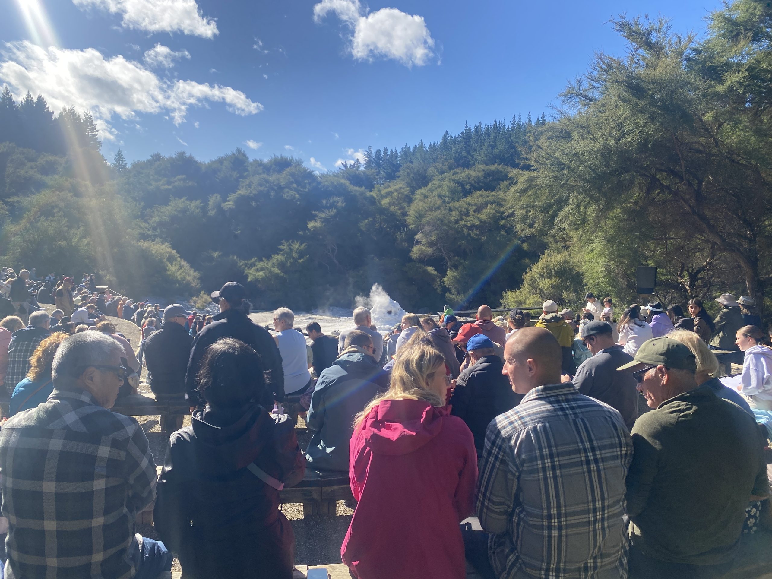
This time there was entertainment. The guide sang a Maori song as the overfoaming started, so when the eruption started, we couldn't hear it, despite some roaring as it reached maximum height. Then the eruption died down completely, ending at just over a minute in duration. There was no attempt at any afterplay splashing that I could see. On the whole, a disappointing experience. Years ago we managed to induce better eruptions from #42w.
We returned to the main thermal area a pretty much the end of the line of vehicles, but we did get a decent parking spot. Returned to the geyser overlook, and learned that we hadn't missed anything. The area around the vent was still dry, and even with the better sun angle, there didn't appear to be any water visible in the vent.
Also while we were gone, it got windy at the overlook location, which made observing distinctly uncomfortable. Suzanne left me to do that. Just a short distance away there were some picnic table in the sunlight where the breeze was tolerable, so I waited there for ten to fifteen minutes, then returned to the overlook to be disappointed by no change in the geyser.
Finally gave up a couple of hours later. Figured that there wasn't going to be enough time for the geyser to show signs of life before closing time. Did do some videos of Champagne Pool and the features around it. There was one vent that was splashing slightly, which was the sum total of the natural eruption activity I saw today.
Since it was just down the road, we stopped in at the mudpots again. The activity there was much more entertaining. There were a couple of areas that every so often would explode with mud thrown in all directions, reaching heights of about four meters.
Finally, on the drive back, we stopped at the trail to the Crater Lake overlook. This is a warm thermal pool at the base of Rainbow Mountain. It used to be two craters, but the one to the north was more of a mud flat. The color of the water is that milky, opalescent blue that would otherwise indicate that it was much hotter.
At this point I'm thinking that should there be a future visit to New Zealand, there will be no need to visit Waiotapu.
Posted on
Observations for 2026 March 02
On our way north from Tongariro for our week in Rotorua, we stopped in at Tokaanu again, just to confirm that nothing much had changed. It was a cold and windy morning (at Tongariro the weather forecast included snow showers). Houni and Matawei were identical. Taumatapuhipuhi seemed to be a bit murkier (it probably rained overnight), and a stick we'd noticed was no longer in the vent, but the activity seemed unchanged.
The previous visit I had noticed sounds coming from the area to the south/left as I had entered the thermal area, but had not been able to see the source of the noise. Maybe it was because it was early and not afternoon, but this time I saw the source. It was a small sputterer, with a height of perhaps 5-15 cm, situated in a alcove at the southern edge of Huri Kariori (#11), a large pool next to the stream and entrance walkway.
After a while, it seemed to die down, and was harder to spot even knowing it was there. When we left about 15 minutes later, it was active, but still seemed subdued compared to what we saw on arrival. The few references don't mention any activity there, despite the pool having a name.
Later in the afternoon, we stopped at the Waiotapu Mud Pots. It turned out there was major construction on State Highway 5 and we had to wait for at least 1/2 hour to make the final kilometer to the junction road. Fortunately there are alternative routes when we visit Orakeikorako in a few days.
The mudpots looked much like they have in previous visits. They are a large, gray soupy pool with lots of thicker islands scattered mostly along the shoreline. Some of these islands were explosively active, with mud being splattered a couple of meters high. Also, near the entrance to the walkway were a couple of older, inactive mud cones about 1-1/2 meters high.
Posted on
Observations for 2026 February 28
First up was the CO2 cold water Mokena Geyser at Te Aroha. This was the first eruptive feature of our 2019 visit, and it was unimpressive that visit. Mostly it just spit and sputtered and made a lot of noise. But this time we got to see some real eruptions.
When we arrived there was a slight wisp of vapor coming from the vent opening. Otherwise it looked like there was little hope of observing any sort of activity. After about twenty minutes, the sound of water moving could be heard below the southernmost hatch leading to the spa intake. Within a few minutes the sound got louder and then the eruption started with no warning.
This was a thin jet of fizzy water that quickly reached an estimated six to seven meters above the vent. The jetting stayed strong for about a minute, then started to subside. By about two minutes, the jetting paused, then restarted. This activity continued for another 4-1/2 minutes, with the pauses getting longer and the heights of the jets decreasing. By the end, the height was maybe ten centimeters lasting a couple of seconds. Then all was quiet again.
There had been reports of intervals around forty minutes, and based on how long it took for us to see the eruption, we decided to stick around and catch the next eruption, assuming the interval would be in the forty minute range.
At around forty minutes, I could hear water moving again below that hatch, and within five minutes, we got a secon eruption with an interval around 45 minutes. This time the eruption didn't seem as strong or as high. I estimated the height to be four meters at most, and the first pause occurred around 1-1/2 minutes into the eruption. But the pauses and weak jetting continued for almost as long as the first eruption, finally ending at six minutes.
I reviewed my video of Mokena from 2019 and noticed a few differences. First, the vent has changed. The current one has a wider opening and is flat, while the earlier was more nozzled. Also, a section of the retaining wall at the gate was removed. So it appears that the "geyser" got a upgrade over the past seven years.
A few hours later we finally got to a real thermal area— the Tokaanu Thermal Reserve. When we last visited in 2023, we got to see multiple eruptions of Taumatapuhipuhi and an eruption of Hoani. This time we did not see any geyser activity.
Taumatapuhipuhi (#13) was in a near constant start of small ebullition over the vent, maybe 8cm high. Every so often there would be a rumble and belch from the southern end of the vent. We saw no evidence of any vent there in the previous visits. The area around the geyser show no signs of activity, but instead there was significant debris which would have been washed if it had been active. There was also some plant fragments floating on the northern end, near outlet to the trench leading to the bathtubs. The small slit I noticed last visit was also periodically spitting out some water.
Houni (#31B) was hot, but the water level was down about a meter. It was acting as a drain for Matawei (#31D), the feature across the trail. The broad flat expanse around Hoani's deep vent has some grass growing in it, so there has not been a great rise like we saw back in 2023.
Matawai appeared to be boiling, and pouring off water which drained through a pipe leading into Hoani. Behind Hoani the feature Kirihoro (#31A) was drained, and it too had plant life growing among its formations.
It seemed like there were a number of features along the walkway that were low, because they were surrounded by dead plant life or other indications of earlier high water.
Across the street there was a new fence blocking the view of some of the features at the western end of that area, where the Tuwhare Geyser (#23A) was located. The curb on the street wasn't steaming, but it was also a relatively warm afternoon, not a damp early morning as in our earlier visits.
We may stop in briefly in a few days to check on things on our way north to Rotorua, but it was disappointing to not see what has been the only free natural geyser activity in New Zealand.
Posted on
Hot Water Beach, New Zealand, 2026 Feb 26
It's our third trip to New Zealand, and after spending over a month on the South Island, we finally got around to visiting Hot Water Beach on the Coromandel peninsula of the North Island. It was as uninspiring as I had expected. Didn't miss much by not stopping here on earlier trips. The first trip (2019) we ran out of time, and wanted to see real thermal activity. Second trip (2023) we didn't visit Coromandel at all because of all the typhoon related road and trail closures.
Instead of going to the paid parking tourist trap area, we used the free car-park and walked along the beach toward the mass of people to the south.
We arrived about 10:00, an hour after low tide, and it was amusing to see people industriously digging away in the sand trying to construct their soak hole only for the rising seawaters to wash it all away with a couple of incoming waves.
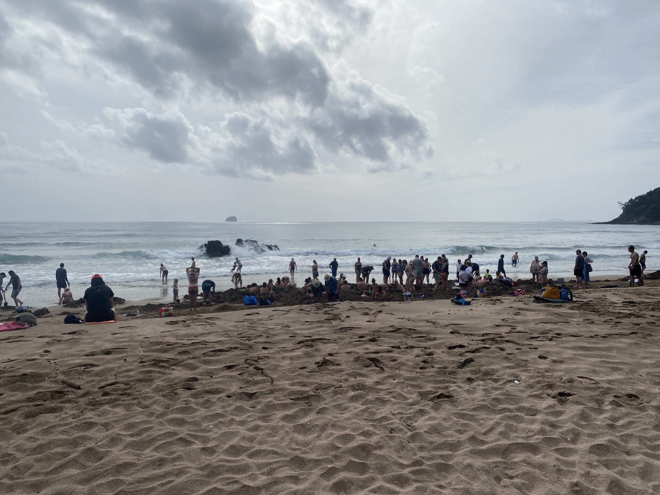
Some of the diggings did hit hot water, as we could see steam rising from some of the pits. Didn't stick around as the area seemed to combine the worst features of hot bathing springs and beaches (boring places for boring people).
Besides, in a few days will be able to report on real geyser activity (or the lack thereof).
Posted on
Depression Geyser, 2025
Posted on
Video update
The following video postings were updated to include footage taken during August and September.
Posted on
Gizmo Geyser, 2025
Posted on
Slot Geyser, 2025
Posted on