On our way north from Tongariro for our week in Rotorua, we stopped in at Tokaanu again, just to confirm that nothing much had changed. It was a cold and windy morning (at Tongariro the weather forecast included snow showers). Houni and Matawei were identical. Taumatapuhipuhi seemed to be a bit murkier (it probably rained overnight), and a stick we'd noticed was no longer in the vent, but the activity seemed unchanged.
The previous visit I had noticed sounds coming from the area to the south/left as I had entered the thermal area, but had not been able to see the source of the noise. Maybe it was because it was early and not afternoon, but this time I saw the source. It was a small sputterer, with a height of perhaps 5-15 cm, situated in a alcove at the southern edge of Huri Kariori (#11), a large pool next to the stream and entrance walkway.
After a while, it seemed to die down, and was harder to spot even knowing it was there. When we left about 15 minutes later, it was active, but still seemed subdued compared to what we saw on arrival. The few references don't mention any activity there, despite the pool having a name.
Sputterer at Tokaanu Huri Kariori (#11). 2026 March 02. Video by H.Koenig.
Later in the afternoon, we stopped at the Waiotapu Mud Pots. It turned out there was major construction on State Highway 5 and we had to wait for at least 1/2 hour to make the final kilometer to the junction road. Fortunately there are alternative routes when we visit Orakeikorako in a few days.
The mudpots looked much like they have in previous visits. They are a large, gray soupy pool with lots of thicker islands scattered mostly along the shoreline. Some of these islands were explosively active, with mud being splattered a couple of meters high. Also, near the entrance to the walkway were a couple of older, inactive mud cones about 1-1/2 meters high.
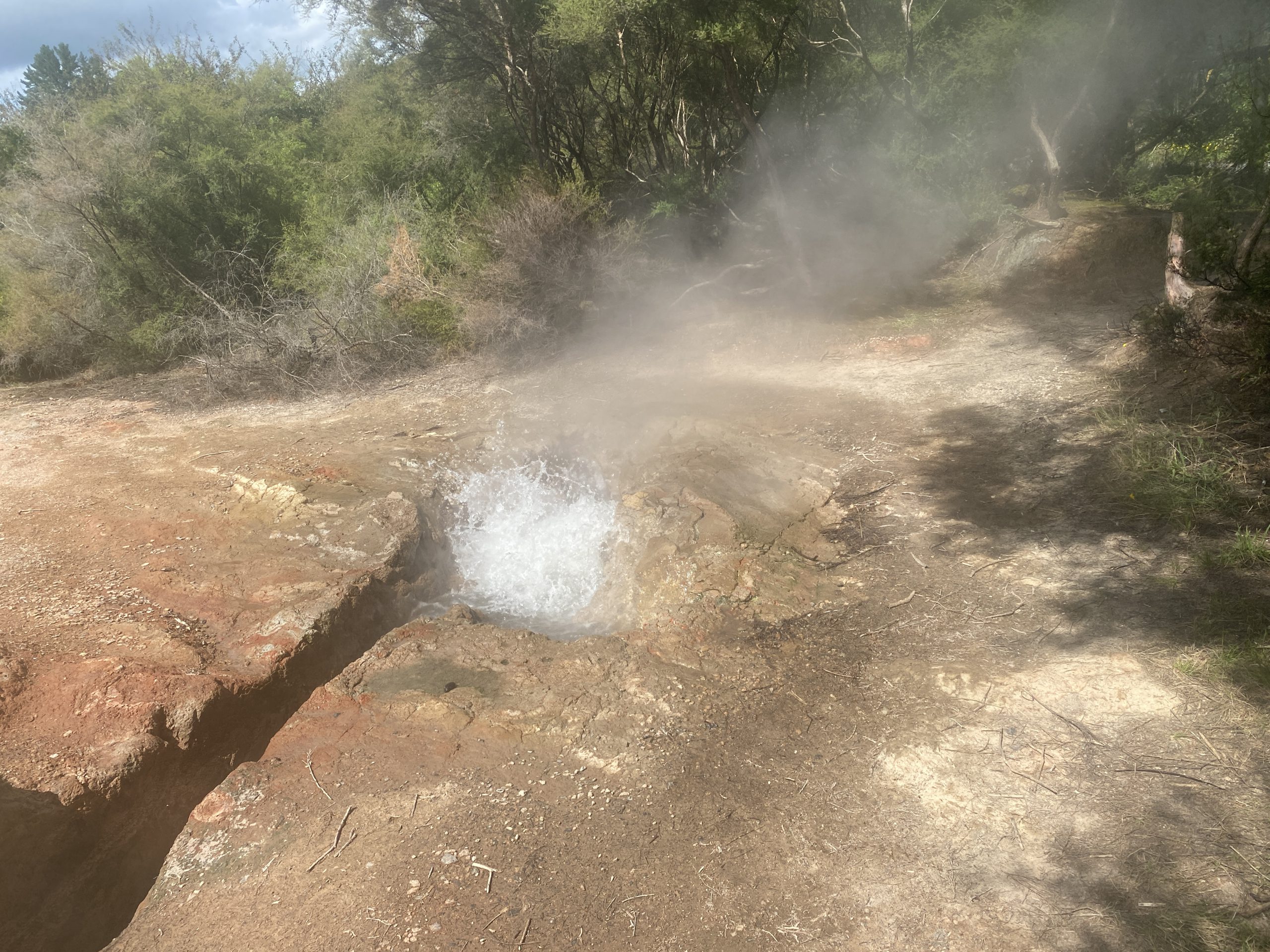
First up was the CO2 cold water Mokena Geyser at Te Aroha. This was the first eruptive feature of our 2019 visit, and it was unimpressive that visit. Mostly it just spit and sputtered and made a lot of noise. But this time we got to see some real eruptions.
When we arrived there was a slight wisp of vapor coming from the vent opening. Otherwise it looked like there was little hope of observing any sort of activity. After about twenty minutes, the sound of water moving could be heard below the southernmost hatch leading to the spa intake. Within a few minutes the sound got louder and then the eruption started with no warning.
This was a thin jet of fizzy water that quickly reached an estimated six to seven meters above the vent. The jetting stayed strong for about a minute, then started to subside. By about two minutes, the jetting paused, then restarted. This activity continued for another 4-1/2 minutes, with the pauses getting longer and the heights of the jets decreasing. By the end, the height was maybe ten centimeters lasting a couple of seconds. Then all was quiet again.
There had been reports of intervals around forty minutes, and based on how long it took for us to see the eruption, we decided to stick around and catch the next eruption, assuming the interval would be in the forty minute range.
At around forty minutes, I could hear water moving again below that hatch, and within five minutes, we got a secon eruption with an interval around 45 minutes. This time the eruption didn't seem as strong or as high. I estimated the height to be four meters at most, and the first pause occurred around 1-1/2 minutes into the eruption. But the pauses and weak jetting continued for almost as long as the first eruption, finally ending at six minutes.
Mokena Geyser @ Te Aroha. 2026 Feb 28. Video by H.Koenig
I reviewed my video of Mokena from 2019 and noticed a few differences. First, the vent has changed. The current one has a wider opening and is flat, while the earlier was more nozzled. Also, a section of the retaining wall at the gate was removed. So it appears that the "geyser" got a upgrade over the past seven years.
A few hours later we finally got to a real thermal area— the Tokaanu Thermal Reserve. When we last visited in 2023, we got to see multiple eruptions of Taumatapuhipuhi and an eruption of Hoani. This time we did not see any geyser activity.
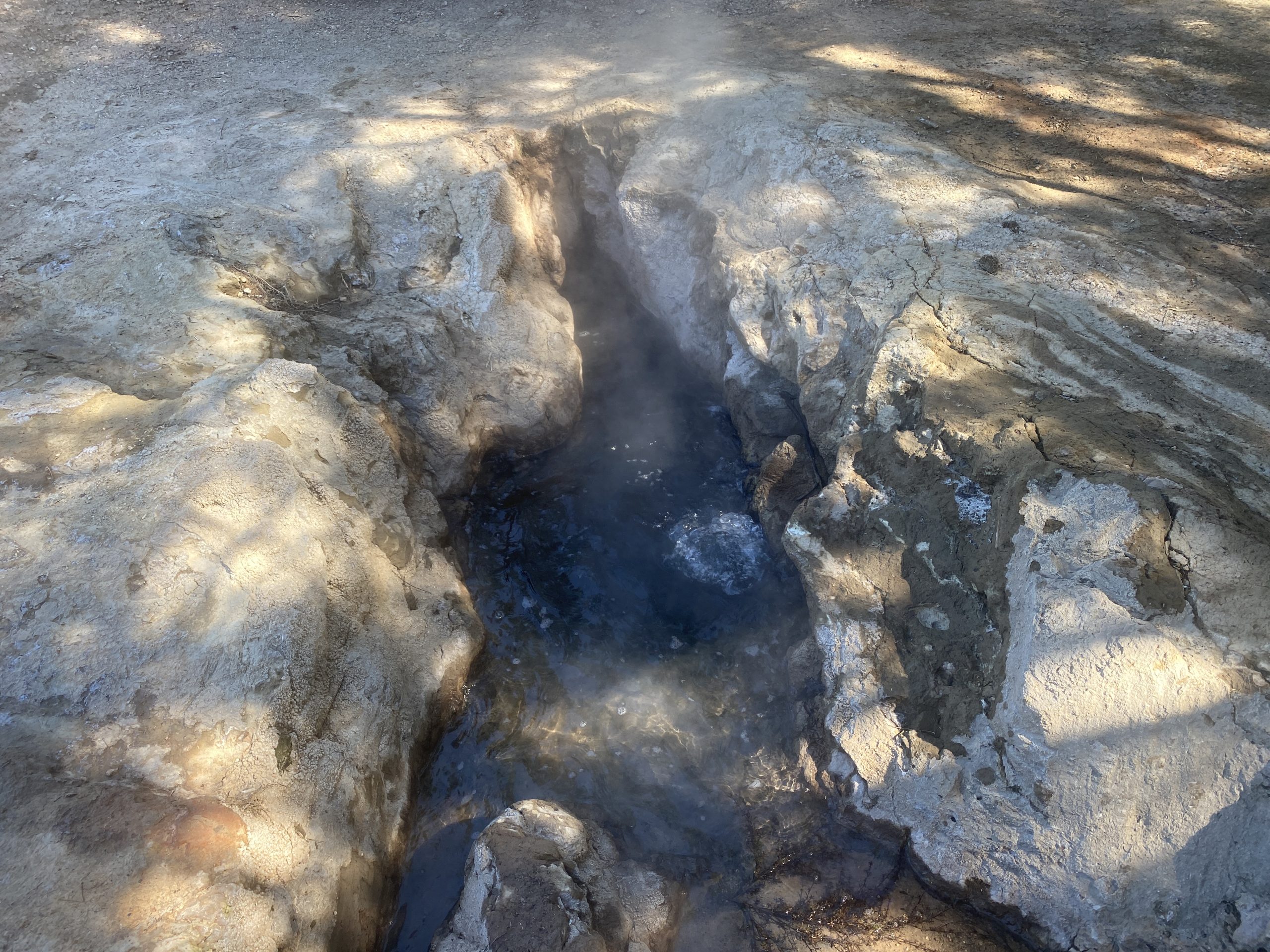
Taumatapuhipuhi (#13) was in a near constant start of small ebullition over the vent, maybe 8cm high. Every so often there would be a rumble and belch from the southern end of the vent. We saw no evidence of any vent there in the previous visits. The area around the geyser show no signs of activity, but instead there was significant debris which would have been washed if it had been active. There was also some plant fragments floating on the northern end, near outlet to the trench leading to the bathtubs. The small slit I noticed last visit was also periodically spitting out some water.
Taumatapuhipuhi Geyser, Tokaanu. 2026 Feb 28.
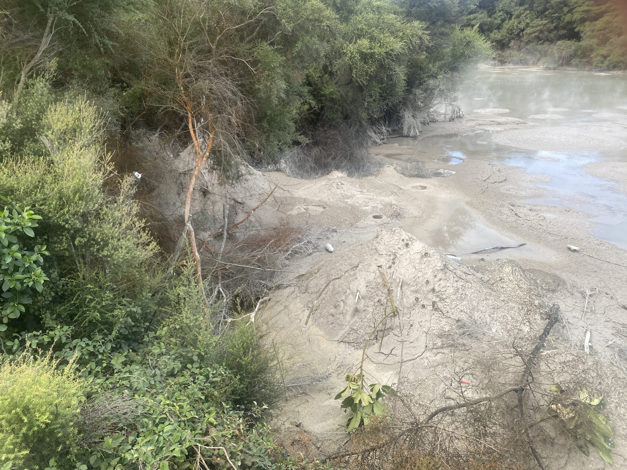
Houni (#31B) was hot, but the water level was down about a meter. It was acting as a drain for Matawei (#31D), the feature across the trail. The broad flat expanse around Hoani's deep vent has some grass growing in it, so there has not been a great rise like we saw back in 2023.
Matawai appeared to be boiling, and pouring off water which drained through a pipe leading into Hoani. Behind Hoani the feature Kirihoro (#31A) was drained, and it too had plant life growing among its formations.
Hoani and Matawei, Tokaanu. 2026 February 28. Video by H.Koenig
It seemed like there were a number of features along the walkway that were low, because they were surrounded by dead plant life or other indications of earlier high water.
Across the street there was a new fence blocking the view of some of the features at the western end of that area, where the Tuwhare Geyser (#23A) was located. The curb on the street wasn't steaming, but it was also a relatively warm afternoon, not a damp early morning as in our earlier visits.
We may stop in briefly in a few days to check on things on our way north to Rotorua, but it was disappointing to not see what has been the only free natural geyser activity in New Zealand.
It was cool and damp when we arrived at Tokaanu. Before going into the Reserve proper, we investigated the features across the road. There we could hear, hidden in the bush, the sounds of splashing. Along the street, there were areas of hot ground, including a spot between the curbstones where a frying pan was forming.
Went into the reserve, and almost immediately things didn't look good. There were two vehicles parked exactly at the spot where there's a gap in the fence to get to Taumatapuhipuhi. On the back of the flatbed truck was a dog that loudly objected my presence anywhere while I was within sight. It barked continuously for several minutes. At one point I heard an eruption hidden by the vehicles, which I assume was Taumatapuhipuhi. I finally decided to walk the loop taking videos and then decide what to do.
As I neared the finish of the loop, I heard the vehicles leave. The way to Taumatapuhipuhi was now open. As it turned out, I heard them leave as I was passing a feature that would become a center of attention during our visit, and so I didn't pay as much attention to that feature as I should have.
Eruption of Taumatapuhipuhi, 11:54
Was able to log the times for eight consecutive eruptions of Taumatapuhipuhi, starting with the one I heard. The intervals started long. We had to wait almost 36 minutes to see the eruption after the one I heard. From then on, the intervals decreased so that the last interval we saw was 21 minutes. Because of this, we did miss a couple of the eruptions. The first time that happened, we walked up to see the sinter platform wet and steaming. The second time I did get an "in eruption" time.
The durations of the eruptions varied from 26 to 10 seconds, with the other three durations being about 20 seconds. The heights were about two meters, and wide. I got splashed once standing about three meters from the rim.
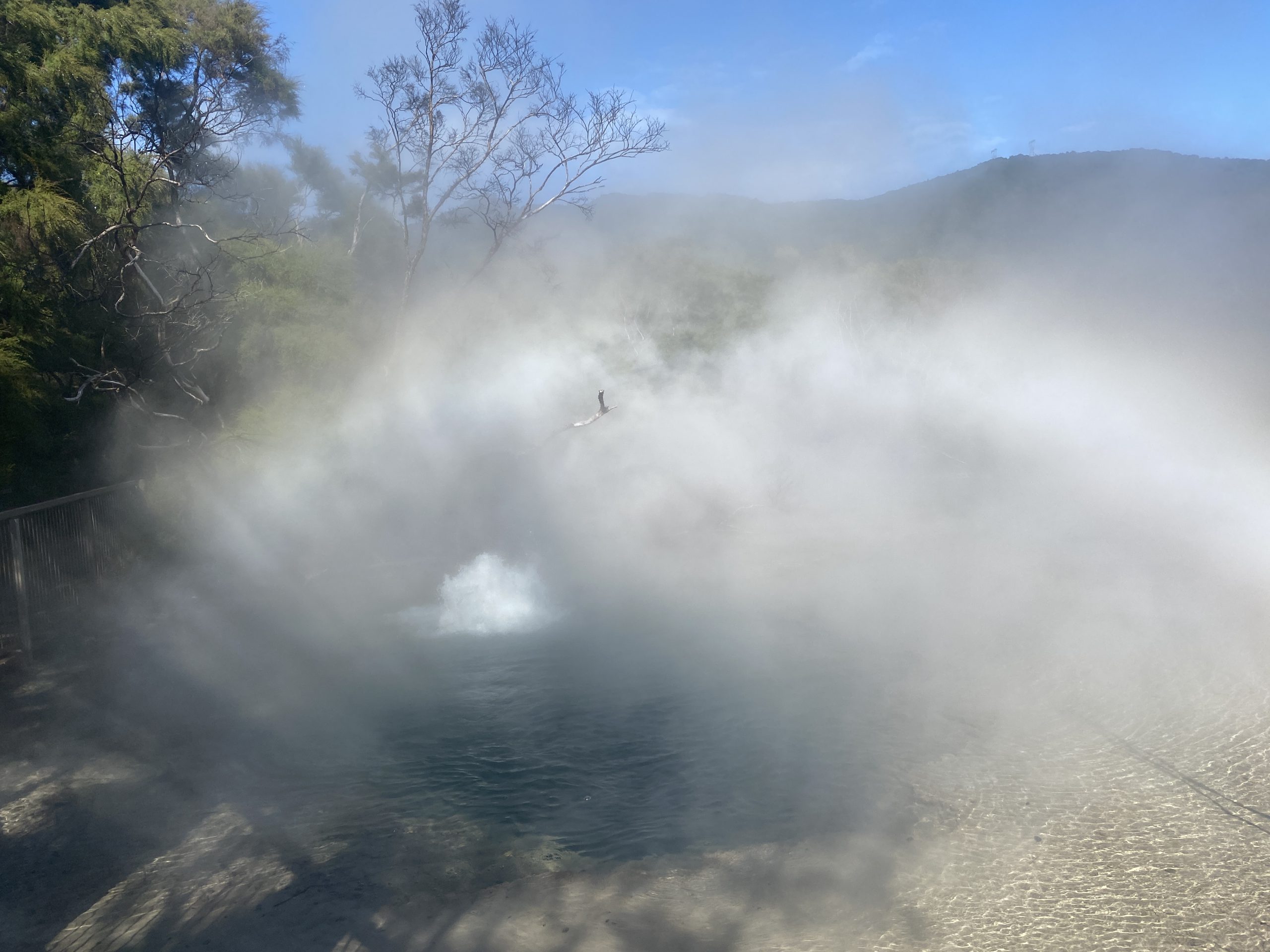
The reason we missed eruptions was because we discovered another erupting feature. Named Hoani, it is a wide, deep boiling pool. The central pit was about five meters across, and I could not see any bottom to it. It is located in a broad, tannish colored sinter sheet depression.
Eruption of Hoani
When I walked by taking a video, and the video shows that it was quite hot, and full to the rim. I didn't remember any such feature from our visit four years ago. After the first eruption of Taumatapuhipuhi finished, we decided to head back to look at a few features along the trail, and immediately noticed the 30-40cm high boiling on one side of the crater. This boiling built up to well over a meter, then subsided. This activity continued for at least 1h15m, and we probably saw it near the start. At one point, I saw some surges that could have been two meters high. The activity was much like Artemisia.
The walkway was not built with an erupting, boiling spring in mind. There were times when I was walking along that the fog from the eruption was almost scaldingly hot. This steam was condensing on some of the trees, producing a rain below them. We tried to time our visits to Taumatapuhipuhi and spend rest of the time at Hoani, which is why we missed a couple of Taumatapuhipuhi eruptions.
It was after one of those eruptions that we noticed that the pool was quiet again. Previous pauses had lasted only a few seconds, but this one stretched into a minute or more. Then we noticed that the pool was dropping. By the time we left the area, 45 minutes later, Hoani was down 30-40cm, with the outer rim already drying in spots.
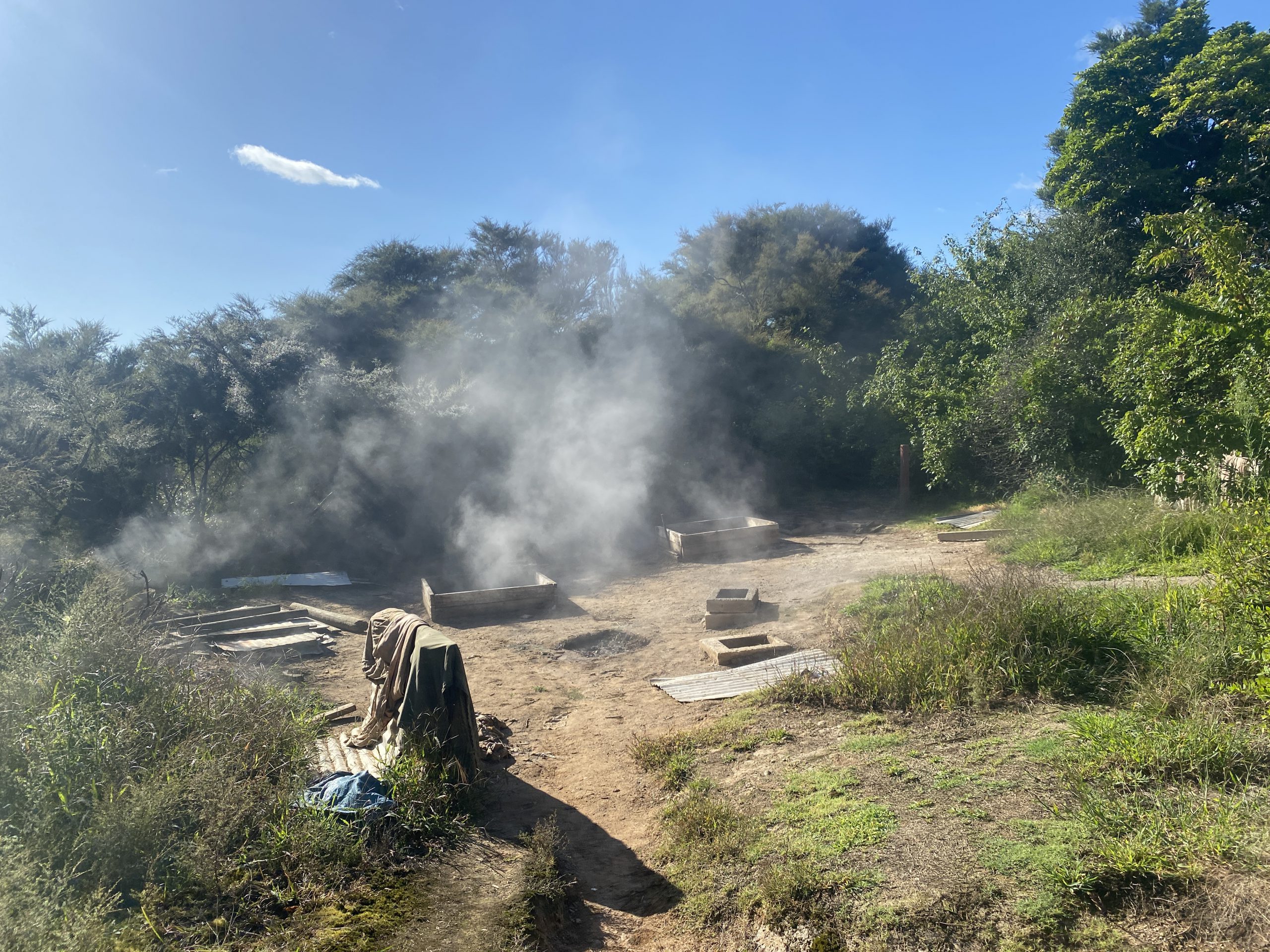
Beyond Taumatapuhipuhi is an area that's been heavily "culturally modified." An area of hot ground and frying pans that's been converted into an area for the preparation of hangi, the Maori method of cooking in hot ground.
Hangi area, Tokaanu.
After almost four hours at Tokaanu, we headed towards Rotorua. There were a couple of minor thermal areas north of Taupo that we had not visited the last time that we were going to try to see.
The first was "Craters of the Moon", where the Karapiti Blowhole was located. The area has been heavily affected by the nearby geothermal powerplants, and consists mostly of subsidence craters with some weak fumaroles scattered about. The only feature of any interest is the replacement for Karapiti, which is up on a hillside and consists of a wet, moderately noisy fumarole and some other noisy fumaroles. This of "A Fumarole" at Fountain Paint Pots.
This area can be bypassed unless you want to see what a destroyed thermal area looks like, or want to complete a checklist.
The second stop was going to be the "Wairakei Thermal Valley". This is an area that used to contain close to a hundred geysers, some playing to over 30 meters. It is now completely overgrown because all the activity has gone into making electric power. Was not looking forward to visiting, but figured should at least see what it looked like. But when we got to the entrance road, we were blocked by a closed sign. In the Taupo area the cyclone of a few weeks earlier had destroyed a significant percentage of the trees in the area. A lot of those trees had their tops snapped off, while others were complete uprooted.
(Earlier in the week, near Tongario National Park, we had to lengthen our hike to a waterfall by an extra 500 meters because the road was blocked in three places by downed trees. The road was low priority for clearance, as it had no other reason for being other than access to that hike.)
Since we had a little time, and we were passing right by, instead we stopped at the Waiotapu Mud Pots. These are in a free area, and well worth a stop. In the pool were a number of active areas spouting mud to as much as three meters high. These areas were periodic, with the longer the quiet period, the more vigorous the activity when it finally did erupt.