
Posted on
Tag: New Zealand
Posted on
Posted on
Tokaanu Thermal Reserve, New Zealand
Posted on
KiwiRail, South Island, New Zealand.
In Hokitika, on the South Island's West Coast, one branch of the New Zealand national railroad ends at a major dairy. There was a daily train going there the three nights we stayed there, coming in while dark in the morning, leaving in the late afternoon.
At Arthur's Pass is a passenger station at the line's summit, where westbound trains go into the Otira Tunnel. The tunnel is 8.5km long with a 3% downgrade , so there are helpers added and removed here. One freight train is a unit train carrying coal from west coast mines to a power plant near Christchurch. Not sure what the other is carrying.
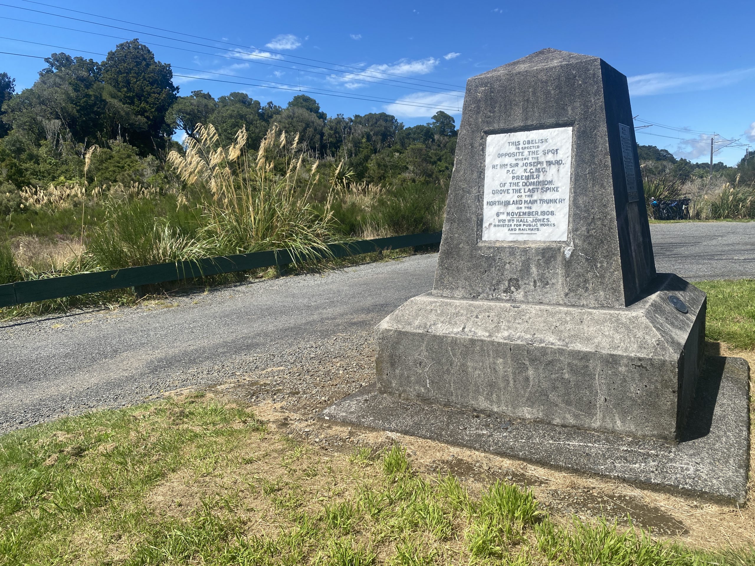
Standard gauge on all New Zealand railroads is 3'6", which over a foot narrower than the North American standard of 4'8.5". This allows for tighter curves and shorter crossties. Much of the North Island line is electrified. By accident we stopped at a rest area where there was a monument to the "golden spike" location.
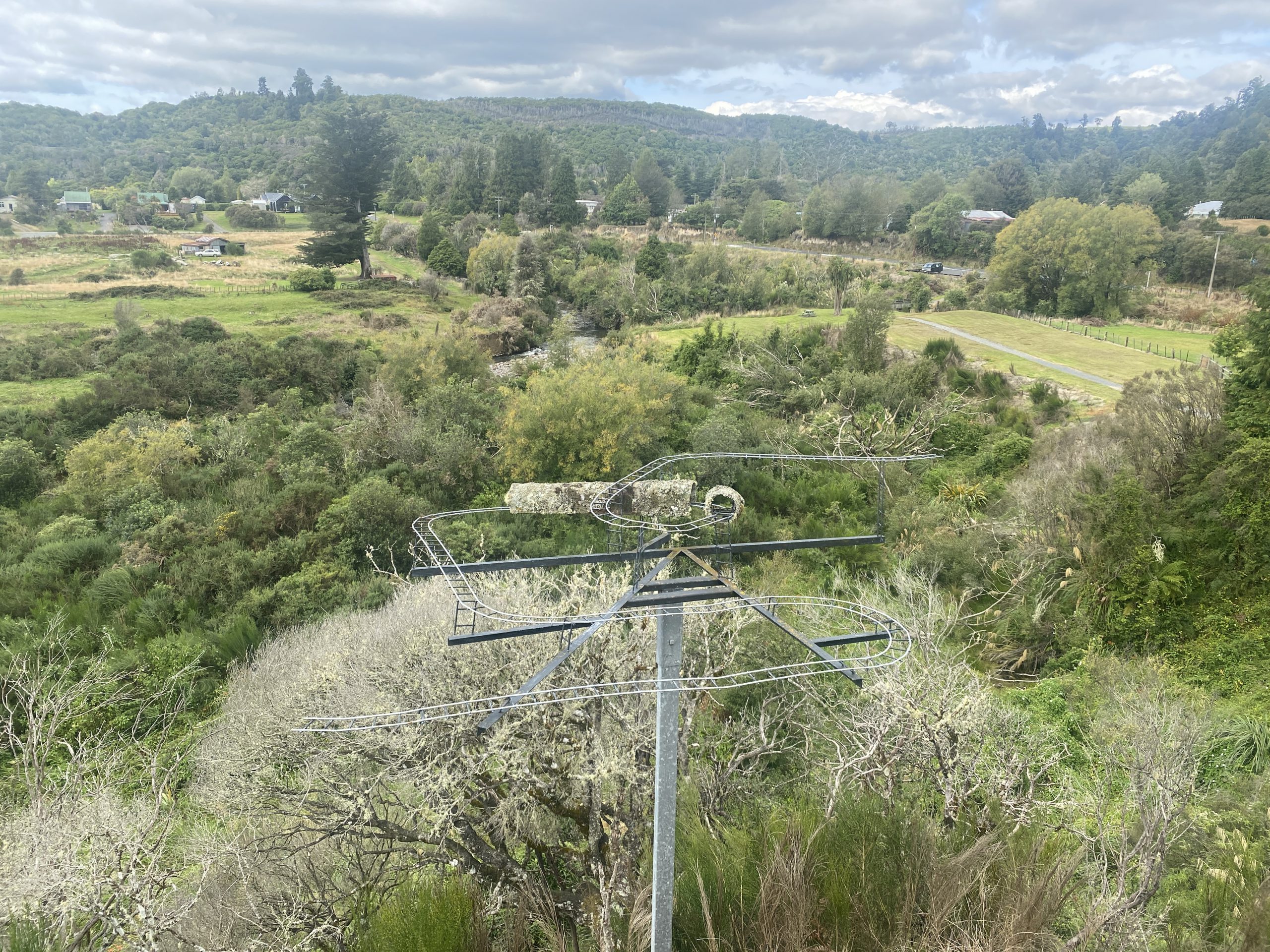
Finally, the video ends with a quick view of the Raurimu Spiral on the North Island near National Park. It's where the main line crosses over itself above a tunnel, then continues on through reversing horseshoe curves. Not much is actually visible due to the geography and plant life, and the road to get to that location is a bit rough at the end. Never did see any rail traffic on the North Island lines, and the place we stayed at Raurimu, while near enough to the railroad at the bottom of the Spiral to hear it, didn't have a view.
Posted on
New Zealand 2023 Postings
Videos:
- Sapphire and Cascade Geysers, Orakeikorako
- Wairiri Geyser, Orakeikorako
- Bush Geyser, Orakeikorako
- Artist's Palette, Orakeikorako
- Waimangu Valley
- Steaming Cliffs at Rotomahana, Waimangu
- Waiotapu Mudpots
- Champagne Pool, Waiotapu
- Te Manaroa, Waikite
- Kereru, Whakarewarewa
- Pohutu, Whakarewarewa
- Mahanga, Whakarewarewa
- Whakarewarewa Thermal Walkway
- Whakarewarewa Forest Mudpot
- Hoani, Tokaanu
- Taumatapuhipuhi, Tokaanu
- Puanga & Mangaroa Street Features, Tokaanu
- Te Kopia
- Kuirau Park, Rotorua
- Rotorua Lakeshore and Government Gardens
Observation reports:
- 2023 March 04 : Tokaanu, Karapiti/ Craters of the Moon, Wairakei
- 2023 March 05 : Waiotapu, Waikite, Te Kopia
- 2023 March 06 : Whakarewarewa / Te Puia
- 2023 March 07 : Waimangu & Rotomahana
- 2023 March 08 : Orakeikorako
- 2023 March 09 : Whakarewarewa Village
- 2023 March 10 : Kuirau Park
- 2023 March 11 : Tikitere / Hell's Gate
- 2023 March 12 : Rotorua (Government Gardens, Lakeshore, Puarenga Stream), Whakarewarewa Forest
Other, non-thermal videos:
Posted on
Waiotapu Mudpots, Waiotapu, New Zealand
Posted on
Te Manaroa, Waikite, New Zealand
Posted on
Kereru Geyser, Whakarewarewa (Te Puia), New Zealand
Posted on
Hoani, Tokaanu, New Zealand
Posted on
Taumatapuhipuhi, Tokaanu, New Zealand
Posted on
New Zealand Stereoviews
Here are a series of stereoviews taken of New Zealand geysers taken around the start of the 20th Century.
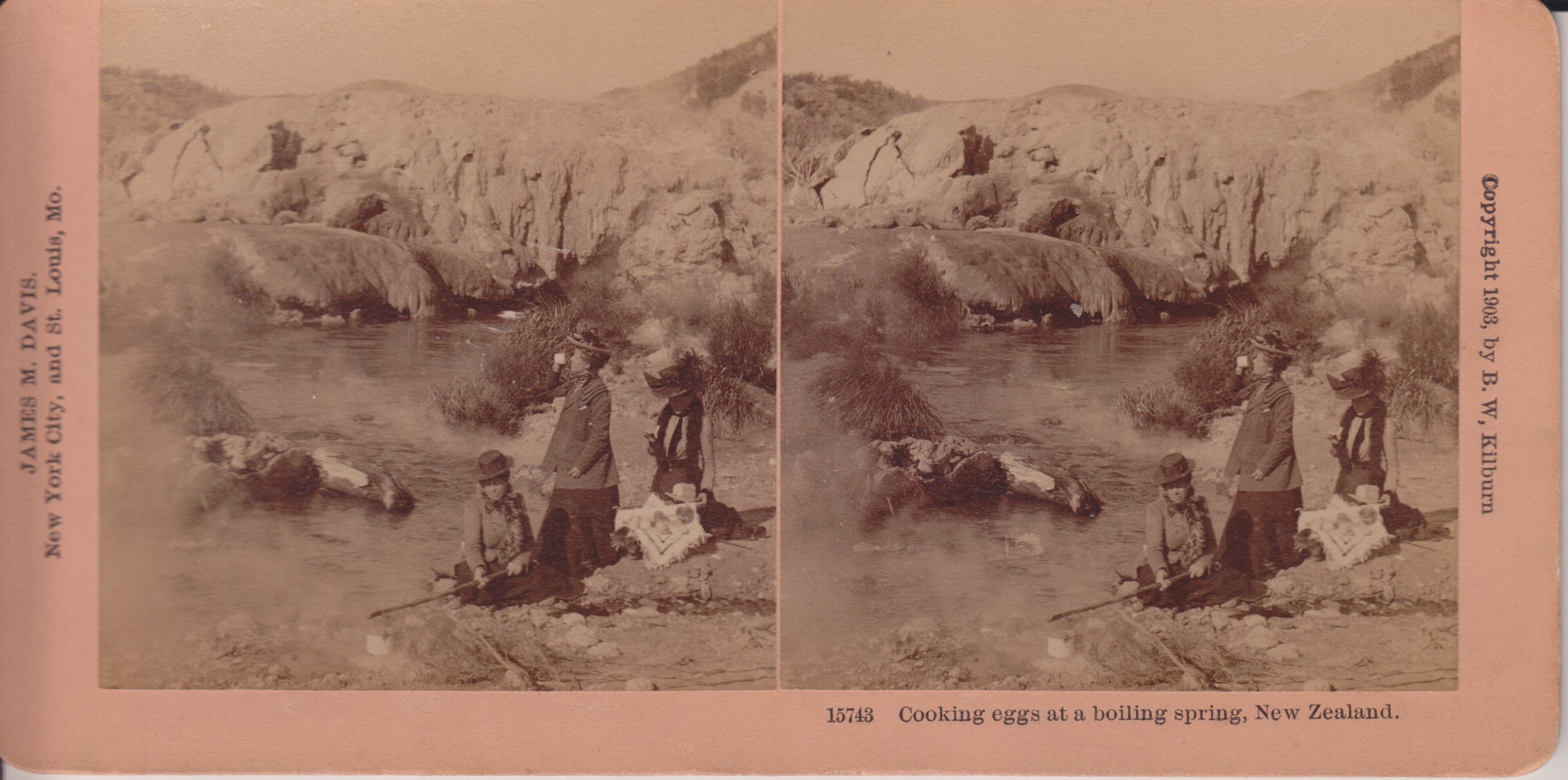
B.W.Kilburn #15743
This is a view of Kereru Geyser and the Geyser Flat mound where Pohutu Geyser is located. Kereru is the low, darker mound along the stream bank. When we visited in 2019, the area where the cooking is occurring was an area with numerous frying pans, but no distinct erupting features that I could see.
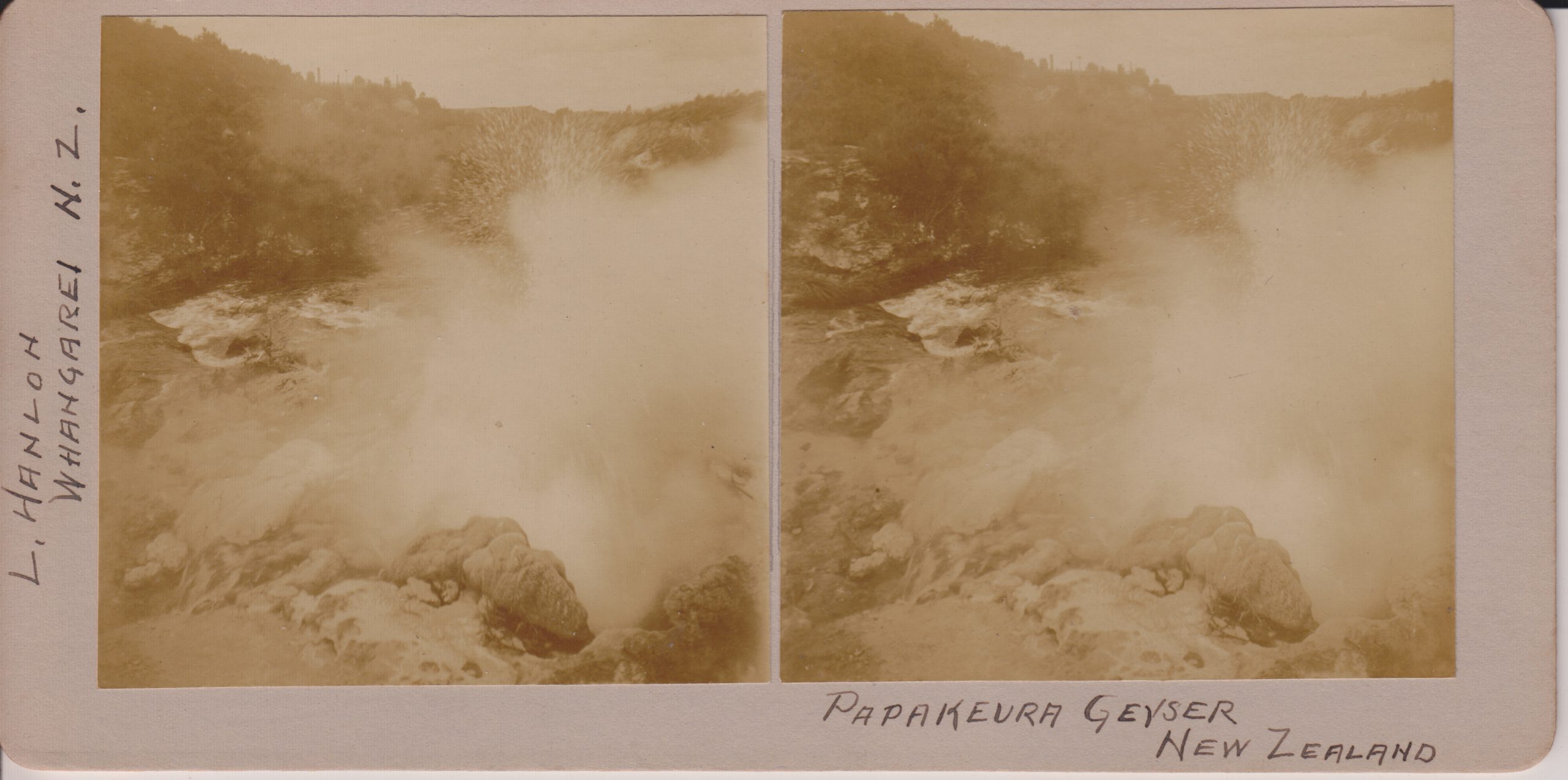
L.Hanlon, Whangarei
Now called Papakura Geyser, this feature was a large perpetual spouter upstream from Pohutu Geyser along Puarenga Stream at Whakarewarewa. The activity ended in 1979, and that cessation lead to the campaign to limit the use of geothermal bores within 1.5 kilometers of Pohutu. Papakura did erupt for a couple of days in 2015.
Underwood & Underwood
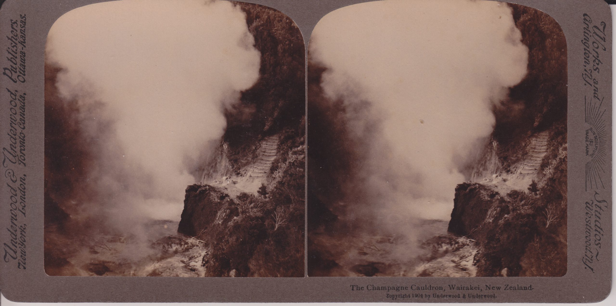
With the production wells for the Wairakei powerplants nearby, this feature is now a hole in the hillside filled with vegetation.
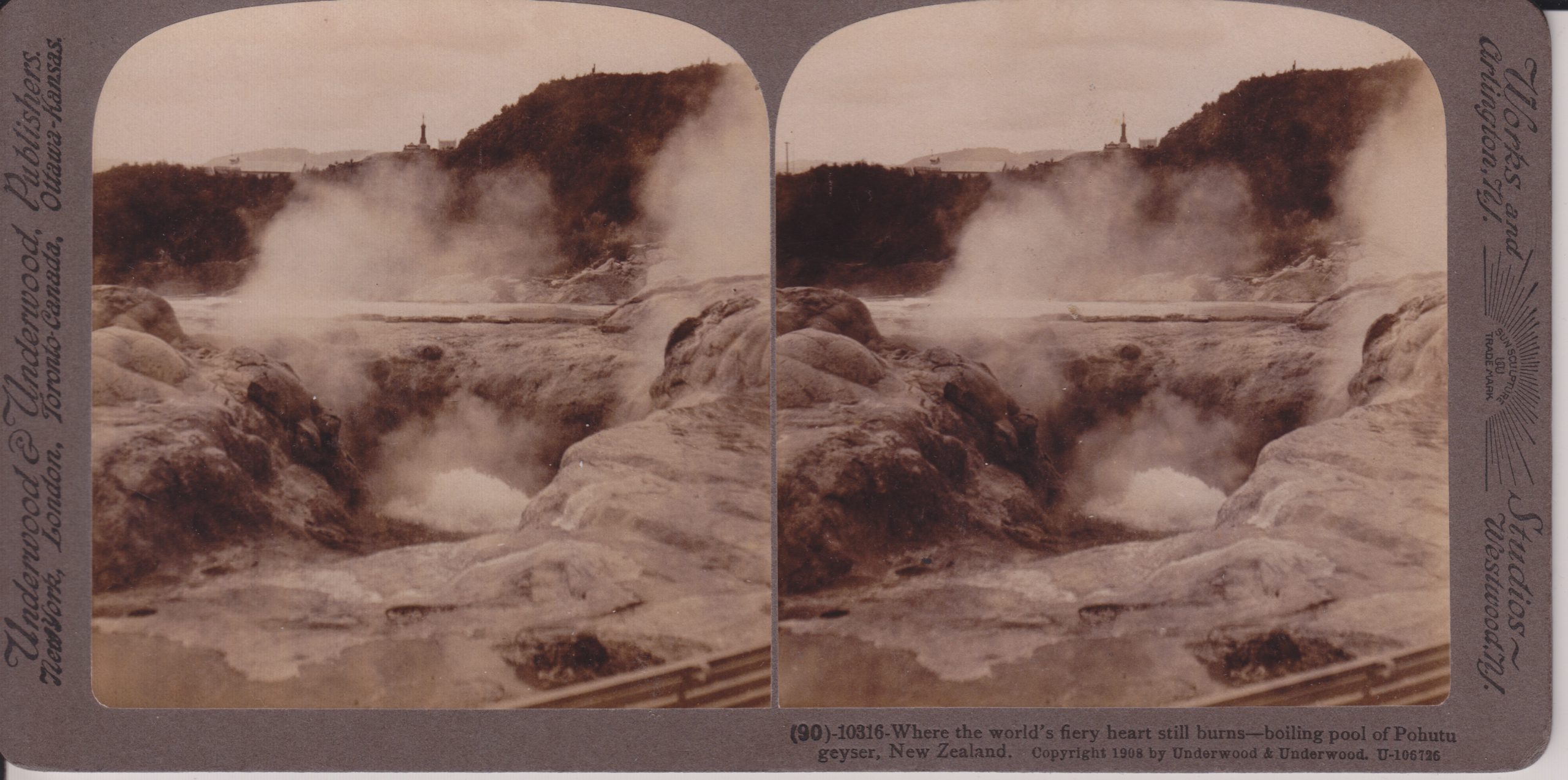
Underwood & Underwood #10316
The large vent in the center seems to actually be the vent of Te Horu, which in years past would show sympathetic responses to Pohutu's activity. I believe Pohotu is actually the mound cut off by the right edge of the photo.
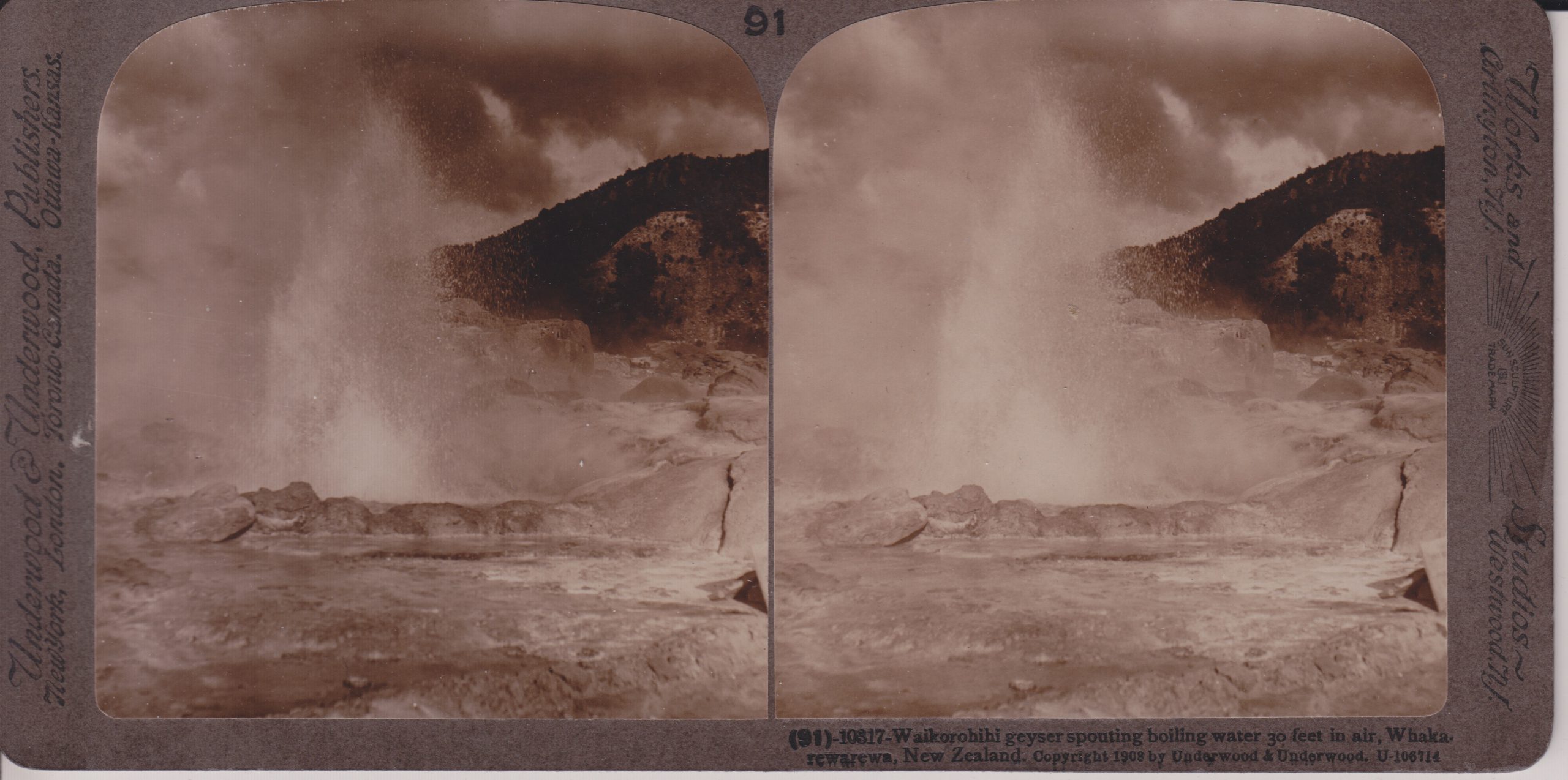
Underwood & Underwood #10317
This feature is located near Pohutu, and has underground connections to it. It has been occasionally active the last few decades. When we visited in 2019, that was not one of those times, as it and nearby Mahanga were steaming and depositing sulfur around the vents.
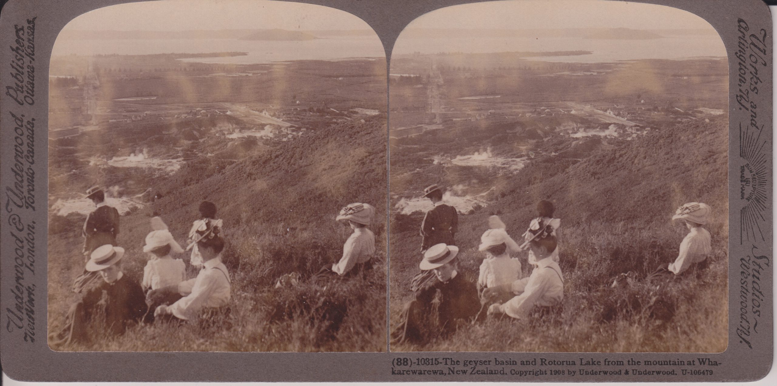
Underwood & Underwood #10315
This is probably near the overlook we hiked to when visiting in 2019. On the left side Fenton Street is visible. Fenton was laid out to point directly toward Waikite Geyser, which is located in the bare area behind the standing woman. Pohutu Geyser and the Geyser Flat is the bare area above and to the right of that. Off in the distance, Sulphur Bay of Rotorua Lake is visible. The Whakarewarewa village is in the steaming area to the left of the center of the view. Note that today, the whole area beyond the thermal areas is the city of Rotorua. Much of the hillside to the right is now covered in trees.