
Posted on
Posted on
Posted on
Grand Geyser Starts, 2021 (Pt.5)
Posted on
Grand Geyser Starts, 2021 (Pt. 4)
Posted on
Grand Geyser Starts, 2021 (Pt. 3)
Posted on
Grand Geyser Starts, 2021 (Pt. 2)
Posted on
Grand Geyser Starts, 2021 (Pt. 1)
Posted on
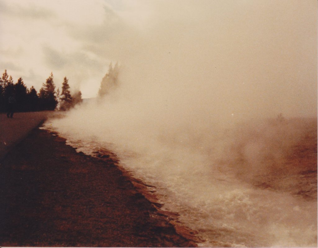
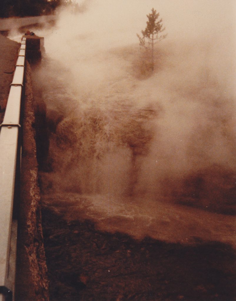
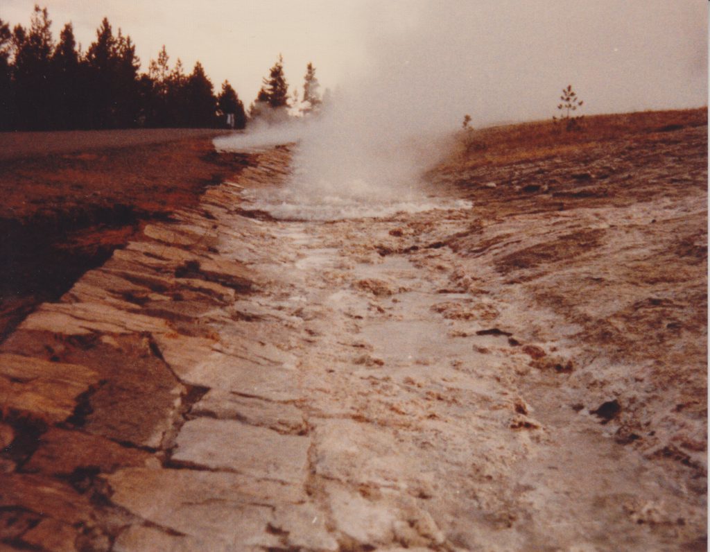
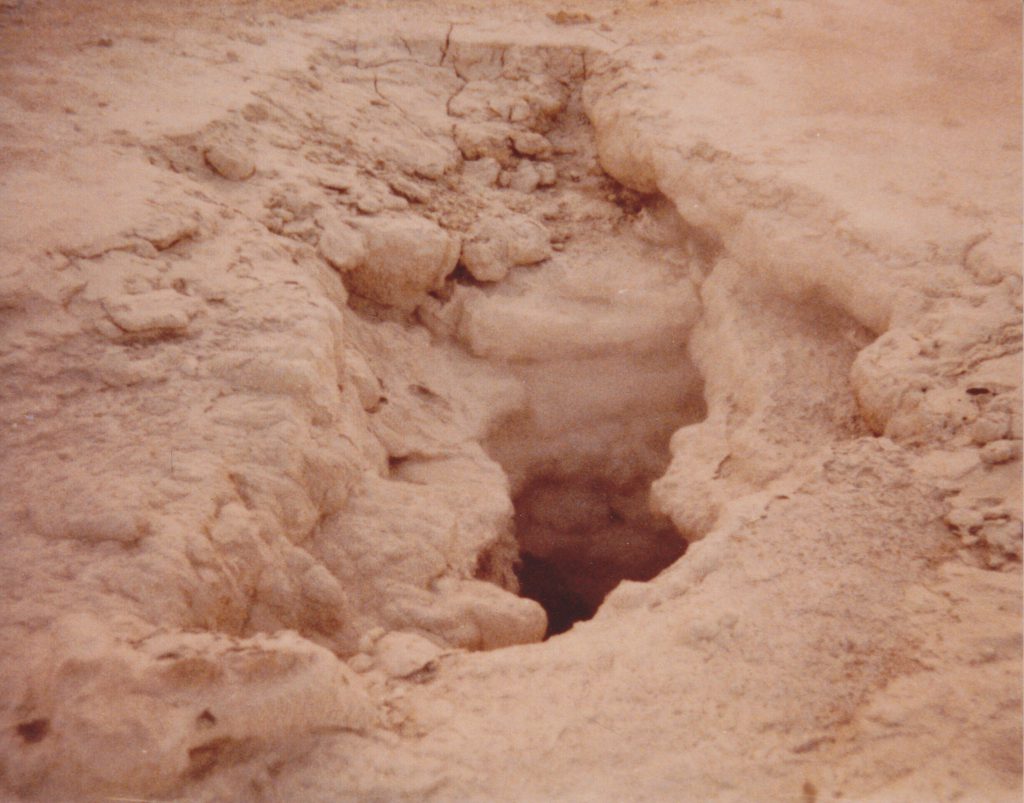
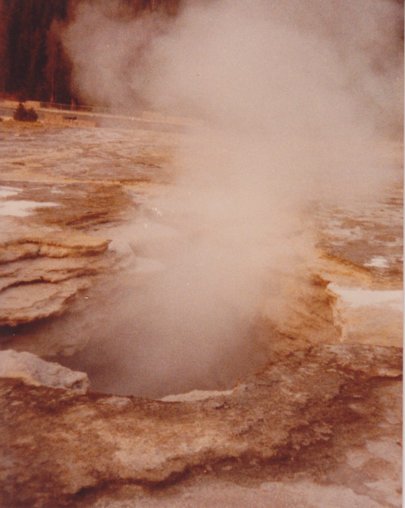
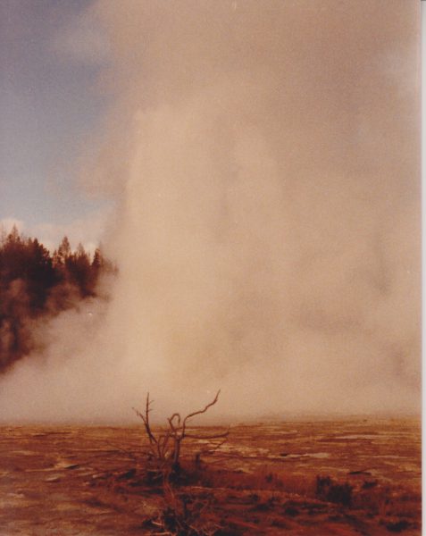
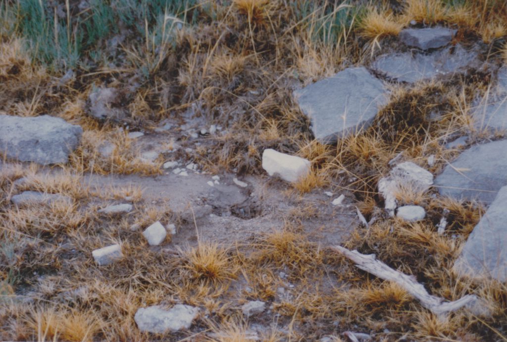
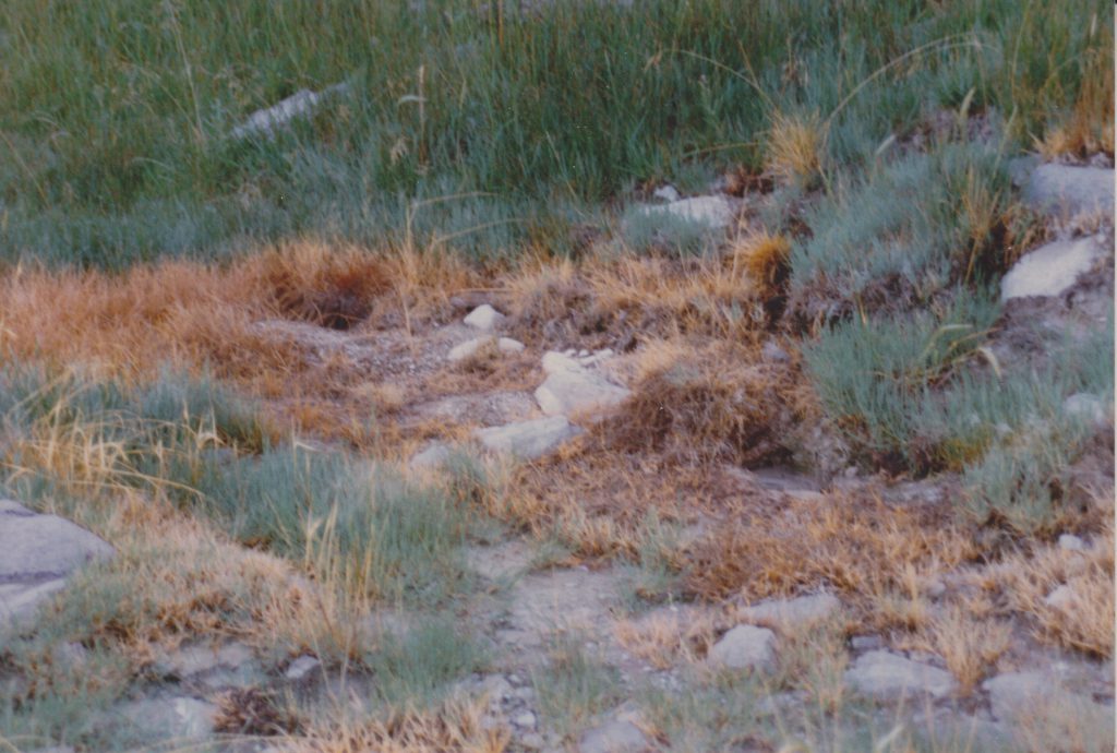
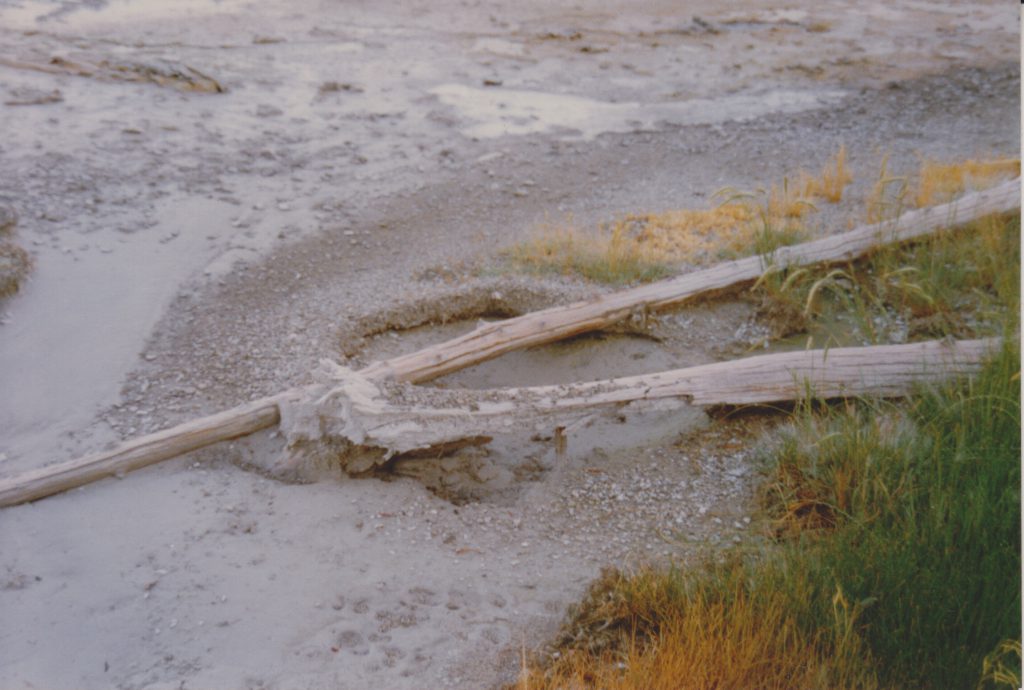
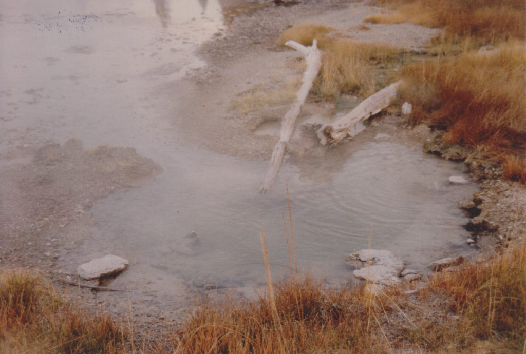
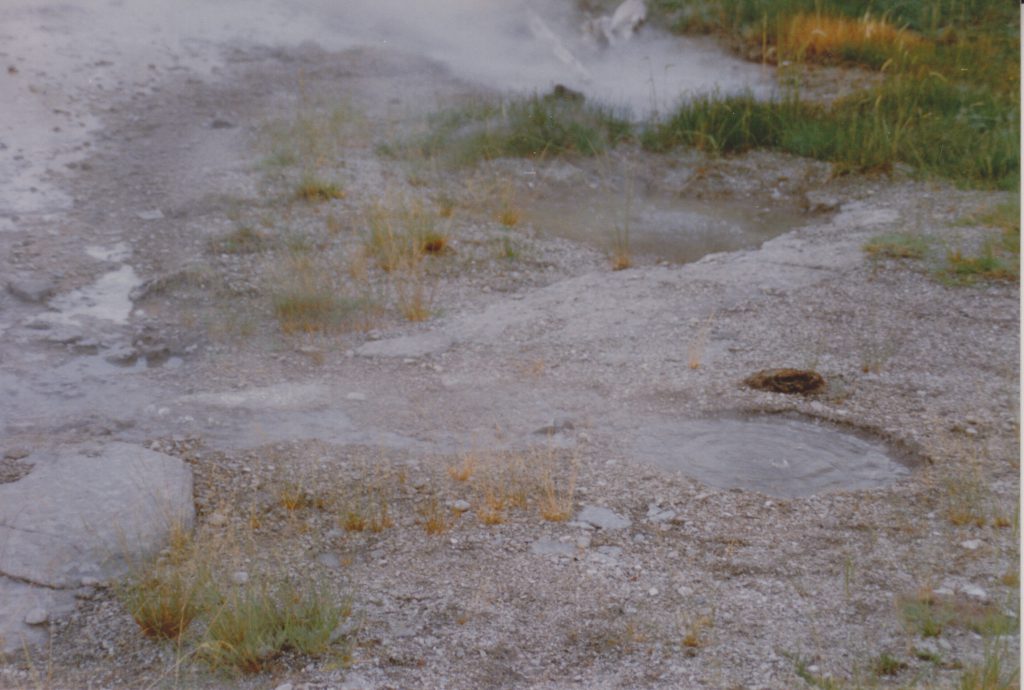
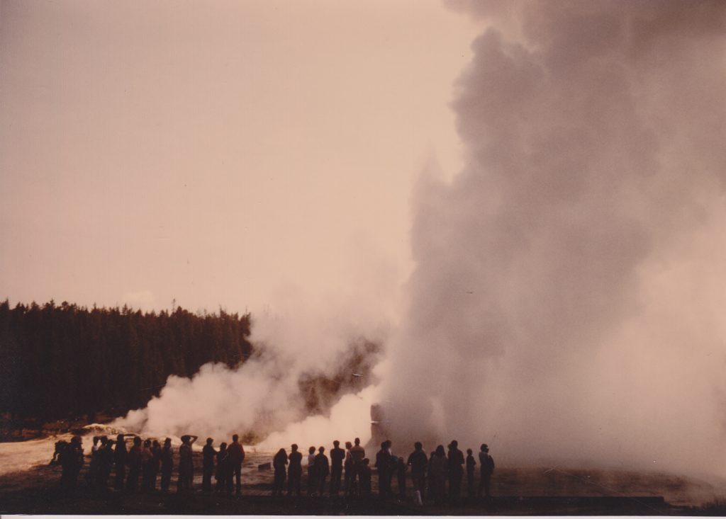
Link Geyser, 1983
Here's a series of photos showing some of the activity of Link Geyser and the Chain Lakes Group during the activity in October 1983. Over a period of five days, Mary Ann Moss, Marie Wolf and I got to see several dozen major eruptions. We missed much of the activity of the first day.
Mary Ann took these photos, and as you can see, it was cold, damp and gray that week, which made seeing the eruptions difficult at times, but it didn't snow or rain. For more details on the activity, see my article in one of the early GOSA Transactions. Think of this as a supplement to that article.
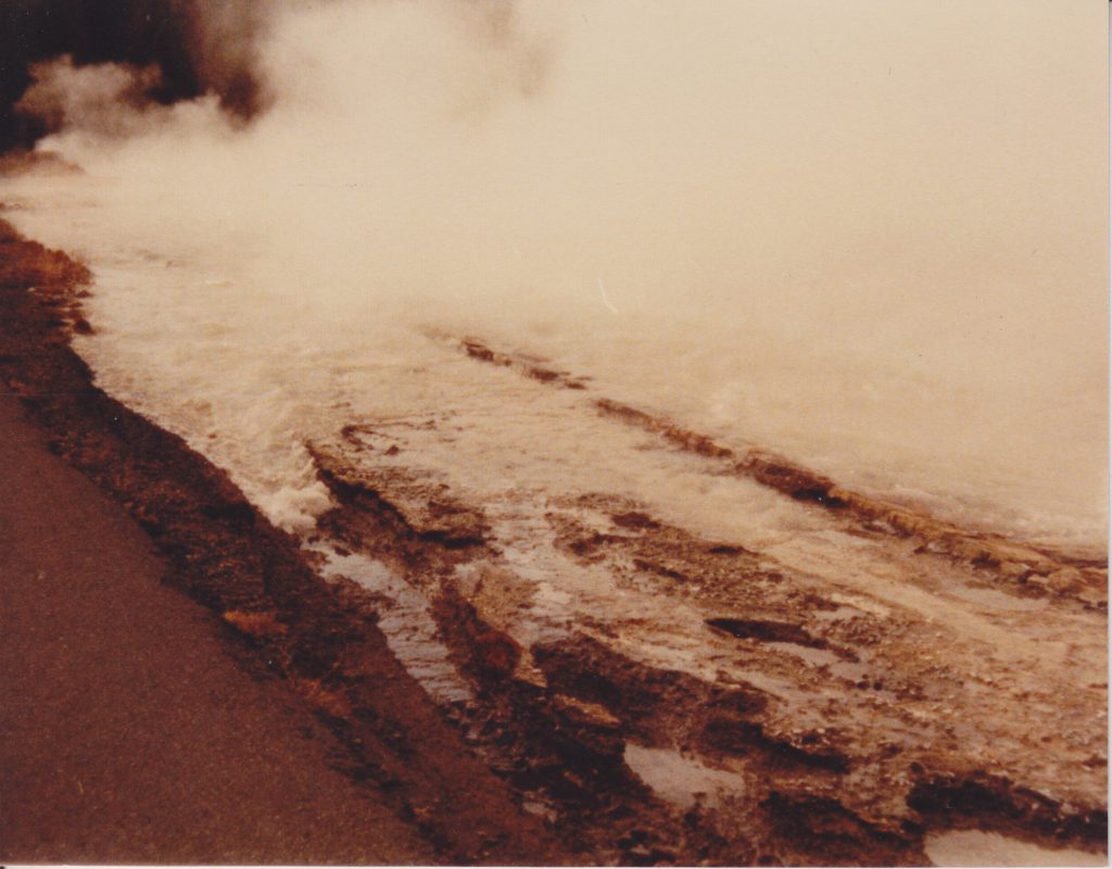
Here's what we saw of one of the first eruptions we witnessed. A lot of steam coming from opaque water. The ruts produced by the runoff channel didn't get much deeper or wider over the next few days, which supports our conclusion that the first few eruptions that no one saw were even more voluminous and powerful than what we saw.
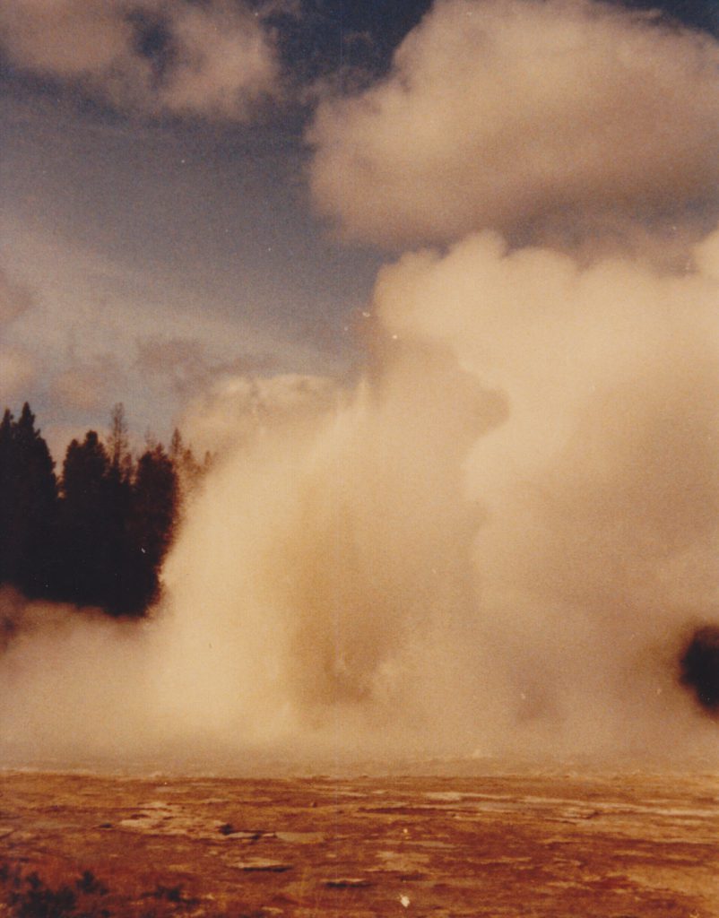
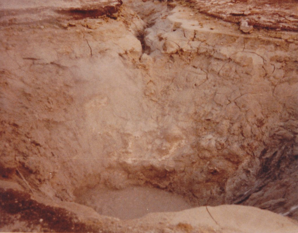
Here's one of the better photos, showing some of the details of the jets. I would estimate the height here at around 15 meters. We think we saw higher, more angled jets at times.
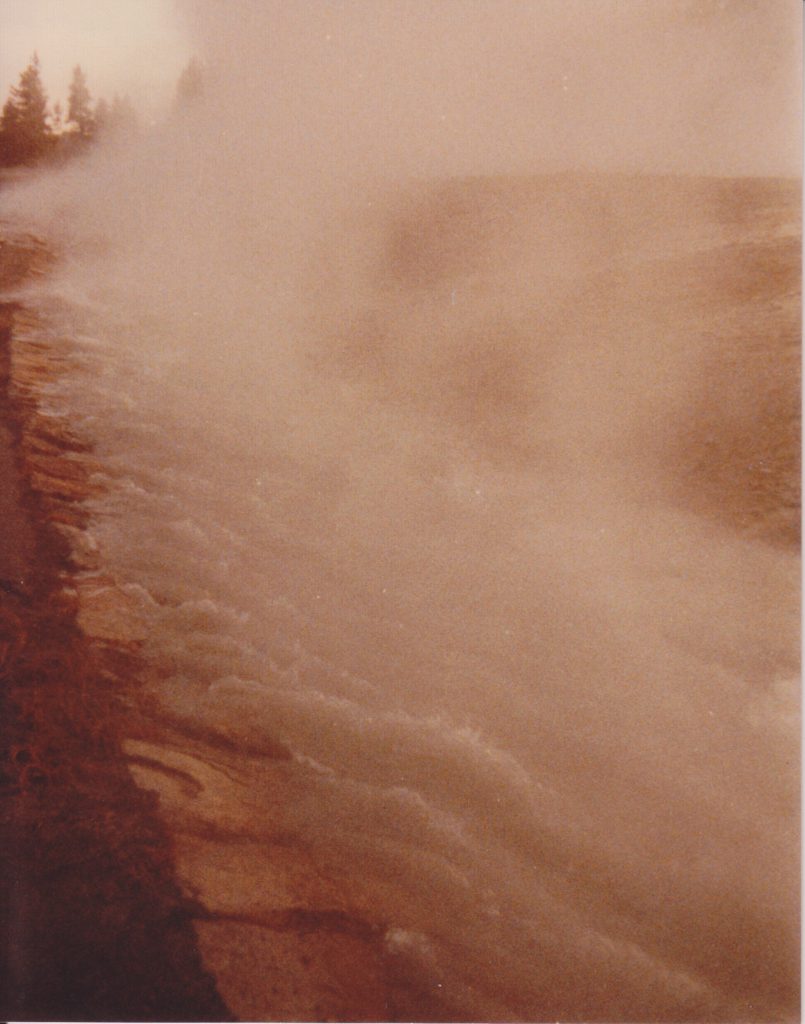
A couple more views of the discharge from an eruption.
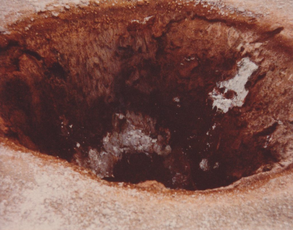
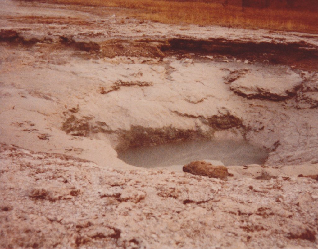
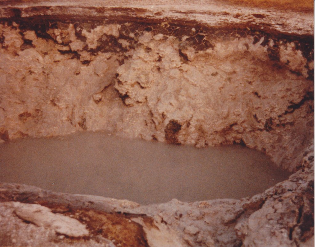
Next are a series of close-up views of the drained vents of the Chained Lakes.
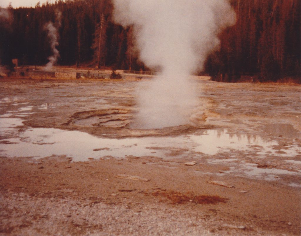
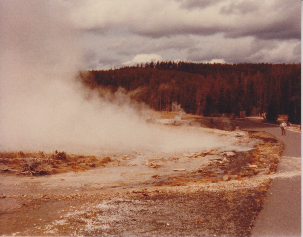
Note the debris washed onto the bike trail. We never saw an eruption put out enough water to reach that far, which again supports our assumption that the first eruptions were even larger.
And that's J.Randolph Railey watching the eruption.
Posted on
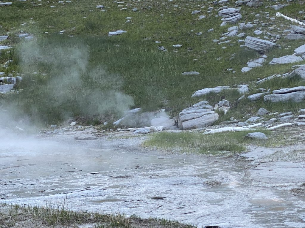
Grand's North Triplet Sputs
It appears that the locations and designations of the various sputs that have appeared in and around the old site of North Triplet are in need of further documentation. In going through some old files, I came across photos that Lynn Stephens took of that area in October 1989. While a lot of things there have changed since then, this does give a good record of what was happening there, and how it relates to current activity.
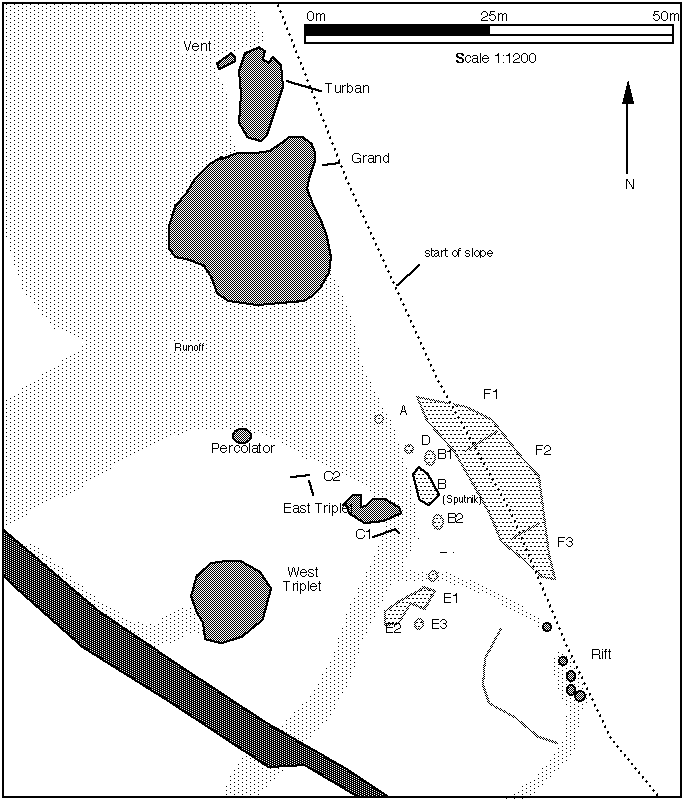
The map comes from my original GOSA Transactions article on the area, and is still a good guide. The only major difference is the disappearance of East Triplet, and the associated Sput-Cs near it.
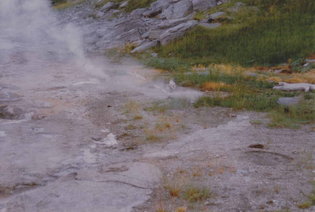
In the center of this photo, with a downed branch beside it, is Sputnik, or Sput-B. To the left, the plume of steam, is Delta, or Sput-D. In the foreground are several frying pans constituting Sput-E, which are no longer active, but the area is still devoid of vegetation.
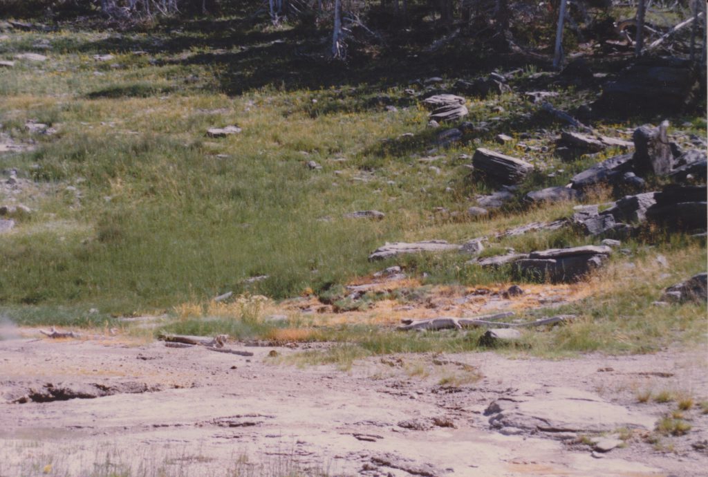
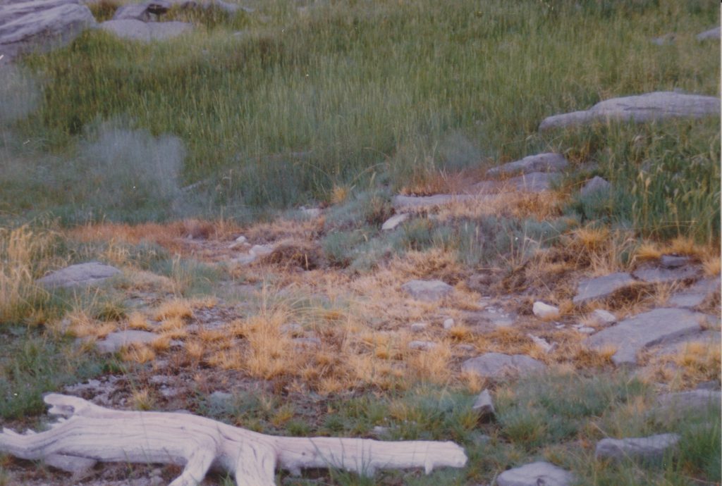
On the left edge of the photo the rim of East Triplet's vent can be made out. Above and to the right, beside the downed log is Sputnik. The large brown area of dead grass is Sput-F. Eventually, three areas of activity became more pronounced and were given sub-designations.
Sputnik also developed some satellite vents, one on each side. Over the years the craters have been filled and cleared out, so which is which is probably not possible to determine any more.
In the foreground is the wet frying pan at the north end of Sput-E. Behind it, in the middle of the photo is Sput-B2, while Sputnik itself is near the top of the photo.
Note that at this time, Sput-D was a small hole which steamed heavily. Over the years it enlarged itself.
The photo I took last year isn't from up close, but one can still see the are of Sput-F is still active, and the grass there hasn't recovered. Finally, here is a short video showing the area with everything that was active in June 2020.
Posted on
2021 Uncertain Geyser
First observed eruption on 2021 July 31, and concerted with Sawmill Geyser seen on 2021 August 17, seen from Grand benches.
Posted on
2021 Bulger Geyser and Bulger's Hole
Posted on
2021 Activity of East Sentinel Geyser
Some typical behavior, and some unusual behavior of East Sentinel during August and September. Chapter markers for—
- Aug 02
- Aug 09
- Aug 16
- Aug 21
- Aug 22
- Aug 23
- Aug 28 13:28 Post eruption
- Aug 30 14:30 South rim activity
- Aug 31 06:53 Post eruption, empty
- Aug 31 15:20
- Sep 04 12:44 Post eruption
- Sep 04 12:51
- Sep 04 13:03
- Sep 04 13:17
- Sep 04 13:31
- Sep 04 17:43 Minor eruption
- Sep 04 18:37 Minor eruption
- Sep 09 Post activity overflow cycle
Posted on
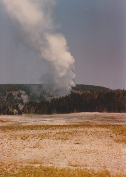
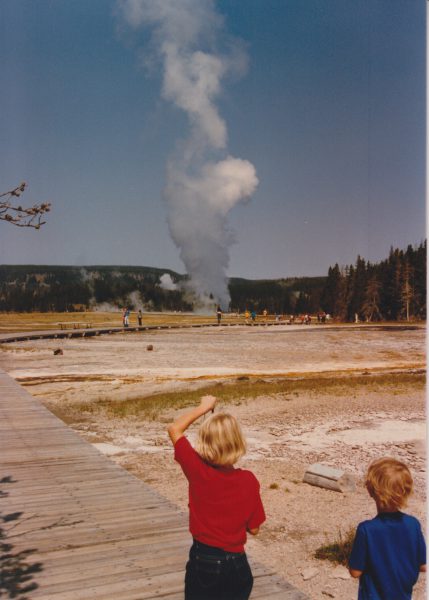
Giant Geyser Eruption of 1986 August 20
I was digging around in my files, looking for something else, and I came across this copy of a letter I sent to a friend two days after Giant Geyser erupted in 1986. Since I wrote it while the memories were fresh, I figure it might be interesting. The photos posted here were taken by George Strasser (Paul's brother), who not only had a camera, but remembered to use it.
On 20 August at 1136, Giant erupted. I was at Daisy for the start, and had just passed Giant five minutes earlier. At that time, it looked like it has all summer, fairly dead. So I get to Daisy, see that Splendid's markers are in place (it had four eruptions the next day), and start to unload my pack. Then I looked over at Daisy, and saw this huge steam cloud rise above the trees.
Paul Strasser, John Railey and I have been using CB radios to keep in touch. They have been useful, but this time they paid for themselves. I grabbed the radio as I was running down the boardwalk and yelled into it, "Paul, something's erupting in the Giant Group!" He had just turned his on, and heard the "erupting in the Giant Group" part from the Lodge Cabins. He and Suzanne were down there in twelve minutes. Several other people saw the steamcloud from the VC, Lower Ham's store, or from Fantail (Biscuit Basin) and assumed either Grand or Oblong. They didn't see it.
[Paul and Suzanne were about to head out with the family of his brother George, "to look for animals", when the call came. The family was abandoned, allowing George to walk out on his own. Fortunately, he took the only series of photos of this eruption that I know about.]
Talked with some people there at the start, and they said that the sputs started maybe 30 seconds before Giant, and Mastiff was erupting only three to four feet high, but overflowing. When it started, Giant sent out a wall of water, running over the south end of the "T" boardwalk. They were afraid of scalded feet.
As I ran around the trees, I could see the water column still climbing. Mastiff was steaming and splashing heavily, while Catfish was sending a thin angled spray to 25 feet. Bijou was steaming only, and the others quickly followed. I took a short cut, and was quite pleased with events.
Giant was now near maximum height, which I estimated [measured?] to be between 150 and 180 feet (~165'). Two night before Sam Martinez and I were going to lay out a baseline, but decided not to since we would never get a chance to use it. [I think I told Sam: "It'll get stolen before we can use it."] The water column was thick, a lot like Ol' Filthy in that sense only. It also pulses, like Beehive, so it doesn't stay at max height, but drops to about 80', then surges back up. The water seemed clear, and the weather was excellent. Clear sky, dead calm but a bit humid. Paul said the steam cloud had to be several thousand feet high. Earlier that day was a thick fog, and later it rained.
By the time Paul and Suzanne arrived, surges were still in the 120' range, but the power had definitely diminished, Originally the water column appeared vertical, now it began to angle to the west slightly. It also sent spray toward the boardwalk. But on the whole, it looked exactly like the old photos.
A half hour later, Giant was still hitting 50', but there was little runoff. By now several sputs were erupting on the platform. They looked like little Uncertains, but only ~4' high. They also surged at the same time as Giant.
By 1227, Giant was mostly steam, and all steam by 1236. Grotto was not erupting all this time.
This was a strange eruption for coincidences. Not just Sam and I at the baseline. The day before at Splendid (no eruptions) T.Scott commented that he didn't have his camera, and if Giant erupted, he would kill himself.
South Purple pool had had several heavy surges of water earlier this year, and now was down below overflow. Later Grotto had some sort of steam phase, or minor eruption. The sputs between it and Rocket were erupting, but Rocket and Grotto made lots of noise and occasionally splashed. The next "real" Grotto [eruption] did not have an eruption of Grotto Fountain [preceding it].
Oblong has been weird this year, with intervals from 32 minutes(!) to 24 hours. Most intervals seem to tend toward 20 hours. Now it had three eruptions in a three hour period, with one interval of 37 minutes. These closing eruptions of a short interval are strange. The water is ejected from an empty pool, and some jets [from the north side] reach the river. They area also very noisy.
It took Bijou about 24 hours to recover, but the next day, the group looked as good, if not better, than it had all year. Now I'm hoping for an interval of less than a year. Say this coming March.
That night, we measured out the distance markers for Giant. Holding one end of the tape over Giant's vent, knowing that it couldn't erupt, was a scary experience.
In the previous thirty years, there had been only four known eruptions of Giant— in 1963, 1978, 1982 and 1984. It's been twenty four years since the last known eruption of Splendid...
Posted on
Big Cub Geyser in 1987
Splendid was active then, and the best way to catch a series was to immediately notice when one started. Daisy was erupting nice and regular, about every 75 to 80 minutes (excluding wind effects). The initial eruption of Splendid would take place shortly before Daisy was expected, so if you didn't see an eruption at the predicted time, it was time to make a quick bike ride out to see what was going on. So every hour or so, I'd ride my bike over from The Box to the fence that ran along the walkway west of the Lodge. If I didn't see Daisy after about ten minutes or so, I'd head on down basin.
On 06 Aug 1987, around 10:30, I did my usual ride up, and saw a plume of water over on Geyser Hill. It wasn't Lion, and at first I thought I was seeing a North Goggles major. Then I realized that the water column was to the left of Lion, on the wrong side. I had no idea if it was Big Cub, or Lioness, so I got on my bike and went on around the circle to get a better look at Geyser Hill.
As I approached the Visitor Center, I saw Jim Lenertz and Rick Hutchinson looking over there with binoculars. They too had noticed the activity, and wanted to get a better view and to figure out which geyser it was.
It was Big Cub, and fortunately, Phil Landis, who was working as Rick's assistant, was on Geyser Hill near Teakettle, and was able to take this photo. (I don't know how to contact Phil for explicit permission. But it is, as far as I know, one of the few, if not the only, photo of Big Cub in eruption.) We watched the activity for at least 3-1/2 minutes, and I would estimate the height was from 10 to 12 meters. Note also that Little Cub was also in eruption.
Afterwards, Rick went over to checkout the platform there, to see if there were any other changes (or signs of manipulation). I tagged along. Everything looked normal, and if we hadn't actually seen the eruption, we wouldn't have seen any evidence of an eruption. (Other than it was a bit wetter down wind of Big Cub, but that dried quickly). The one interesting thing is that the vent has a little side hole in it. A small jet of water coming from it can be seen in the photo on the left.
And I did see Daisy a few minutes later, so no Splendid activity that day. Or for the next few weeks. But I did see Giant about a month later.
Update: I've been told that Phil took the photo as part of his official duties working for Rick, so it's in the public domain. And that Phil died of cancer a few years back.
Posted on
2021 Infant Geyser
Posted on
2021 Giantess Geyser — Transition to Steam
While I walking around Geyser Hill, Giantess made the transition to a weak steam phase.
Posted on
Start of Fan & Mortar Geysers Eruptions (Pt.3)
- 2021 Aug 06
- 2021 Aug 12
- 2021 Aug 27
- 2021 Sep 02
- 2021 Sep 07
- 2021 Sep 11
- 2021 Sep 13